
Maps
Latitude and longitude
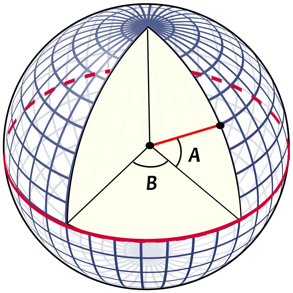
Lines of latitude are parallel lines circling the Earth in an east-west direction. Lines of longitude run north-south and converge at either pole. Together, latitude and longitude make up a grid, which used to locate places accurately on the Earth's surface. This grid, or network, is known to cartographers as the graticule. To locate points on the Earth's surface even more precisely, degrees latitude and longitude are been divided into minutes (') and seconds ("). There are 60 minutes in each degree, and 60 seconds in each minute. Every point has both a unique latitude coordinate (for example, 51° 47' 20" N) and a unique longitude coordinate (for example, 1° 29' 53" W).
Latitude
Lines of latitude, running east-west, circle the globe from pole to pole. They are also known as parallels and are an equal distant from each other. Lines of latitude allow a north-south position anywhere on the Earth's surface to be fixed.
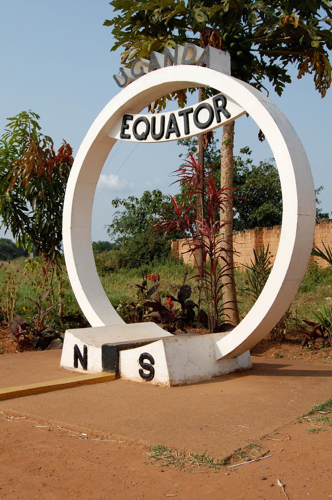
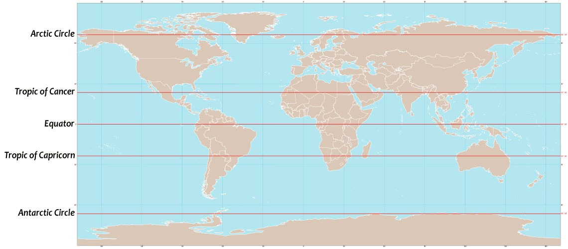
The line of latitude that runs around the Earth's middle, exactly halfway between its poles, is called the Equator: it is 0° latitude. It divides the Earth into Northern and Southern hemispheres. Places to the north of the Equator have latitude positions anywhere between 0 and 90°N; places to the south of it have latitude positions anywhere between 0 and 90°S. Each degree of latitude is about 111 kilometres (69 miles) apart.
Longitude
Lines of longitude, running north-south, divide up the globe by degrees of a circle, allowing an east-west position anywhere on the Earth's surface to be fixed. There are 360 degrees in a circle, but the Earth is divided into two hemispheres of 180 degrees each. The line of longitude that runs through Greenwich is the Prime Meridian: it is 0° longitude. On the exact opposite side of the Earth is the 180° longitude. Together, the Meridian and the 180° line form a giant circle running between the two poles. This divides the Earth into two hemispheres, Eastern and Western. Places to the east of the Meridian have longitude positions anywhere between 0 and 180°E; places to the west of it have longitude positions anywhere between 0 and 180°W.
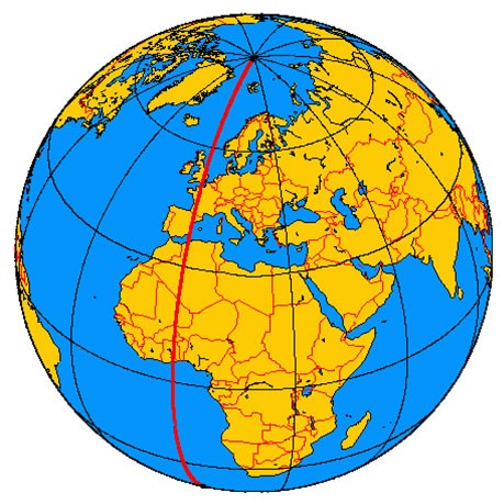
Lines of longitude converge at the poles, and are farthest apart at the Equator, where each degree is the equivalent of about 111 kilometres (69 miles).
Tropics
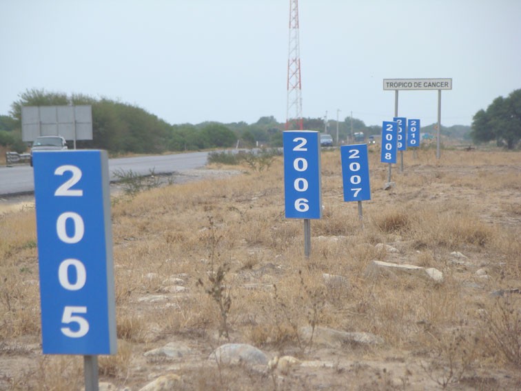
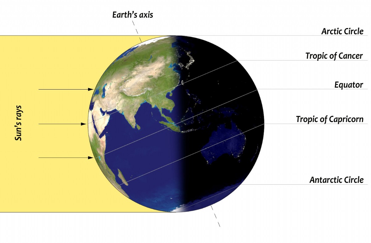
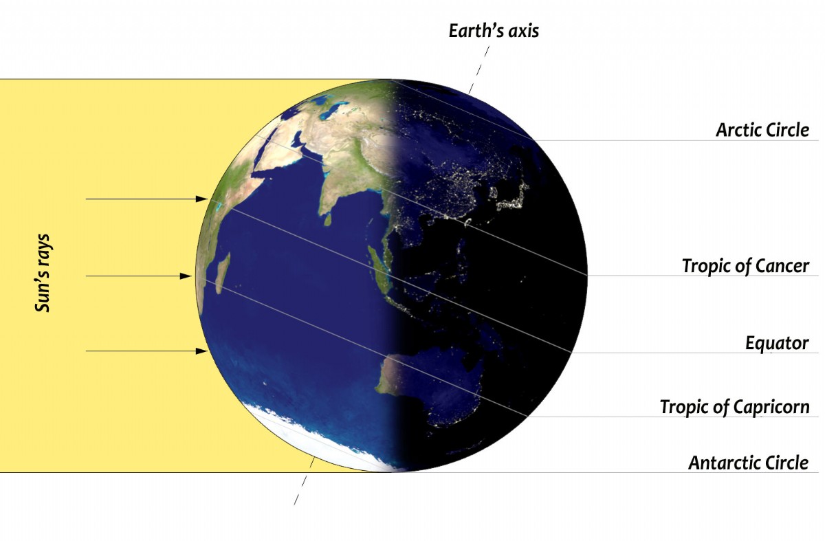
The Tropic of Cancer is the line of latitude at which the Sun appears directly overhead at the Summer Solstice (in the north, 20th June to 21st June), when the Northern Hemisphere is tilted toward the Sun to its maximum extent. This is approximately 23°30' N; it varies because the Earth's angle of tilt is shifting constantly.
The Tropic of Capricorn is the latitude at which the Sun appears directly overhead at the Summer Solstice (in the south, 21st December to 22nd December), when the Southern Hemisphere is tilted toward the Sun to its maximum extent. This is approximately 23°30' S.
Arctic Circle
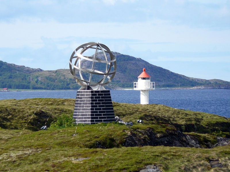
The Arctic Circle, approximately 66° 30' N, is the southernmost latitude in the Northern Hemisphere at which the Sun can appear to remain continuously below the horizon for 24 hours at the Winter Solstice (21st December to 22nd December). North of the Arctic Circle, the Sun is above the horizon for 24 hours at least once per year and below the horizon for 24 hours at least once per year. This event occurs on more or more nights the further north you go.
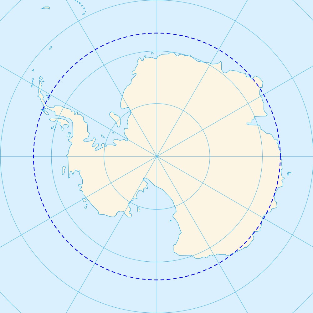
Antarctic Circle
The Antarctic Circle, approximately 66° 30' S, is the northernmost latitude in the Southern Hemisphere at which the Sun can appear to remain continuously below the horizon for 24 hours at the Winter Solstice (20th June to 21st June). South of the Antarctic Circle, the Sun is above the horizon for 24 hours at least once per year and below the horizon for 24 hours at least once per year. This event occurs on more or more nights the further south you go.
Time zones
It takes the Earth roughly 24 hours to rotate the full 360°. Therefore, one hour represents a 15° shift in longitude, or to put it another way, the time at two places lying 15° of longitude apart differs by one hour. Rather than have clocks set to slightly different times in places lying short distances away from one another, the Earth has been divided into time zones, within which all places have the same time.
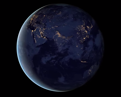
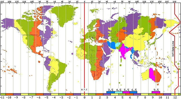
The time zones are 24 vertical bands drawn around the globe. Places in time zones to the east of the Greenwich, or Prime, Meridian (longitude 0°), are a certain number of hours ahead of Greenwich. For example, Auckland, New Zealand, at 175° East, is twelve hours ahead, or GMT + 12. Places in time zones to the west of Greenwich are certain numbers of hours behind Greenwich. For example, Lima, Peru, at 77° West, is five hours behind, or GMT - 5.
On the opposite side of the Earth to the Greenwich Meridian is the International Dateline (IDL, following 180°, but zigzagging here and there to avoid running across land or islands). Travel across the IDL going eastwards, you go back to the previous day; travel across it westwards and you go forward to the next day.