
Maps

CITE
We have made every effort to follow citation style rules, but there may be some minor differences. If in doubt, please refer to the appropriate citation style manual.
Mapping today. (2026). In Q-files Encyclopedia, Geography, Maps. Retrieved from
https://www.q-files.com/geography/maps/mapping-today
"Mapping today." Geography, Maps, Q-files Encyclopedia, 1 Apr. 2026.
https://www.q-files.com/geography/maps/mapping-today.
Accessed 6 Aug. 2026.
Mapping today 2026. Geography, Maps. Retrieved 6 August 2026, from
https://www.q-files.com/geography/maps/mapping-today
Geography, Maps, s.v. "Mapping today," accessed August 6, 2026.
https://www.q-files.com/geography/maps/mapping-today


Mapping today
There have always been two key tasks in map-making (also called cartography). The first task is to collect information about the Earth. The second task is to combine, select and display that information on a map in a useful and attractive way. During the late 20th century, new ways of collecting information changed cartography for ever. These methods make use of new technology, such as satellites, lasers radar and lidar. Today, the information collected is usually called “data” as it is stored digitally on a computer. The development of new computer systems—called geographic information systems (GIS)—also changed the way data is worked with and displayed. Cartographers are highly skilled, but today anyone can have a go at being a map-maker, using mapping software, websites and apps that let us download basic maps, alter their scale and decide which features to display.

Geographic information systems
Geographic information systems (GIS) are computer systems that store geographical information from a range of sources, from satellite images to geophysical surveys. A GIS can combine, select and display all this information for any given place. GIS are used by cartographers to create maps with an endless variety of scales, themes and styles.
Simplified GIS can be used on navigation websites and apps (see web map services, below)—for example, the user can decide which features to show on their personalized map, from restaurants to petrol stations.
Global Positioning System (GPS)
GPS is a navigation system that uses satellites to calculate the exact location of any point on Earth. There are up to 32 GPS satellites in orbit around the world, giving worldwide coverage. The satellites are run by the US government and the system is free to anyone with a GPS receiver. GPS satellites constantly broadcast radio signals that give their location and exact time, using onboard atomic clocks.
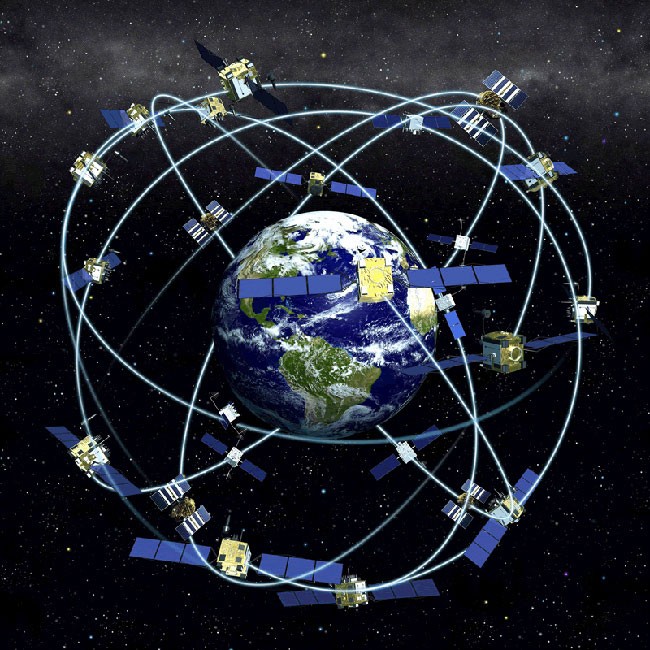
The GPS radio signals travel through space at the speed of light. A GPS device on Earth receives the radio signals, noting their time of arrival. It uses the time taken for the signal to arrive to calculate its distance from each satellite in view. Once a GPS device knows its distance from at least four satellites, it can use geometry to determine its location on Earth in three dimensions—latitude, longitude and altitude.
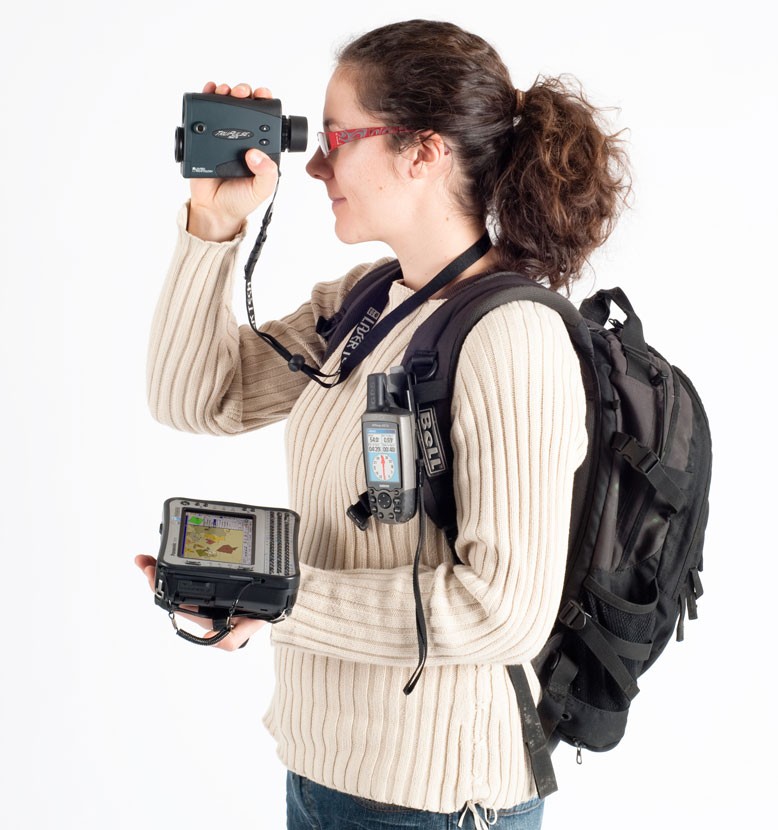
Since GPS became widely available in the 1990s, it has transformed mapping. Armed with a GPS receiver, a laser rangefinder (which uses a laser beam to determine distance to an object) and a rugged computer (tough and wireless), a surveyor or cartographer can create maps as they travel through any terrain. Satnav devices, used for navigation in cars, also contain GPS receivers.
As of 2024, four global satellite navigation systems are operational: the United States's Global Positioning System (GPS), Russia's Global Navigation Satellite System (GLONASS), China's BeiDou Navigation Satellite System (BDS) and the European Union's Galileo.
Aerial and satellite photography
Photographs taken from the air—for example, from helicopters or remote-controlled aircraft—as well as by satellites, are widely used by cartographers. The technique of using photographs to check measurements on the ground is called photogrammetry. It uses methods such as triangulation. Often, aerial photos are used simply for collecting data, but sometimes the images themselves become part of a map in a process often called photomapping. It is also possible to create digital elevation models (showing the terrain in 3D) by combining information from many aerial or satellite images. Photogrammetry and photomapping are often combined with remote sensing to get a fuller picture.
Virtual globe
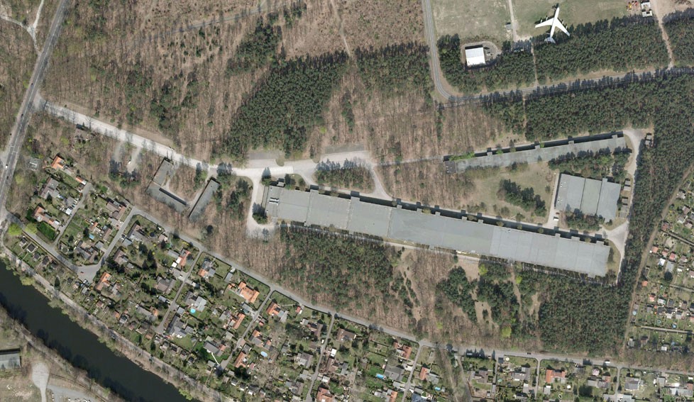
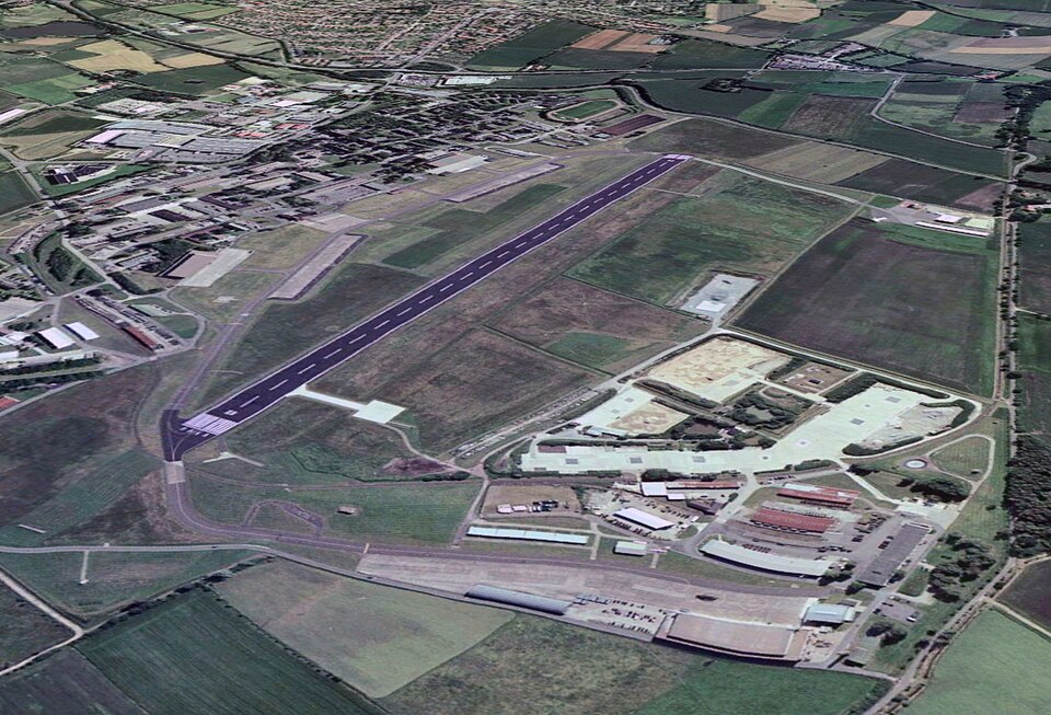
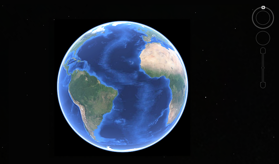
A virtual globe is a three-dimensional (3D) software model or representation of the Earth or another world. The programme maps the Earth by superimposing satellite images, aerial photography and GIS data on to a 3D globe, allowing users to see cities and landscapes from various angles. The first popular online virtual globes were NASA WorldWind (released in 2004) and Google Earth (2005). For much of the Earth, Google Earth uses digital elevation model data collected by a satellite, creating the impression of 3D terrain, even where the imagery is only two-dimensional.
Google Mars and Google Moon are applications within Google Earth that provide high-resolution images enabling you to explore the surfaces of Mars and the Moon. WorldWind offers the same, plus imagery of the surfaces of Venus and the four Galilean moons of Io, Ganymede, Europa and Callisto.
Web mapping
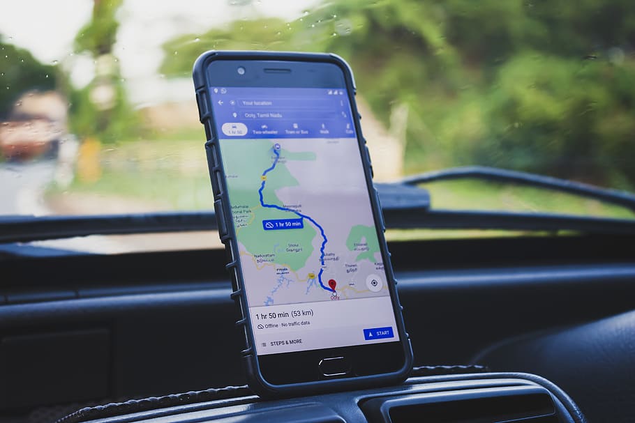
Web (or online) mapping offers maps on the world wide web, usually through the use of GIS. Users of apps on devices linked to the web can receive turn-by-turn directions to a location from where they currently are located (obtained via GPS) with the most current geographical information. The apps also allow you to select your route with distances and estimated times of travel for different means of travel: driving, cycling, walking or public transport. The maps display information almost in real time (the actual time during which something takes place). These include traffic congestion or the current locations of buses or trains, allowing users to be aware of delays.
Two of the most popular web mapping apps are Google Maps and Apple Maps. As of 2024, Google Maps had approximately 1.8 billion users while Apple Maps had 500 million users.
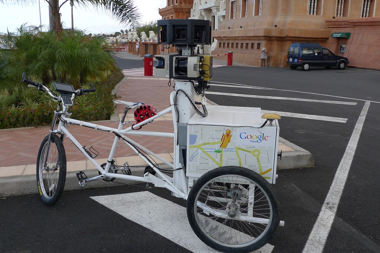
First launched in 2007, Google Street View is a technology featured in Google Maps and Google Earth. It provides interactive photographic panoramas from positions along many streets in the world. Most photography is done by car, but some is done on foot or by tricycle, boat or even snowmobile. Images are made using 20-megapixel cameras alongside laser range and lidar scanners. Accurate positioning is provided via GPS and other sensors.
Remote sensing

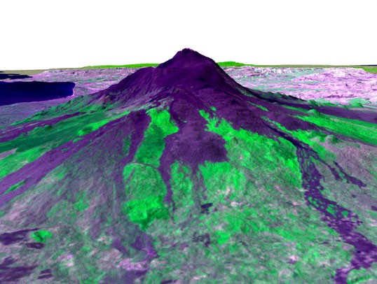
Remote sensing is the use of sensors on board aircraft or satellites to get information about the Earth’s surface, oceans and atmosphere. For example, lidar (a word that merges “light” and “radar”) sensors on board planes can measure distances by illuminating targets with a laser and analysing the reflected light. Lidar (see below) is commonly used for making digital elevation models and for mapping vegetation types. Radar sensors send out radio waves, which scatter or bounce back to the sensor. They can create very useful maps of features such as volcanoes or landslides.

Earth observation satellites, such as the USA’s Landsat satellites, capture images in both visible light (ordinary photographs) and infrared. Infrared images—which record the heat energy emitted by and reflected from the Earth’s surface and oceans—are particularly useful for collecting information about land use.
Lidar

Lidar (Light Detection and Ranging) uses light in the form of a pulsed laser to measure ranges (variable distances) to the Earth's surface. By pairing a lidar unit with a GPS (Global Positioning System) receiver, data can be collected from a wide area as the unit is moved across it in a plane. Besides mapping, lidar is used by self-drive vehicles. It has recently proved to be a valuable tool in archaeology, in particular for revealing ancient settlements hidden in the dense rainforests of the Amazon and Central America.
Pulses of laser light are fired out from the plane. They bounce off the ground and return to the detector on the underside of the aircraft. Based on the timing and intensity of the returning pulses, the detector can map the contours of the terrain. Although only a small fraction of the pulses passed through the closely-packed trees of the forest, the large number emitted allowed enough light to reach the ground. By pointing lasers at the ground from different angles, lidar can create detailed 3D collections of data points, called point clouds. In this way, the hills, ditches and ancient ruins covered in vegetation can be detected and mapped in detail.

Geophysics and bathymetry
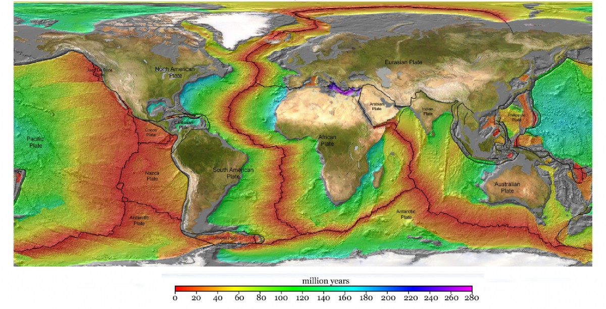
Geophysical surveying can create maps of the Earth below its surface. Instruments include: ground-penetrating radar, which transmit radio waves into the ground and measure the reflected waves; magnetometers, which measure the magnetism of different rock types; electrical resistivity imagers, which measure the different electrical resistances of structures beneath the surface. Bathymetric surveys map the peaks and troughs of the seafloor. Besides lidar, sonar (Sound Navigation And Ranging), which bounces sound waves off the seafloor, is a common technique used.
pics
Without in any way limiting Q-files Ltd’s exclusive rights under copyright, any use of this publication to “train” generative artificial intelligence (AI) technologies to generate text is expressly prohibited. Q-files Ltd reserves all rights to license use of this work for generative AI training and development of machine learning language models.