
South America

CITE
We have made every effort to follow citation style rules, but there may be some minor differences. If in doubt, please refer to the appropriate citation style manual.
Amazon rainforest. (2026). In Q-files Encyclopedia, Geography, South America. Retrieved from
https://www.q-files.com/geography/south-america/amazon-rainforest
"Amazon rainforest." Geography, South America, Q-files Encyclopedia, 1 Apr. 2026.
https://www.q-files.com/geography/south-america/amazon-rainforest.
Accessed 6 Aug. 2026.
Amazon rainforest 2026. Geography, South America. Retrieved 6 August 2026, from
https://www.q-files.com/geography/south-america/amazon-rainforest
Geography, South America, s.v. "Amazon rainforest," accessed August 6, 2026.
https://www.q-files.com/geography/south-america/amazon-rainforest


Amazon rainforest
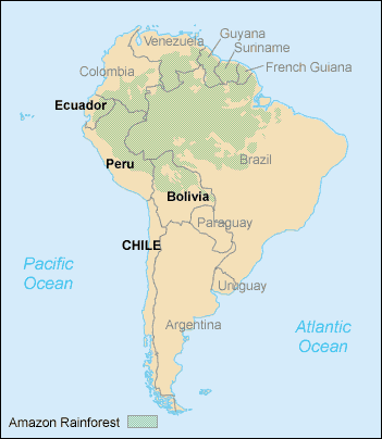
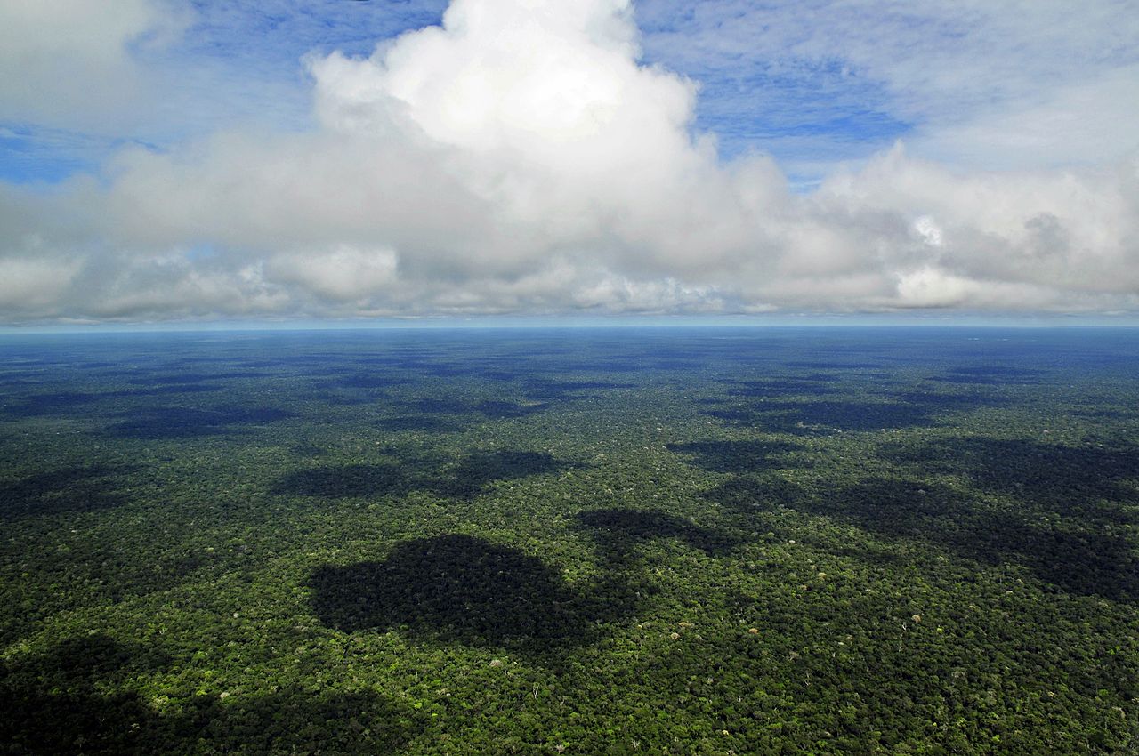
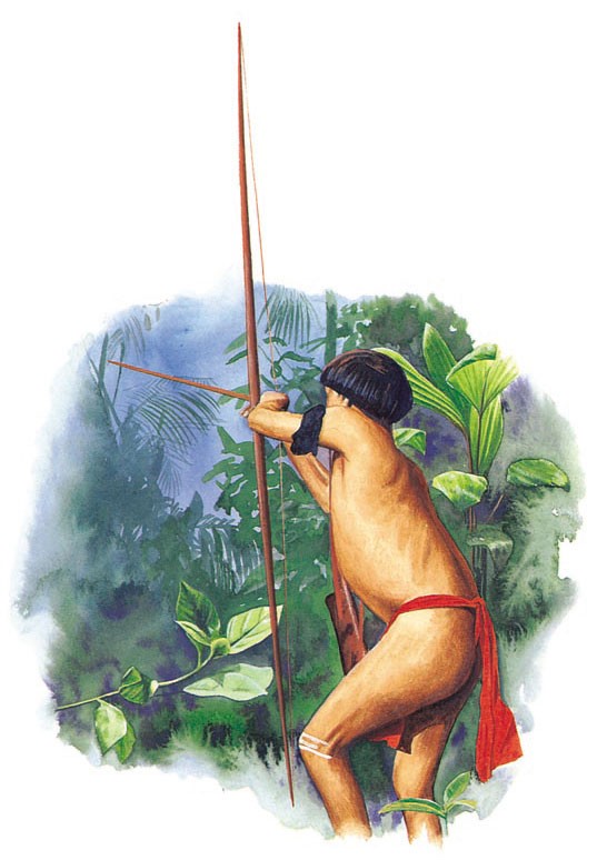
The River Amazon rises in the Andes Mountains and winds its way eastwards through Peru and Brazil before reaching the Atlantic Ocean. This vast river carries a fifth of all the world’s fresh water into the Atlantic Ocean. The Amazon Basin (the land drained by the Amazon and its tributaries) contains the largest area of rainforest in the world. Many kinds of plants and animals live there, and new species are constantly being discovered. The rivers provide both vital transport routes and a source of food for the indigenous (native) peoples who live in forest villages. A few of these peoples still follow a traditional way of life, hunting, fishing and growing crops. Many also take advantage of modern technology, such as engines for their boats.
Follow these links to read about the plants and animals of the Amazon rainforest and rivers.

Climate
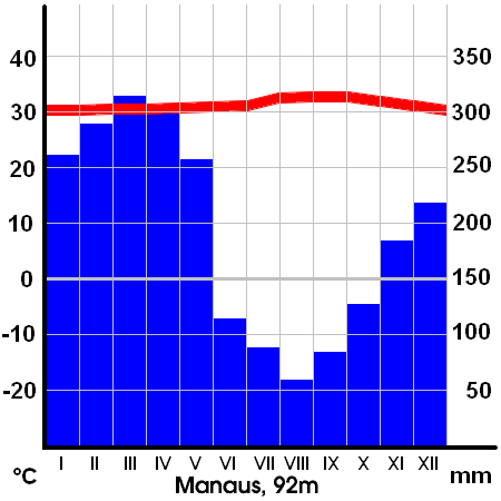
The climate of the Amazon rainforest is constantly warm and humid (high levels of water vapour in the air) with average daily temperatures ranging between 32°C (90°F) in September and 24°C (75°F) in April. Air masses from over the South Atlantic Ocean occasionally drift northwards as far as the Amazon region during Southern Hemisphere winter months, lowering temperatures to around 14°C (57°F). This event is known locally as a friagem.
About half of the precipitation that falls on the rainforest comes from the Atlantic Ocean. The other half comes from evapotranspiration, water vapour from the trees, soils and open water in the tropical forest itself. This often produces what is called convective precipitation. Average annual rainfall in the Amazon lowlands ranges from 150 to 300 centimetres (60 to 120 inches). In central parts there is a drier period running from June to November where rainfall is less or stops altogether.


To the west, the Andes Mountains form a natural barrier that prevents most of the warm moist air from leaving the Amazon Basin. Here in the cloud forest—the forest-covered mountain slopes where clouds often form at low levels—high levels of precipitation (up to 350 centimetres or 140 inches annually) feed the rivers and streams that form a large part of the Amazon system.
Deforestation
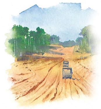
Today, the rainforest is under threat, because of logging for the timber industry, roadbuilding, mining and clearing space for cattle farming or crop cultivation. The poor-quality rainforest soil means that it cannot support grazing or crops for long before the farmers must move on to new areas—so even more of the forest is lost. Between 1970 and 2003 more than 755,000 square kilometres (290,000 square miles) of forest have been lost—an area the size of Chile. The rate of loss of rainforest actually slowed between 2004 and 2012 thanks to conservation efforts, but it has risen significantly since then—and accelerated.

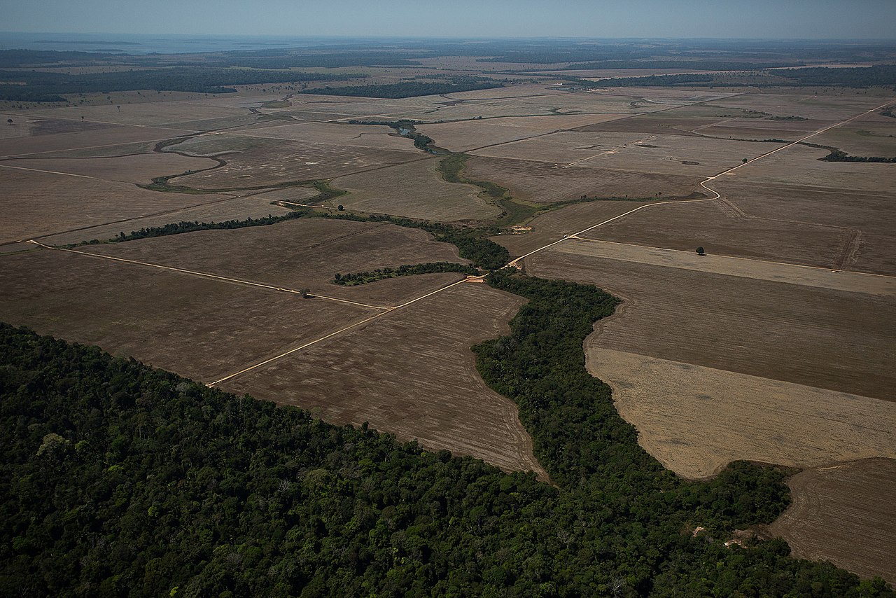
Deforestation in the Brazilian Amazon rainforest rose more than 88% in June 2019 compared with June 2018. It more than doubled in January 2020, compared with the same month in 2019. Turning the land over to cattle farming has been by far the biggest cause. Encouraged by the Brazilian government, deforestation accelerated during the Covid-19 pandemic.
The destruction of the rainforest does not only mean a loss of habitat for millions of plants and animals. The bare landscape that is left also leads to soil erosion, which results in even less land for farming. The loss of so many trees also contributes to global warming, as trees absorb the greenhouse gas carbon dioxide.

Illegal mining
The high value of gold has led to the surge in numbers of people searching for the metal in remote areas of the Amazon rainforest in Brazil, Peru, Colombia and Bolivia. Illegal mining causes deforestation and contamination of soil and water.
The miners cut down swathes of trees and dig ponds to dredge for gold. The particles they extract are crushed and ground to a fine powder which is mixed with mercury to form a mercury-gold amalgam. The gold is concentrated by boiling away the mercury.
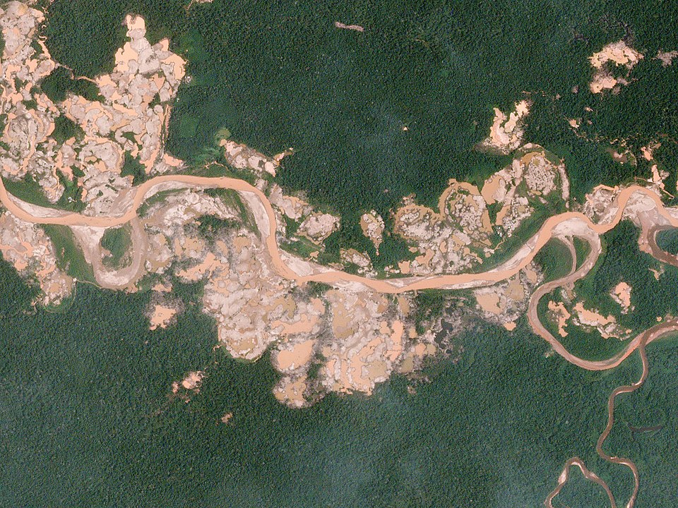
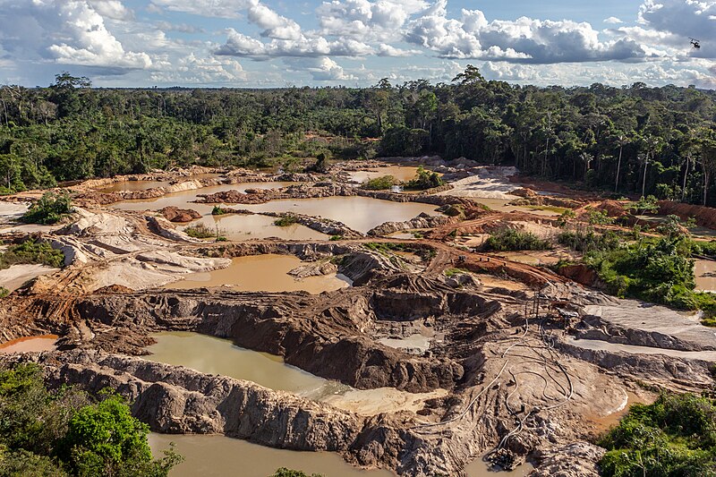
The process of extracting gold is extremely hazardous because mercury, which enters the groundwater and rivers, is highly toxic: it poisons the land the indigenous Amazonian people use to plant their food and the rivers they use to fish and on which they rely for drinking water. The presence of miners also exposes the local residents to contagious diseases, especially malaria, to which children are especially vulnerable. Meanwhile, the lands once covered with dense, species-rich forest are being transformed into lifeless wastelands peppered with stagnant pools.
Climate change
Often described as the "lungs of the planet", the Amazon rainforest plays a key role as a carbon sink, removing carbon dioxide from the atmosphere (by the natural process of photosynthesis in which leaves take in carbon dioxide and water to make food). Over the centuries, the forest has adapted to the pattern of wet and dry seasons, even droughts. But rapid deforestation in recent decades (around one fifth of the rainforest has been lost over the last 50 years) has left it more vulnerable to weather extremes, which are now becoming more common due to climate change.
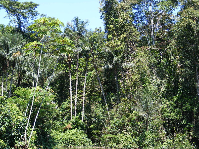

Climate change reduces the amount of water in the forest in two main ways. Firstly, the Amazon Basin receives even less rain than it used to between June and November, the dry season. Secondly, hotter temperatures mean higher evaporation rates: the trees and soils lose more water to the air. In these conditions, more trees die back, either from dehydration (insufficient water) or wildfires (drier forests are more flammable). Besides helping to cool temperatures, trees retain and release moisture through evapotranspiration, allowing the forest to create its own clouds which provide regular rain. Fewer trees increases the Amazon's vulnerability to drought—and so the deadly cycle continues.
While droughts in the Amazon are not uncommon, that of 2023–24, when some rivers fell to their lowest levels in more than a century, is exceptionally severe. It is the fourth of four dry spells in less than 20 years. High water temperatures have caused the deaths of more than 150 endangered Amazon river dolphins in a single week. Millions of people have been affected by drinking water shortages, failed crops and power cuts (insufficient water caused hydro-electric power plants to stop working).
The droughts have also triggered the second largest series of wildfires in the 21st century after the 2023–24 Australian bushfire season. Tens of thousands of wildfires have burned large areas of the Amazon rainforest, along with the Pantanal wetlands and the Cerrado savanna, an estimated total of 46 million hectares (114 million acres).
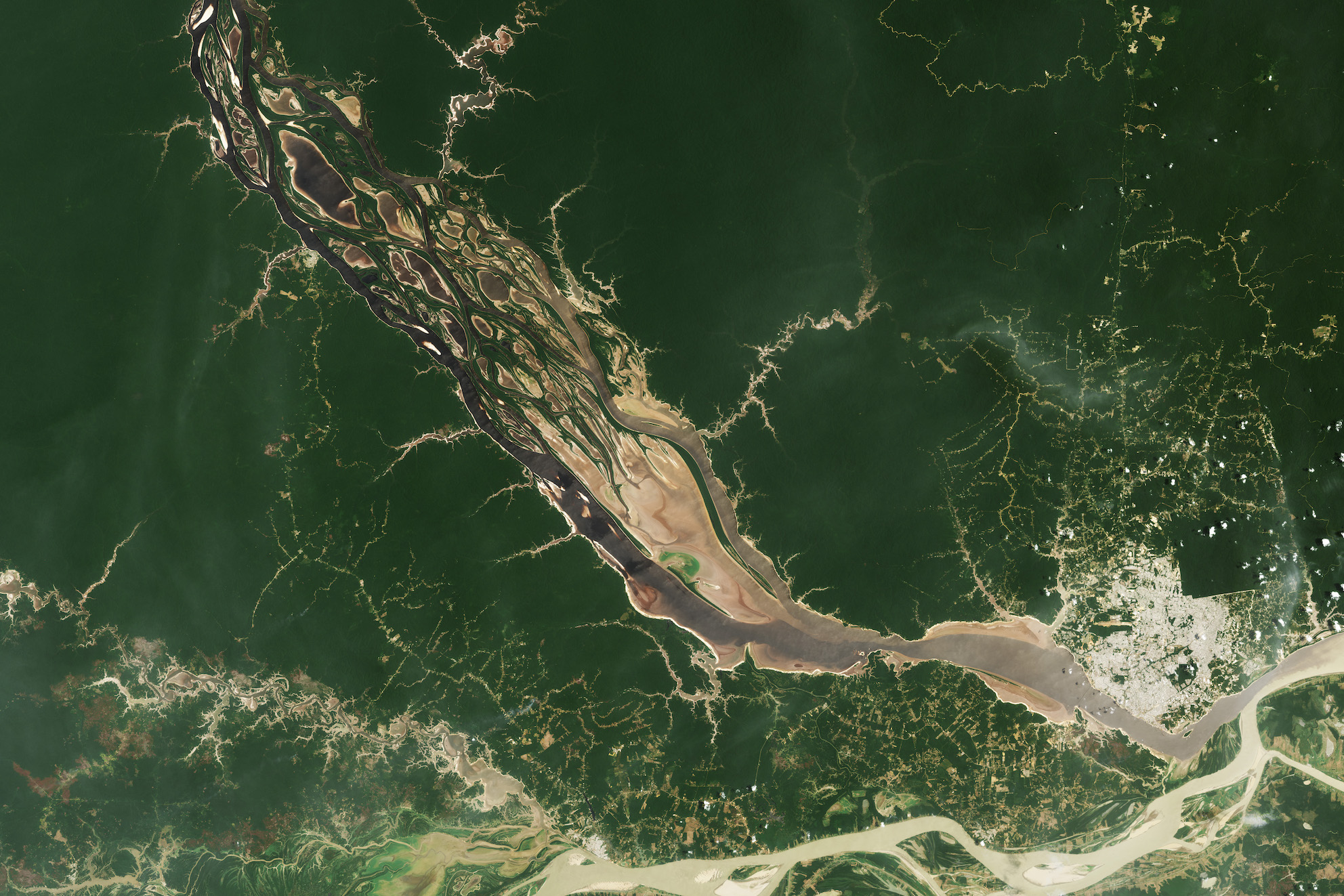
Scientists warn that if climate change and deforestation are to continue at their current pace, the Amazon Basin could soon reach a "tipping point", beyond which it would no longer be capable of sustaining a rainforest with its own water cycle. This could lead to the rapid—and irreversible—dieback of the entire forest. The region would then become a major source of carbon dioxide emissions rather than a carbon sink. Fortunately, after a long period of deforestation, the rate fell in 2023. Brazilian president Luiz Inácio Lula da Silva promised to halt it completely by 2030. This, alongside urgent action around the world to slash the greenhouse gas emissions that are fuelling global warming, could still preserve the Amazon rainforest.
Amazon inhabitants
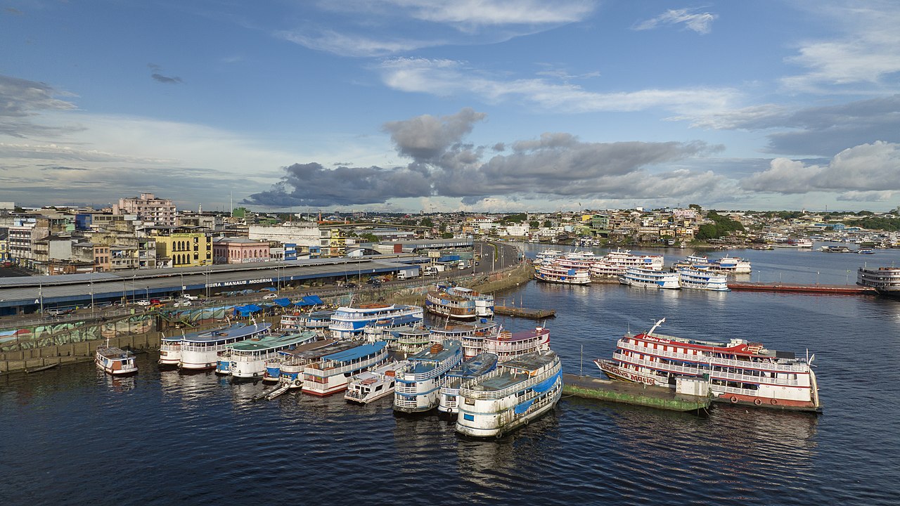
More than 30 million people of 350 different ethnic groups live in the Amazon. Indigenous peoples make up 9% of the total; around 60 of the groups are mostly isolated. Most of the inhabitants live in a few larger cities on the banks of the Amazon and other major rivers, including Iquitos in Peru and Belém in Brazil. Manaus, capital of the Brazilian state of Amazonas, is, with 2.2 million inhabitants, the largest city in the Amazon basin. It was the centre of the Amazon region's "rubber boom" during the late 19th century.
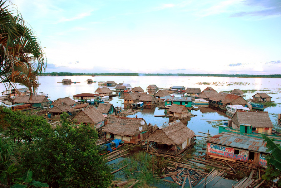
There are scattered settlements inland, where people farm the areas cleared of forest, now under soya bean plantations or cattle pasture. But most villages are located close to river banks or "float" on the water itself. Here, following the seasonal floods which spread nutrient-rich silt on to beaches, ribeirinhos (local people) grow rice, beans and maize. Fish from the rivers and chickens provide year-round food. Rivers are the main means of travel, with transport ranging from rafts and dugout canoes to modern steel-hulled boats.

Indigenous peoples
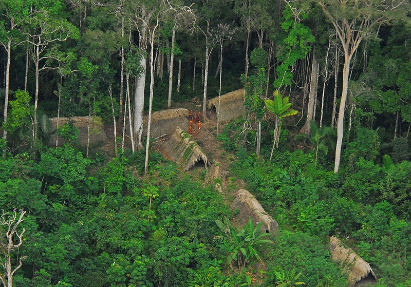
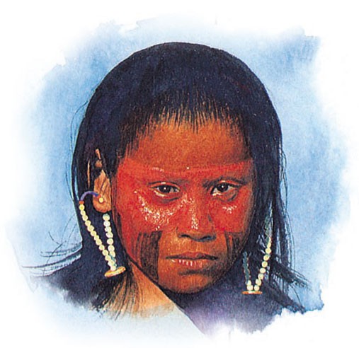
Indigenous American peoples, such as the Panará, Xingu and Yanomami, still inhabit the Amazon region (a few tribes have yet to be contacted by the outside world). Some live in one part of the forest for a while, where they hunt and grow basic crops, and then move on to another site to give the soil a chance to recover: this is known as slash and burn cultivation. As more and more of the forest is cut down, the homelands of traditional peoples are depleted. They have also suffered from persecution and illness as outsiders have moved into the forest.
Ancient Amazonian cities
For years, it was thought that the Amazon rainforest had always been sparsely populated. Because of its poor soil, large-scale farming, which would be needed to support cities, could not develop here. However, recent findings suggest that the Amazon region was once, in fact, densely populated—perhaps by as many as 5 million people in the 1500s. This was the time when Spanish conquistador Francisco de Orellana travelled the length of the River Amazon (1542) and reported seeing a complex civilization (his claims were said to have been wildly exaggerated at the time). Experts think that this civilization could have been later devastated by the spread of diseases from Europe, such as smallpox.
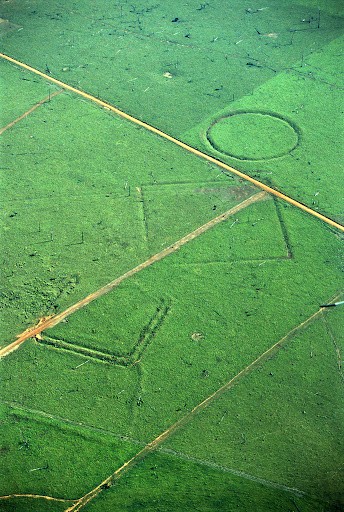
What is the evidence, apart from than Orellana’s claims? Since the 1970s, a number of geoglyphs (large manmade patterns in the ground) have been discovered on deforested land and dating between AD 1–1250. Remains of roads, bridges, earthworks and plazas were found in the Xingu National Park in 2003.
In 2022 a number of ancient settlements in the forests of Bolivia were discovered. Archaeologists used lidar technology to produce 3D maps of the terrain from data gathered by laser pulses transmitted and received by a helicopter flying overhead. The maps revealed the existence beneath the forest cover of walls, causeways and pyramids made of earth up to 22 metres (72 feet) high.
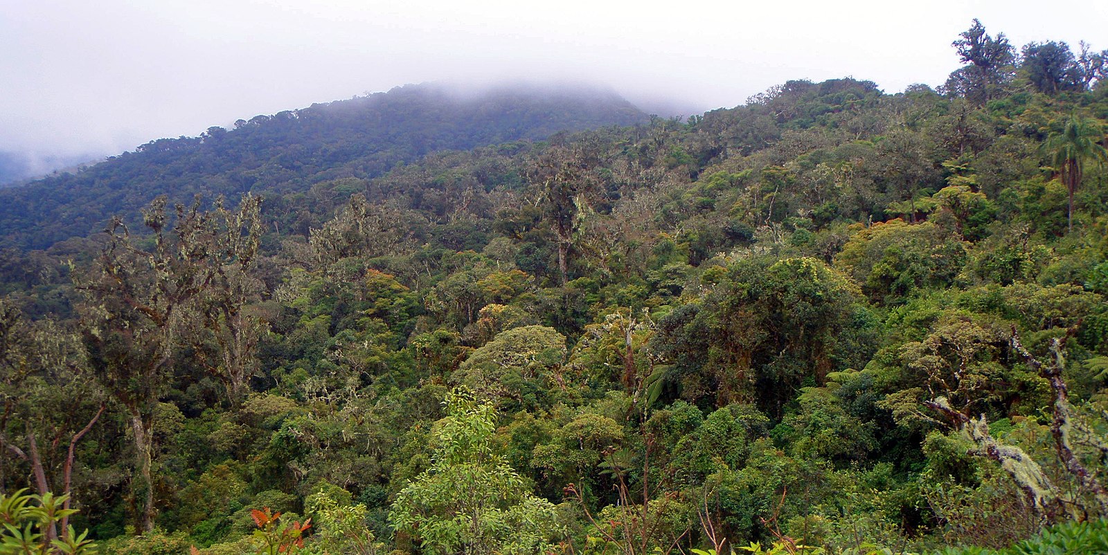
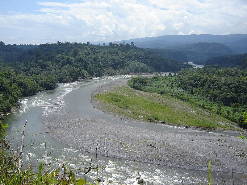
In 2024, it was reported that a team of scientists, also using lidar technology, had discovered 6000 mounds they believe once made up a cluster of ancient cities—home to tens of thousands of people—that flourished in the Amazon rainforest around 2500 years ago. People lived there for 1000 years or so (between about 500 BC and AD 500, roughly the same time as the Roman Empire in Europe) before their civilization disappeared, all evidence covered over by lush vegetation. The settlements, in the Upano area in eastern Ecuador, were connected by a network of long straight roads and canals. The area lies close to the Sangay volcano, which provided the region with rich soils for cultivation—but may also have destroyed the civilization in a violent eruption.
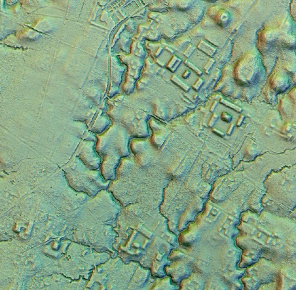
By combining the data they have gathered using lidar, researchers estimate that more than 10,000—and perhaps as many 24,000—earthworks may still be hidden beneath the Amazon rainforest.
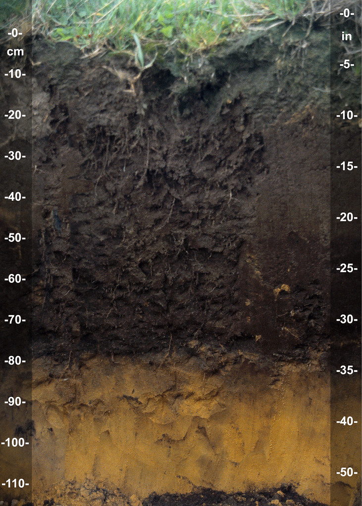
Terra preta, a type of dark, fertile soil made by adding charcoal, bone and manure to otherwise infertile soil, has been found in many parts of the Amazon forest. It is clear that native peoples, centuries before Europeans arrived, set about enriching the soil themselves, allowing them to farm extensive areas. After their civilization ended, the forest grew back. The evidence of their occupation remains in the soil.
Consultant: Lloyd Jenkins
pics

Without in any way limiting Q-files Ltd’s exclusive rights under copyright, any use of this publication to “train” generative artificial intelligence (AI) technologies to generate text is expressly prohibited. Q-files Ltd reserves all rights to license use of this work for generative AI training and development of machine learning language models.