
Maps

CITE
We have made every effort to follow citation style rules, but there may be some minor differences. If in doubt, please refer to the appropriate citation style manual.
History of cartography. (2026). In Q-files Encyclopedia, Geography, Maps. Retrieved from
https://www.q-files.com/geography/maps/history-of-cartography
"History of cartography." Geography, Maps, Q-files Encyclopedia, 1 Apr. 2026.
https://www.q-files.com/geography/maps/history-of-cartography.
Accessed 6 Aug. 2026.
History of cartography 2026. Geography, Maps. Retrieved 6 August 2026, from
https://www.q-files.com/geography/maps/history-of-cartography
Geography, Maps, s.v. "History of cartography," accessed August 6, 2026.
https://www.q-files.com/geography/maps/history-of-cartography


History of cartography
The story of maps starts at least 8000 years ago, when some people first started to draw plans of their town, region, world—or the heavens. At first, they worked from memory or entirely from their imagination. As societies became more ordered and complex, people saw the need for accurate maps. They began to survey the land, taking accurate measurements and plotting features. As explorers reached foreign lands, map-makers (also called cartographers) started to cover larger and larger regions in their maps. Inventions such as the compass, astrolabe and theodolite began to turn cartography into a combination of science, design and technology.
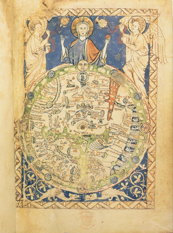
The earliest maps
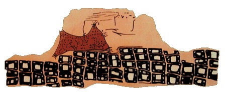
The very earliest maps were probably not meant to help with navigation: they may have had ritual or religious uses. One of the earliest maps ever found is a wall painting in the ancient city of Çatal Höyük, Turkey, dating from around 6200 BC. The map features a rough plan of the town, drawn from the map-maker’s imagination. Behind the town is an eruption of the twin-coned volcano Hasan Dag, which is visible from Çatal Höyük.
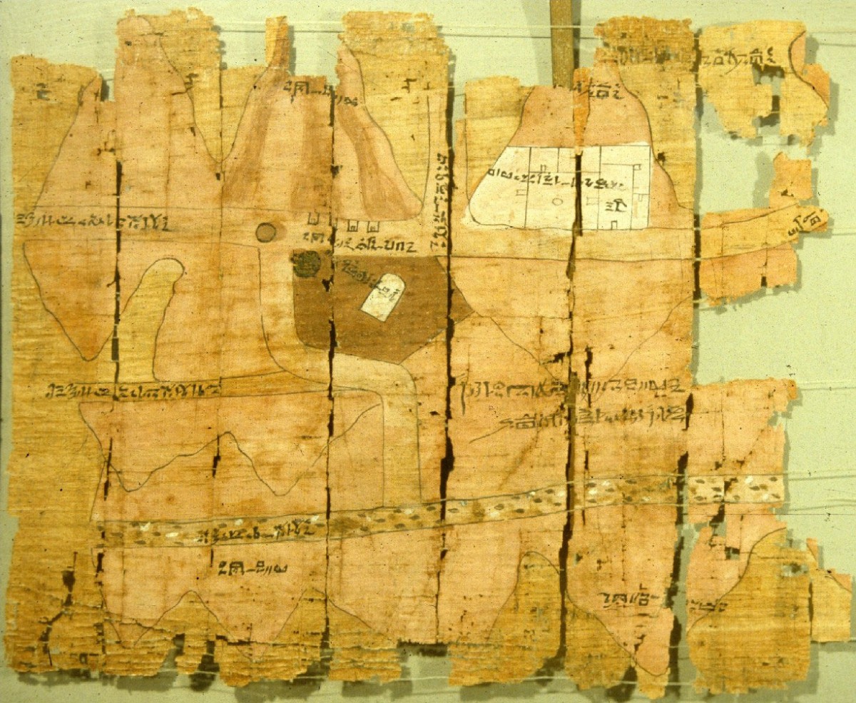
The ancient Mesopotamians were the first to draw maps to scale and to base them on measurements of the land. More accurate maps were important to them, as ownership of land and irrigation systems had become central to their society. Mesopotamian topographic maps marked into clay tablets have been found from around 2350 BC. The Egyptian “Turin Papyrus” map, dating from around 1300 BC, shows the locations of gold and silver mines in the hills between the River Nile and the Red Sea. It may be the world’s first known geological map.
Greek and Roman maps
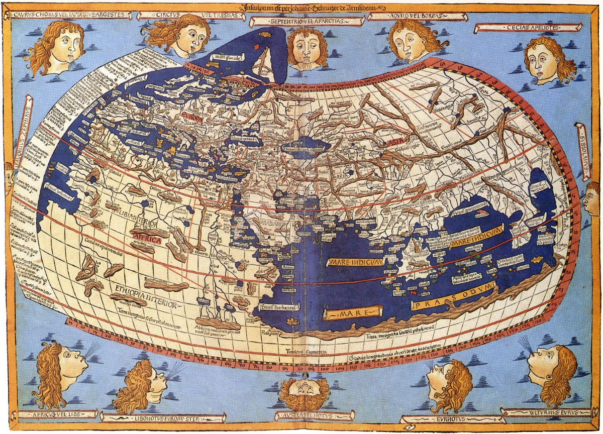
The ancient Greeks were the first to propose that the world was a sphere rather than flat. Using astronomical observation and mathematics, they made fairly accurate calculations of the circumference of the globe and devised the idea of latitude and longitude, dividing the Earth into a regular grid. The Greek mathematician and geographer Claudius Ptolemy (c.AD 90–168) devised map projections (methods of representing the sphere as on a flat plane) and listed rough longitude and latitude coordinates for 8000 locations in the regions known to him. His influence on cartography is still evident today.
The Romans were concerned with the practical methods of accurately mapping their vast empire, including its roads, the ownership of land and the layout of towns. For the first time, land surveying became a profession in its own right. Roman surveyors established a system of standard measurements, and used geometry and measuring tools such as pegs and ropes, as well as the groma (used to measure straight lines and right angles), to map the land.

Navigation and cartography
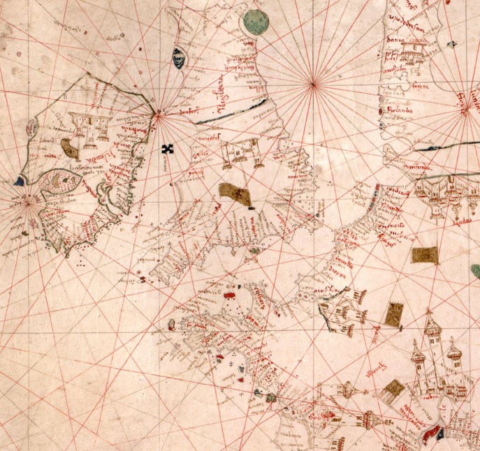
From the Middle Ages, the story of cartography is closely linked to the stories of exploration and navigation. The development of the compass, which spread from China to the Islamic World and Europe by the late 12th century, meant that explorers could more accurately plot their course and mark their observations on charts and maps. This led to the development of portolan charts in the 1290s. These detailed maps, which featured scales and compass roses were a breakthrough in navigation at sea. The astrolabe was first used at sea in the late 13th century. It allowed navigators and cartographers to determine their accurate latitude (distance north or south of the equator) by measuring the Sun’s height at noon or the height of a known star.
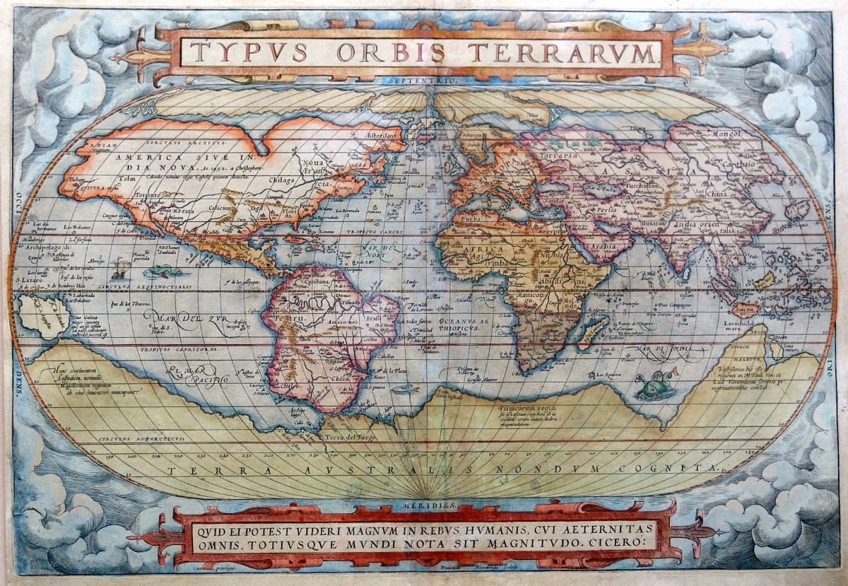
From the early 1400s, European explorers set off to discover and colonize new lands, in a period known as the Age of Discovery. This led to a fascination with cartography, as explorers and governments wanted to make accurate maps of the new territories and their resources, as well as chart safe routes to reach them.
The development of printing using movable type in the 1430s, meant that once maps had been created, they could be reproduced countless times, reaching a wider audience. Cartographers such as Gerardus Mercator (1512–94) and Abraham Ortelius (1527–98), who both lived in what is now Belgium, created bestselling maps and atlases more accurate and detailed than anything that had gone before. It was not until after 1761 that navigators and cartographers could discover their exact longitude at sea, with the invention of the marine chronometer by John Harrison (1693–1776).
Surveying
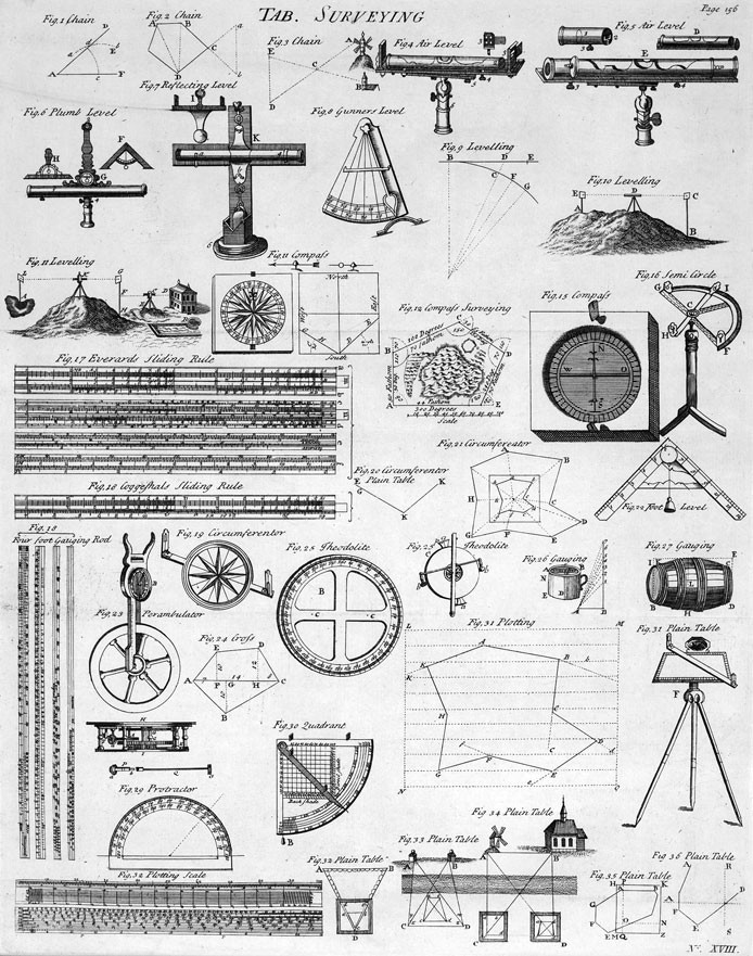
By the early 18th century, surveyors had acquired a range of tools to help them map the land: compass, telescope, “perambulator” (wheel for measuring distance), and quadrant and protractor for measuring and drawing angles.
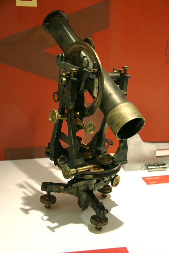
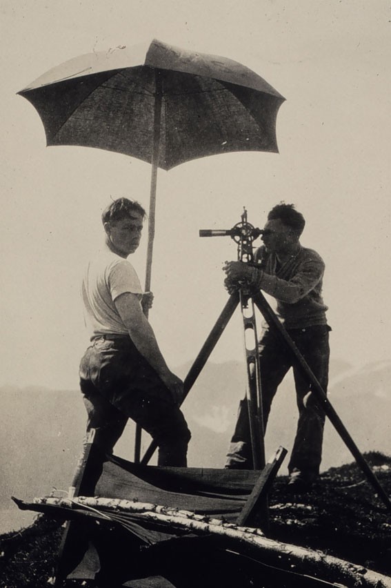
In 1787, a great step forward was made by the English instrument-maker Jesse Ramsden (1735–1800) when he developed a precise theodolite. A theodolite consists of a telescope that is linked with mechanisms to measure horizontal and vertical angles. The angle to a distant point can be measured by first directing the telescope towards it, then reading the angle given on the theodolite’s scale.

Triangulation
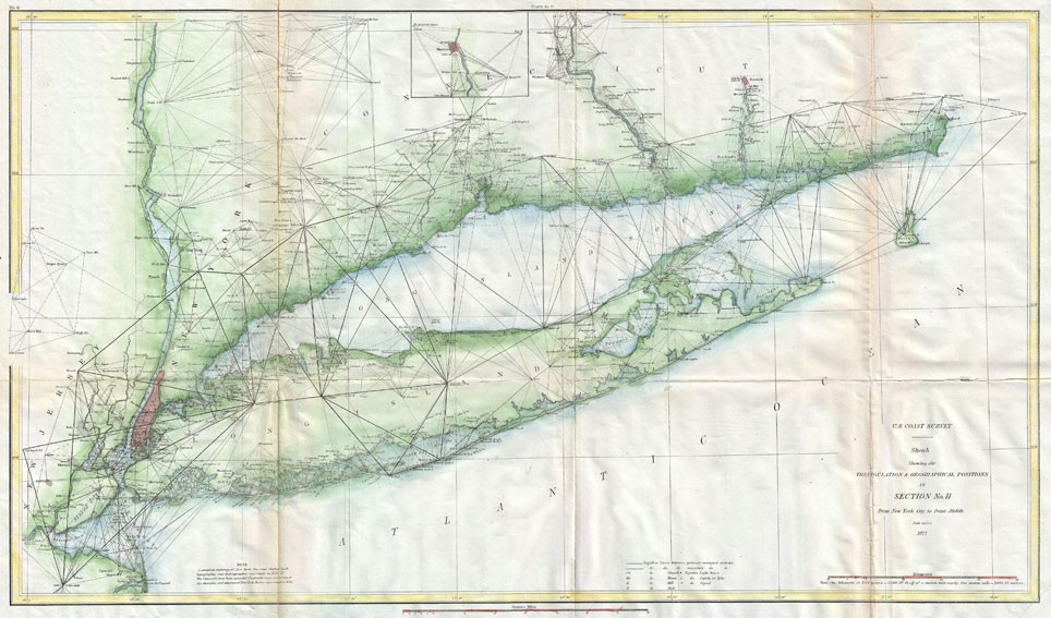
Accurate theodolites were essential for triangulation, a way of determining the location of a distant point using geometry. The technique was developed by the Dutch mathematician Willebrord Snellius (1580–1626). First, the surveyor measures angles from known points at either end of a fixed baseline to a third point. That becomes the third point of a triangle with one known side and two known angles. The surveyor can now calculate the location of the distant point using geometry.
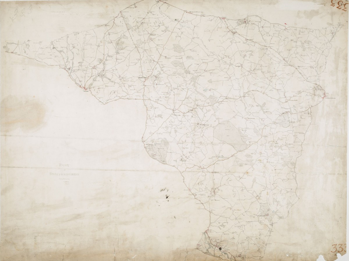
A Ramsden theodolite was used in one of the first large-scale triangulation surveys: the first Ordnance Survey of southern Britain, begun in 1791. Triangulation remained the key method of surveying the land until the development of the global positioning system (GPS) in the late 20th century.
Indigenous mapping
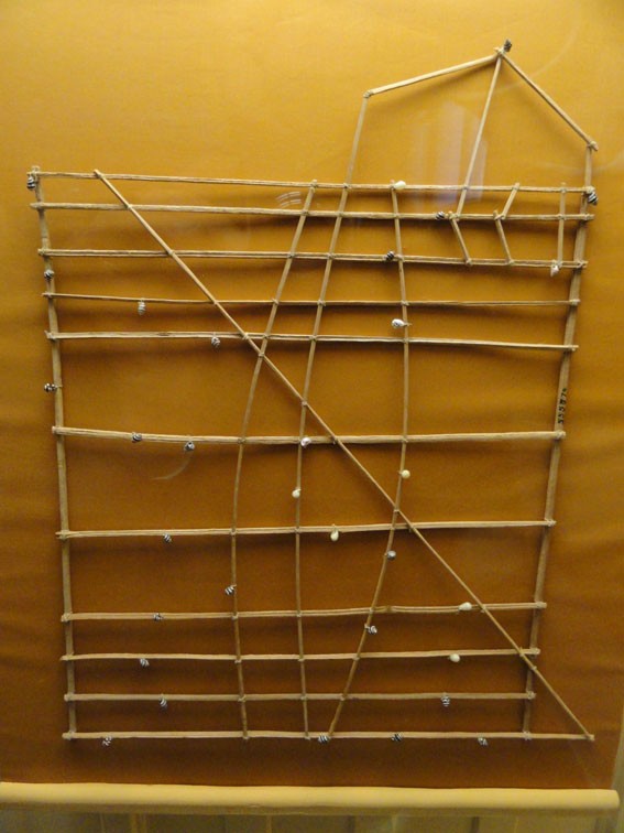
Many peoples around the world represent the space they inhabit in different ways to conventional modern maps. Strict accuracy and scale may be overlooked in favour of other themes. For example, traditional Aboriginal Australian maps combine representations of landforms with a celebration of the meanings of those landforms as part of the Dreamtime; in this way, animals and spirits become part of the map. The Marshall Islanders, who live on a group of islands and atolls in the Pacific Ocean, use stick charts to record ocean currents and wave patterns.
pics
Without in any way limiting Q-files Ltd’s exclusive rights under copyright, any use of this publication to “train” generative artificial intelligence (AI) technologies to generate text is expressly prohibited. Q-files Ltd reserves all rights to license use of this work for generative AI training and development of machine learning language models.