
Erosion

CITE
We have made every effort to follow citation style rules, but there may be some minor differences. If in doubt, please refer to the appropriate citation style manual.
Deserts. (2026). In Q-files Encyclopedia, Earth, Erosion. Retrieved from
https://www.q-files.com/earth/erosion/deserts
"Deserts." Earth, Erosion, Q-files Encyclopedia, 6 Mar. 2026.
https://www.q-files.com/earth/erosion/deserts.
Accessed 30 Oct. 2026.
Deserts 2026. Earth, Erosion. Retrieved 30 October 2026, from
https://www.q-files.com/earth/erosion/deserts
Earth, Erosion, s.v. "Deserts," accessed October 30, 2026.
https://www.q-files.com/earth/erosion/deserts


Deserts
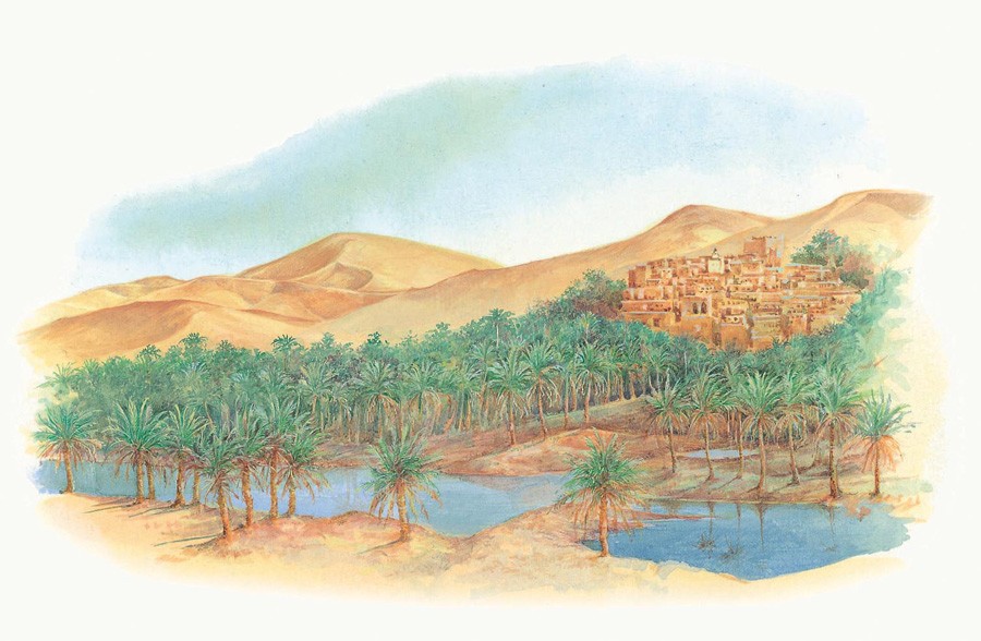
A desert is an area with very low rainfall, usually with less than 25 centimetres (10 inches) of rain or snow a year. Other than at oases, places where underground water comes to the surface, there are few signs of life. Deserts may be hot all year round, as in the Sahara of Africa, or always cold, as in Greenland or Antarctica. The Gobi Desert of Central Asia is hot in summer and cold in winter. “Hot” deserts may be bitterly cold at night. The Takla Makan Desert, China, may be a scorching 40°C (more than 100°F) by day yet plunges to -40°C (-40°F) at night. With no cloud cover, the ground cools very quickly.

Deserts of the world

Deserts and arid regions cover one third of the world’s entire land area. Areas of desert are found in the west of the USA and South America, as well as in central and southwest Asia, Australia and both northern and southern Africa. Antarctica and Greenland are also deserts: very little snow ever falls in these freezing, polar regions.

The driest desert is the Atacama in Chile, South America, with an average of less than one millimetre of rain yearly. In some places it has not rained for centuries. The largest desert is the Sahara in Africa, which is more than 5000 kilometres (3000 miles) wide and covering 9 million square kilometres (3.5 million square miles).
How deserts form
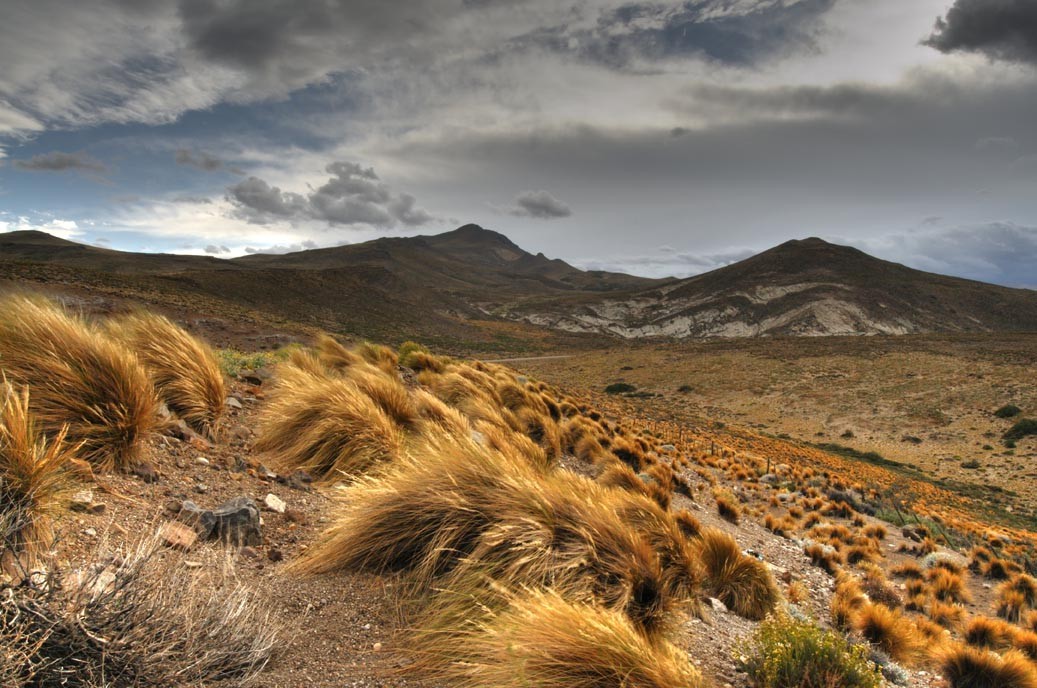
The Mojave Desert in North America, and the Patagonian Desert of South America have formed because moist winds have dropped their water as rain or snow over nearby mountains. The lands beyond lie in what are known as rain shadows. Deserts like the Gobi form in the middle of huge land-masses far from the main source of moisture, the sea. Most deserts, including the Atacama, Sahara, Kalahari and Namib deserts, lie in a band to the north and south of the Equator. These are the result of global patterns of winds and rainfall.
Sand dunes
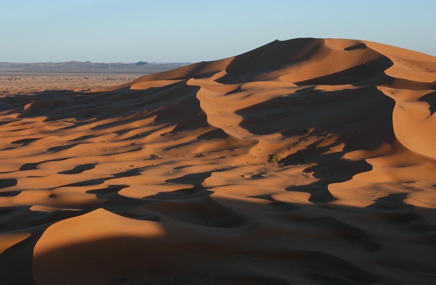
We often think of deserts as vast sandy regions, but only about 20% of the world’s deserts are sandy. The rest are bare rock, or covered with gravel. Most of the Sahara Desert is covered by rock or gravel, only one tenth by sand. Where sand occurs in a desert, it forms either flat sand sheets or dunes, areas of windblown sand piled up in mounds or ridges. Sand dunes are often grouped together in fields, known as sand seas, or ergs.
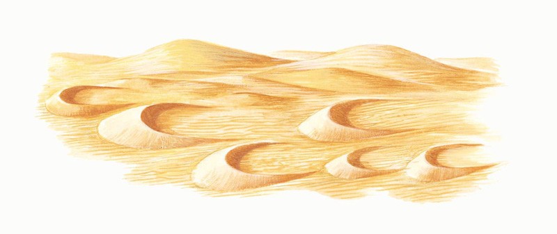
Where the wind always blows in the same direction, and where sand is blowing over a rocky floor, it piles up sand into dunes, called barchans. These are shaped like crescents because the sand at either end is blown faster than the high middle part; the “horns” point downwind. Barchans slowly creep across the desert, blown by the wind.

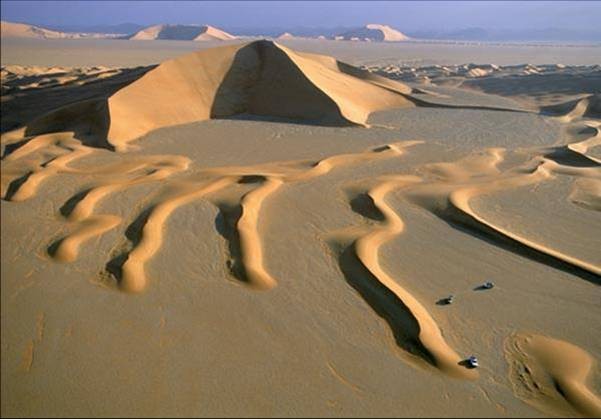
Longitudinal (seif) dunes have sharp, but wavy crestlines, the result of one or more dominant winds beating the sand obliquely (at a slanting angle). The Arabic word seif (meaning "sword") refers to the triangular shape of the dunes in cross-section.
Erosion features
The erosive power of the wind and occasional rainstorms sculpts the desert landscape. Storms hurls sand at rocks, producing features like rock arches and other strange landscapes.
In deserts, the vegetation is sparse so the bare, rocky surface is vulnerable to the erosion by both wind and any rivers that flow across them. In Arizona, southwest USA, the Colorado River has cut a deeper and deeper channel as the land over which it flowed, the Colorado Plateau, slowly began to push upwards from about 10–12 million years ago. The result is the 450-kilometre (280-mile) Grand Canyon.


Wind erosion
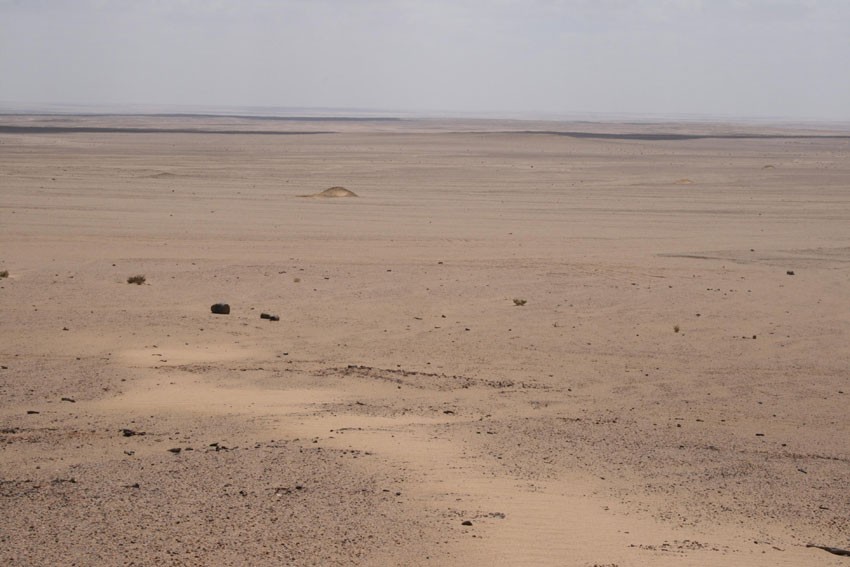
The main force of erosion in deserts where water is largely absent is the wind. Strong winds can carry sand in the air and roll and slide pebbles. In some areas, these winds have, over time, gouged vast hollows out of the ground. A good example is the Qattara Depression in the Libyan Desert, which is 300 kilometres (about 200 miles) across. It lies at 134 metres (440 feet) below sea level.
Strong winds whip up the sand and blast it at rock surfaces, causing abrasion. Rocks of all sizes are affected. Ventifacts, or dreikanter, are individual pebbles that are polished flat on several different sides by the shifting, sand-blasting winds. Where horizontal layers of rock are of different hardnesses, the sand-blasting of softer layers nearer the ground creates top-heavy rock formations called zeugens or mushroom rocks.


Mesas and buttes
Mesas are flat-topped, steep-sided hills—all that remain of once continuous plateaus. In the Monument Valley, Utah, the plateau was once made up of horizontal layers of both soft and hard rocks. The soft beds have eroded away more quickly than the hard ones, causing a stepped outline to develop. As the slopes of the mesas gradually "retreated" (worn away by erosion) over millions of years, some became isolated hills known as buttes. In places, the buttes have been reduced to little more than pillars, called hoodoos.

Wadis
When rain does fall in a desert, the fast-flowing water quickly wears away the rocks to form steep-sided gorges called wadis. Wadis are usually dry all year round, except when there is sudden heavy rainfall (characteristic of some deserts), leading to flash floods: raging torrents of muddy water surging through the wadi.


Bajadas and pediments
Desert basins are sometimes bordered by mountain ranges whose steep, cliff-like slopes are "retreating" (eroding away) in parallel. On the rare occasions when it rains, torrents of water pour down the barren surface, scouring away rock fragments and sand. The debris accumulates at the foot of the cliffs in cone-shaped alluvial fans.
Over time, the alluvial fans gradually merge together and spread out across the gentler, lower slope, called a pediment, to form a continuous skirt, a bajada. The bajadas often contain playa lakes—lakes whose shallow waters regularly evaporate away, leaving behind salt flats.

Inselbergs
Isolated, rounded hills, known as inselbergs, form in some dry regions as a result of a combination of physical and chemical weathering. Well known examples are Uluru and the Olgas in the Australian desert. Rain, which falls on infrequent occasions, gets inside the cracks in the bare surface layers of the rock, and reacts with the minerals, weakening the rock structure along the cracks. Hot days and cool nights result in daily expansion and contraction, and eventually the rock surface splits apart. Sheets of rock fall away layer by layer. This is called exfoliation, or onion skin weathering.


Dust storms and sandstorms
Dust storms (sometimes also called sandstorms) usually start on the edges of deserts. As the winds pick up, dust particles are lifted into the air, sometimes reaching heights of up to 6 kilometres (about 4 miles). They may severely reduce visibility and remain in the air for days on end, sometimes carried for distances of up to 6000 kilometres (about 4000 miles). They are sometimes known by their Arabic name: haboobs.
Much smaller versions can occur in calmer conditions when hot air near the ground rises quickly from the ground, creating whirling column of particles called dust devils.
True sandstorms are much rarer than dust storms. They occur when the wind speed increases to a point where it can lift heavier particles. Sand grains are whipped into the air but their weight stops them being airborne for long, so most only travel a distance of a few metres. The sand streams along only a few tens of centimetres close to the surface of the ground. During a sandstorm, the wind-blown sand particles become electrically charged.

Consultant: Ian Fairchild
pics

Without in any way limiting Q-files Ltd’s exclusive rights under copyright, any use of this publication to “train” generative artificial intelligence (AI) technologies to generate text is expressly prohibited. Q-files Ltd reserves all rights to license use of this work for generative AI training and development of machine learning language models.