
Erosion
Rivers
Rivers are the natural channels that carry away excess water on the land. They are fed by underground water, for example at springs, by rainwater running off the land during storms, and by melting ice from glaciers. Rivers are natural channels that carry rain, melted ice and snow downhill from mountains and uplands to lowlands, lakes and seas. The world’s longest rivers are the Nile in Africa and the Amazon in South America, both about 6600 kilometres (4100 miles) long. Rivers shape the land as they flow over rocks of varying hardness, widening and deepening their valleys by erosion. The faster they flow, the greater their erosive power, and the larger the rocks and amount of sediment they can transport.


Upper waters
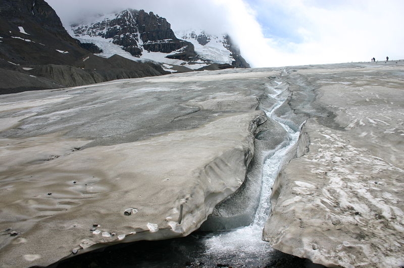
Many rivers rise in mountainous areas and their upper courses. Their valley sides are steep so the waters run quickly. The swift current washes away soil or mud so the bed is stony and the banks are bare. Gradually the slope eases and the river flows more slowly in its middle reaches, widening as smaller rivers, called tributaries, add to it.
Gorges
A gorge or canyon is a deep cleft between escarpments or cliffs. It is carved by the erosive power of a river as it cuts through underlying rock on its way to the sea. Gorges sometimes form in regions where the land over which the river flows is being slowly uplifted, forcing the river to cut a deeper channel to maintain its downward course to the sea. Gorges are also found in limestone (karst) topography, where the water dissolves away the rock to create caves. When the cave roofs collapse, gorges are formed. Very narrow, deep gorges, called slot canyons, often form in areas of soft sandstone rock.


Waterfalls
A waterfall forms where a river cascades over a vertical drop. The cliff may be the result of erosion by the river itself. Where its bed changes from hard to softer rock, the river wears down the softer rock more quickly so a “lip” of hard rock forms above it.
The falling water gouges out a plunge pool at the base of the cliff, undermining it and causing it to collapse. This causes the waterfall gradually to shift further and further back upstream, creating a gorge, a steep-sided valley, downstream.

Floodplain
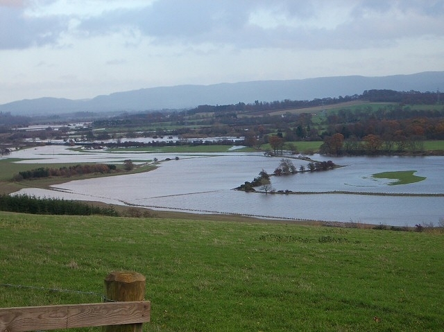
When its flow slows down, a river drops some of the sediment it is carrying. These form gently humped bars along the inside edges of meanders (see below), or, in straighter river channels, long, narrow islands called braids. When the river is in flood, fine sediments such as silt and clay are deposited over its banks. Layers of sediments gradually build up over time and, as the river channel wanders from side-to-side laying down coarser sediments, a level floodplain is formed. The fine sediment deposits are called alluvium and the plain is often referred to as an alluvial plain.
Meanders
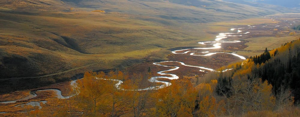

As the river’s course becomes flatter, it flows in looping curves called meanders across its floodplain, while still following its downward route. Meanders are formed when a river erodes its bank on the outside of bends and deposits sediments, creating what are called point bars on the inside of them. The cliff that forms as the river erodes the ground on the outside of its meander is called a cut bank. When undermined by the flow of water, part of the bank collapses into the river. The sediment from this slump is carried into the channel and deposited on the point bar of the next downstream meander.
Ox-bow lakes
As the outside of its bends are eroded away and sediments build up on the inner side, a river's meanders become more horseshoe-shaped. Eventually, the river may cut through the narrow neck of the meander, creating both a new, straighter main channel and a cut-off meander. This is most likely to occur during a flood. The cut-off meander becomes separated from the main channel by sediments and water no longer flows through it: it becomes an ox-bow lake. The lake will gradually fill up with silt and vegetation and eventually become dry land. In areas of arid climate in Australia, these lakes are called billabongs and can be dry for much of the year. In the Ganges–Brahmaputra plain of Bangladesh and and the Indian states of West Bengal and Assam. they are known as beels, or khals in Bengali.

Levees
In its lower course, a river may be edged by raised banks of sediment known as levees. When rivers that carry large quantities of sediments (silt, sand and mud) carried along in their waters flood, most of these tend to settle close to the banks either side of the channel. If the river floods frequently, the sediments build up into rounded ridges, rising higher than the floodplain beyond. These ridges are called levees. Where sediments also build up on the river bed, the channel may eventually rise above the surrounding floodplain, penned in by the levees running either side of it.


Mouth
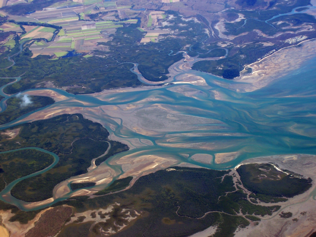
Finally, the river enters the sea at its mouth. Flowing more slowly still, the fragments of rock and soil carried in the water settle as sand and mudbanks on the river bed. If the river widens as it nears the sea, the mouth is described as an estuary. In estuaries, fresh and salt water mix. The waves and tides of the sea meet the outflow of water carrying sediments from the land.
Delta
A delta is formed when the river deposits sediment at its mouth faster than the sea can carry it away. The river divides into many branches called distributaries. Repeated flooding of the river builds up higher levees causing the areas between the distributaries to silt up.
There are three main types of delta. Arcuate or fan-shaped deltas are those where the land around the river mouth arches out into the sea. The river divides into many branches like a tree, forming what is called a dendritic pattern. Examples of this kind are the Niger, Nile and Ganges deltas. Their triangular shape, similar to the Greek letter delta (Δ), is the origin of the name. A cuspate delta, such as that of the Ebro in Spain, simply juts out into the sea without dividing into branches. In a bird’s foot delta, each branch of the river, along with the surrounding land, extends out to sea in different directions like the long claws on a bird’s foot. The Mississippi Delta is an example of this.

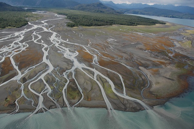
River deltas have extremely fertile soils. A number of great ancient civilizations grew up along deltas, such as those of the Nile. The people living there learned how to cope with the natural cycles of flooding.
Consultant: Ian Fairchild