
Geography of Britain

CITE
We have made every effort to follow citation style rules, but there may be some minor differences. If in doubt, please refer to the appropriate citation style manual.
Geology of Britain. (2026). In Q-files Encyclopedia, Geography, Geography of Britain. Retrieved from
https://www.q-files.com/geography/geography-of-britain/geology-of-britain
"Geology of Britain." Geography, Geography of Britain, Q-files Encyclopedia, 24 Jun. 2026.
https://www.q-files.com/geography/geography-of-britain/geology-of-britain.
Accessed 6 Aug. 2026.
Geology of Britain 2026. Geography, Geography of Britain. Retrieved 6 August 2026, from
https://www.q-files.com/geography/geography-of-britain/geology-of-britain
Geography, Geography of Britain, s.v. "Geology of Britain," accessed August 6, 2026.
https://www.q-files.com/geography/geography-of-britain/geology-of-britain


Geology of Britain
Britain's rocks formed over a long period of geological time—hundreds of millions of years. They were originally laid down in different climates as the global climate changed; as Britain, along with the Earth's continents, drifted to different latitudes; and as sea levels rose, submerging parts of Britain under shallow seas. Continental drift, driven by plate tectonics, has played a key role in shaping Britain's geology. Colliding continental plates were responsible for two major episodes of mountain-building (orogeny): one roughly 400 million years ago, the second 290 million years ago. Most of highland Britain (southwest England, Wales, the Lake District, Pennines, Southern Uplands, Scottish Highlands) consists of what remains of these ancient mountains today. As a result of its eventful geological history, Britain has a rich variety of landscapes.

Precambrian
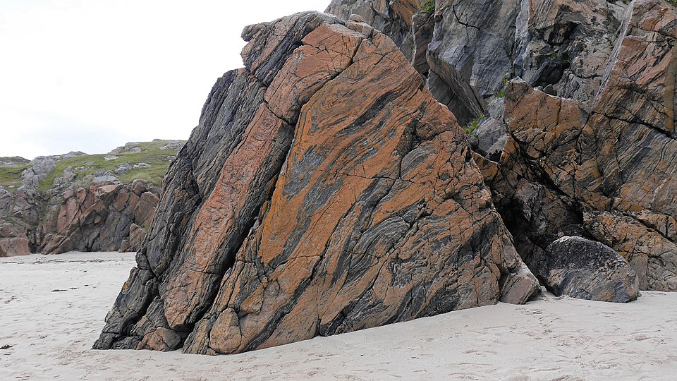
The oldest rocks in Britain are metamorphic rocks found in the far northwest of Scotland and in the Hebrides. Known as Lewisian gneisses (they take their name from the Hebridean island of Lewis), they date from at least 2700 million years ago, during the Precambrian. They are some of the oldest rocks in the world.
Originally igneous (granite) and sedimentary rocks, they were subjected to intense heat and pressure over millions of years, causing them to metamorphose.
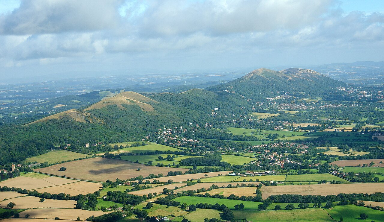
South and east of the gneisses, a mixture of rocks make up the Scottish Highlands, the Grampians and northern parts of the island of Ireland. Most are the metamorphosed remains of sedimentary rocks—sandstone, limestone and mudstone—that were deposited some time between 1000 and 670 million years ago on an ancient seabed.
In the far northwest of the Scottish mainland, Torridonian sandstones are sedimentary rocks that were formed about 1000 million years ago and later uplifted to form mountain peaks.

Palaeozoic


Around 520 million years ago, what is now the island of Great Britain was divided between two continents lying thousands of kilometres apart. Most of Scotland and the northern portion of Ireland made up part of the continent of Laurentia, and lay about 20° south of the equator. The rest of the country belonged to Gondwana and lay much farther south, near the Antarctic Circle.
Most of England and Wales lay under a shallow sea, with only a scattering of volcanic islands standing above the waves. The tips of those ancient volcanoes are still visible in parts of the English Midlands today, for example, Charnwood Forest in Leicestershire.
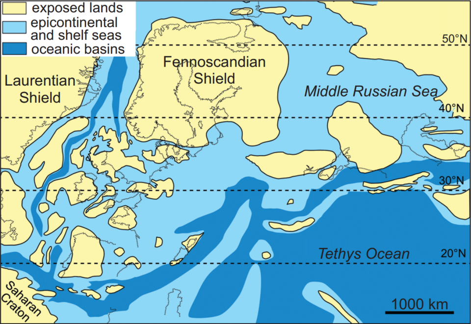
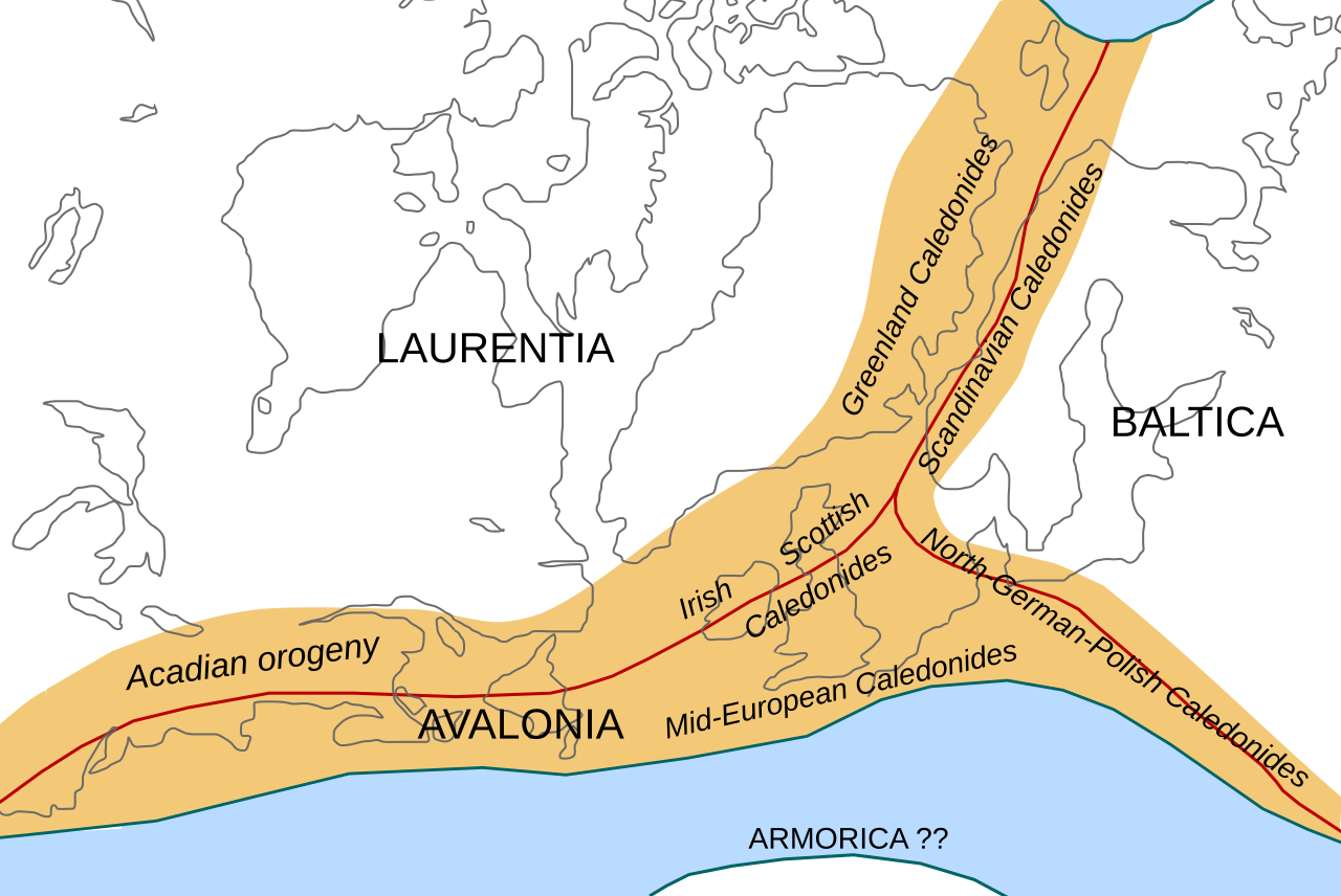
About 500 million years ago, during the late Cambrian Period, southern Britain—along with the east coast of North America and part of Newfoundland—broke away from Gondwana to form the mini-continent of Avalonia. Over the next 100 million years, through the Ordovician and Silurian periods, Avalonia drifted northwards, joining up with another mini-continent, known as Baltica. Meanwhile, erupting volcanoes formed the mountains of Snowdonia in North Wales and the Lake District in northwestern England.
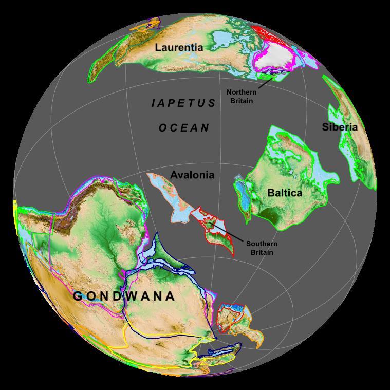

With Avalonia-Baltica drifting northwards, the ancient ocean separating it from the continent of Laurentia, known as the Iapetus Ocean, began to close up. Starting in the Ordovician and accelerating in the Silurian, sediments from the ocean floor built up on the edge of the Avalonian continent, filling the Welsh Basin and piling up to form the Southern Uplands of Scotland and upland areas of County Down and Armagh in Northern Ireland today.
Caledonian Orogeny
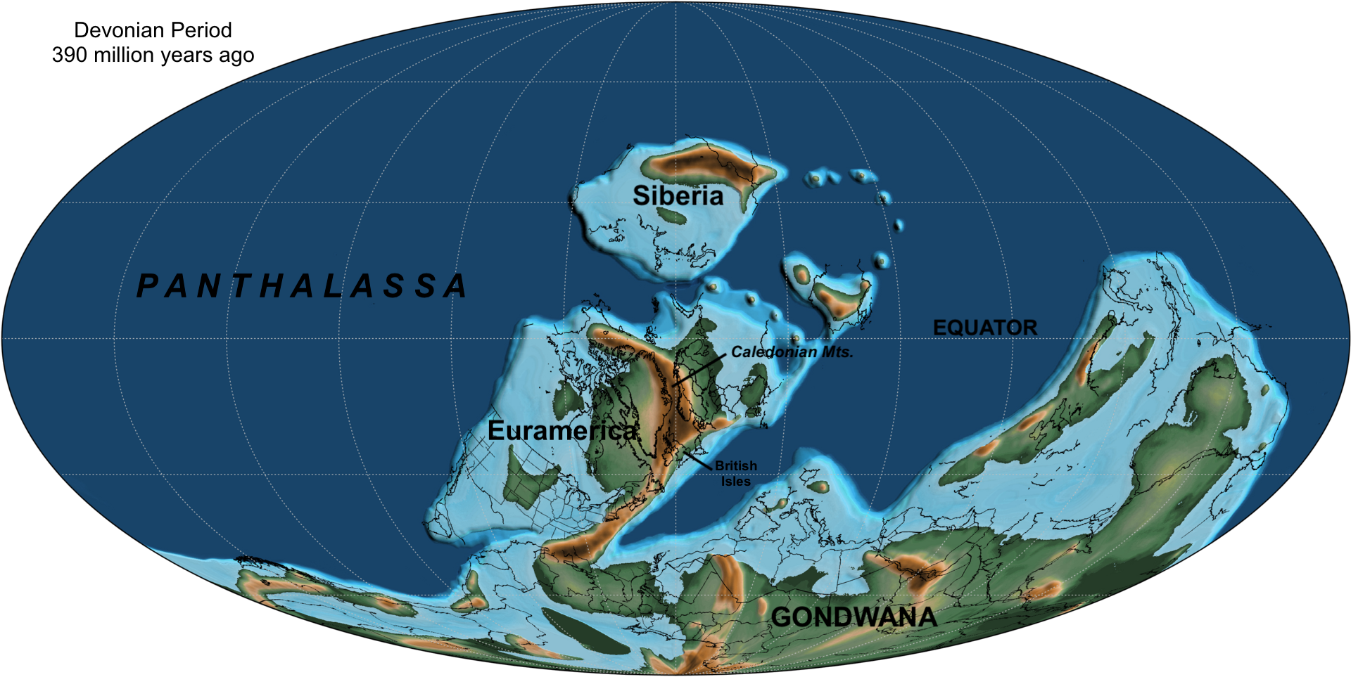
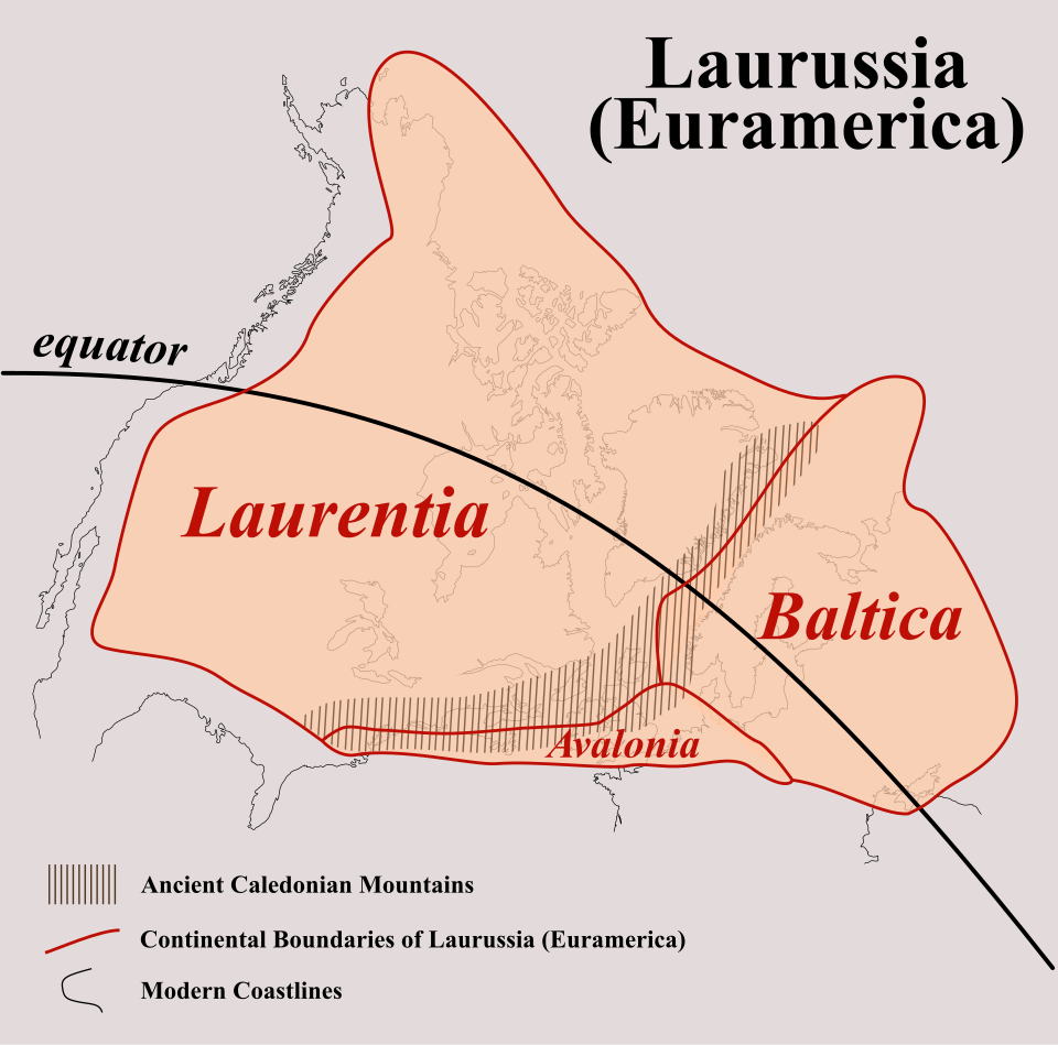
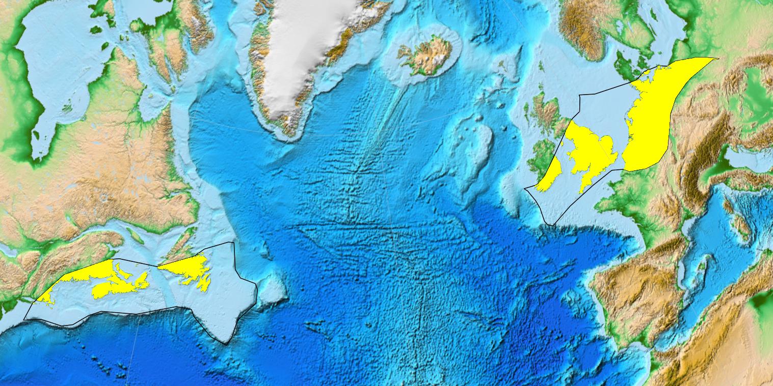
Between 420 and 400 million years ago, during the Devonian Period, the Avalonia-Baltica landmass finally collided with Laurentia. In so doing, the southern and northern halves of Great Britain became joined together. They were now part of the new continent of Euramerica (also called Laurussia).
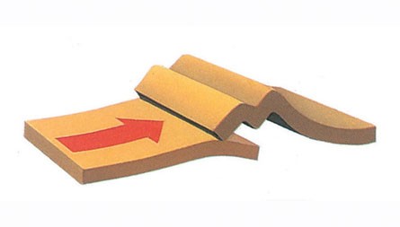
As the two tectonic plates pressed together, that part of the Earth's crust in the collision zone started to buckle. The land was pushed upwards to form mountains running down much of northern and western Britain. This event is known as the Caledonian Orogeny, named after the Latin name for Scotland, Caledonia.
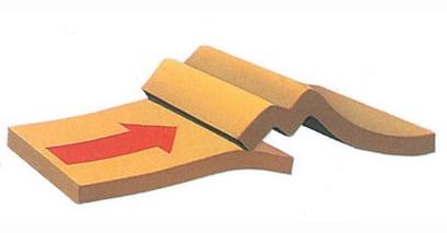
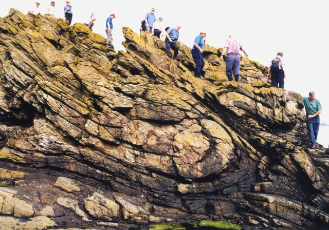
The rocks were crushed and metamorphosed, becoming those that today make up most of the Scottish Highlands and Southern Uplands.
Meanwhile, a series of major faults fractured the Earth's crust, causing the Central Lowlands to slide downwards between these two upland areas.
The melting of rocks beneath the mountains created magma that rose upwards through the crust either to form a granite batholith underground (today exposed at the surface as the Cairngorms mountains), or erupted in volcanoes.
As the uplift took place, the forces of erosion gathered pace, resulting in the deposition of vast amounts of sediments in river deltas and seas. These later turned into layers of sedimentary rock, called Old Red Sandstone. Those found in the county of Devon give the Devonian period its name, although deposits of this age are found in many other parts of the British Isles, including Cornwall, Herefordshire and the Brecon Beacons, the Central Lowlands of Scotland, the Moray Firth coast, the Orkney Islands and southwest Ireland.
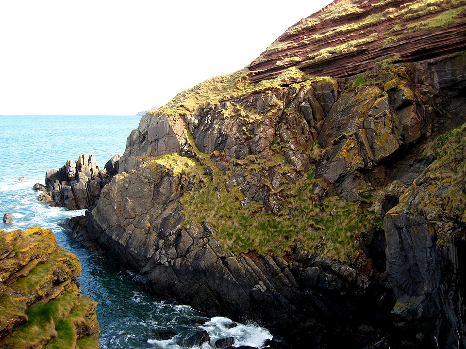
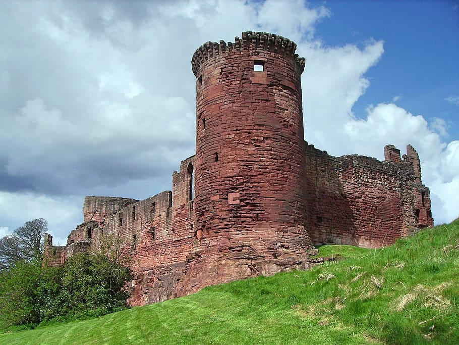
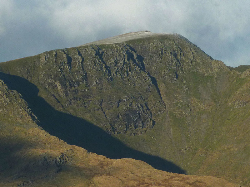
Although most of the mountains pushed up during the Caledonian Orogeny were eroded away by the end of the Devonian, evidence of them can be seen today in the Scottish Highlands, the Lake District and North Wales.
Carboniferous
Around 360 million years ago, at the beginning the Carboniferous Period, the continental landmass of which Britain was part had slowly drifted towards the equator. Much of England was submerged by warm, shallow seawater for many millions of years.
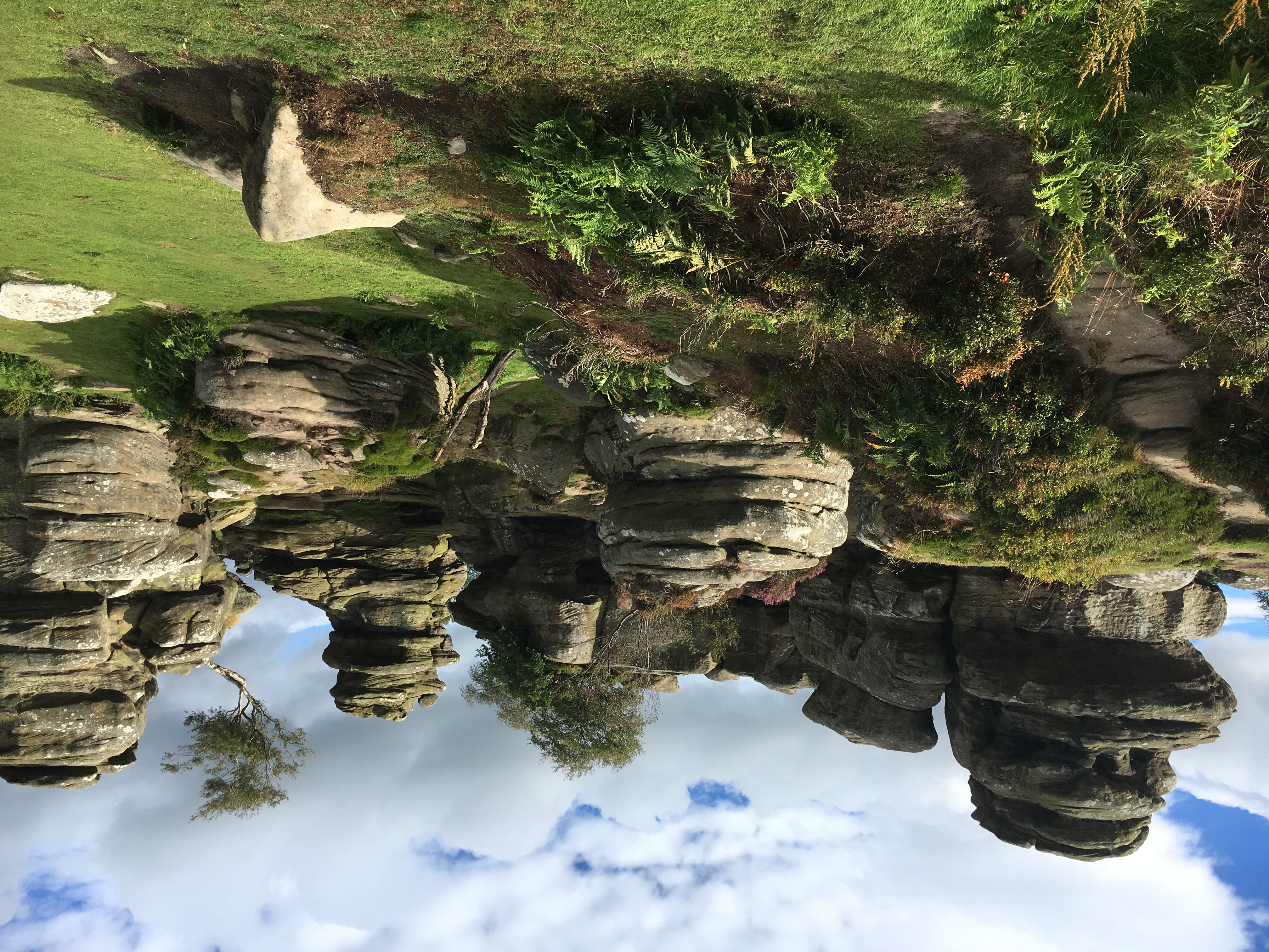
Marine sediments—remains of sea creatures such as corals, brachiopods and crinoids—that would later form Carboniferous limestone, were laid down on the seabed. Outcrops of limestone can be seen today in the Mendip Hills of Somerset, the Peak District of Derbyshire, north Lancashire and the North Pennines, the Yorkshire Dales, the Central Lowlands of Scotland and central Ireland. Later, sand and gravel was deposited on top of the limestone, forming the coarse sandstones of Millstone Grit, seen today in parts of the Pennines.
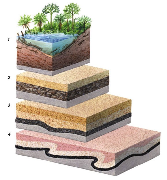
Tropical swamps and rainforest covered the lowland areas bordering the sea. It was here that Britain's coal measures were formed. They exist today as thick layers (strata) of mudstones and sandstones with coal seams between them.
When the thick vegetation died, it rotted down and gradually changed into a dark soil called peat (see below). As the centuries passed, the peat was buried under layers of sand and mud. Successive layers pressed down more and more tightly until the peat was compressed into layers of hard, black, shiny rock: coal. Folding and faulting of the rocks in later geological eras brought some coal layers close to the surface where they were, until the late 20th century, mined.
Variscan Orogeny
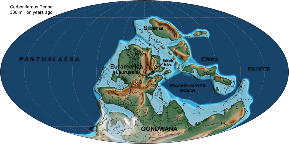
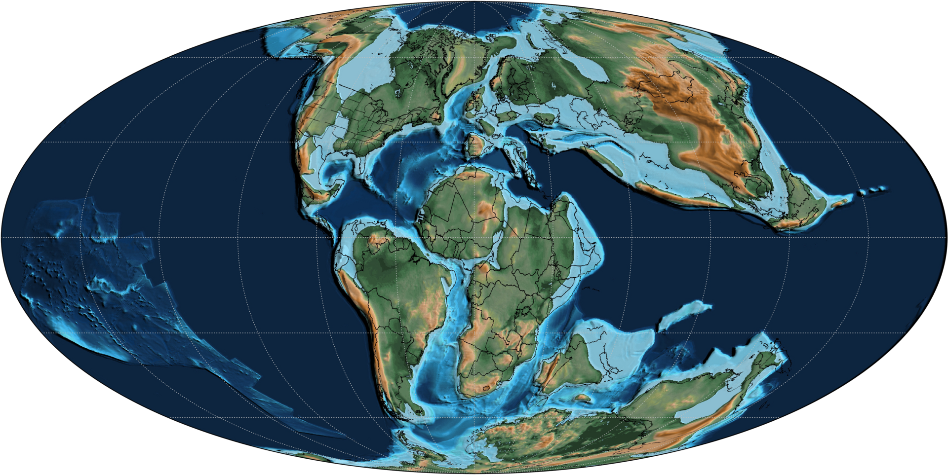
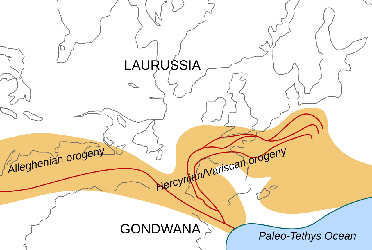
By the late Carboniferous, around 310 million years ago, the continent of Euramerica (of which Britain was part) had started to press up against Gondwana to the south. The two continents would combine to form Pangaea, the giant supercontinent that made up nearly all Earth's landmasses, surrounded by a single ocean, the Panthalassa. The collision between Euramerica and Gondwana led to a new episode of mountain-building in Britain around 290 million years ago. Known as the Variscan Orogeny, it created a belt of fold mountains that ran south of a line stretching from Pembrokeshire in Wales to Kent in southeast England.
Granite was formed from magma rising beneath the surface rocks of Devon and Cornwall. This is now exposed at Dartmoor, Bodmin Moor and the Isles of Scilly. There was also intense folding of rocks, as seen today in the cliffs of North Devon and the South Wales coal fields.

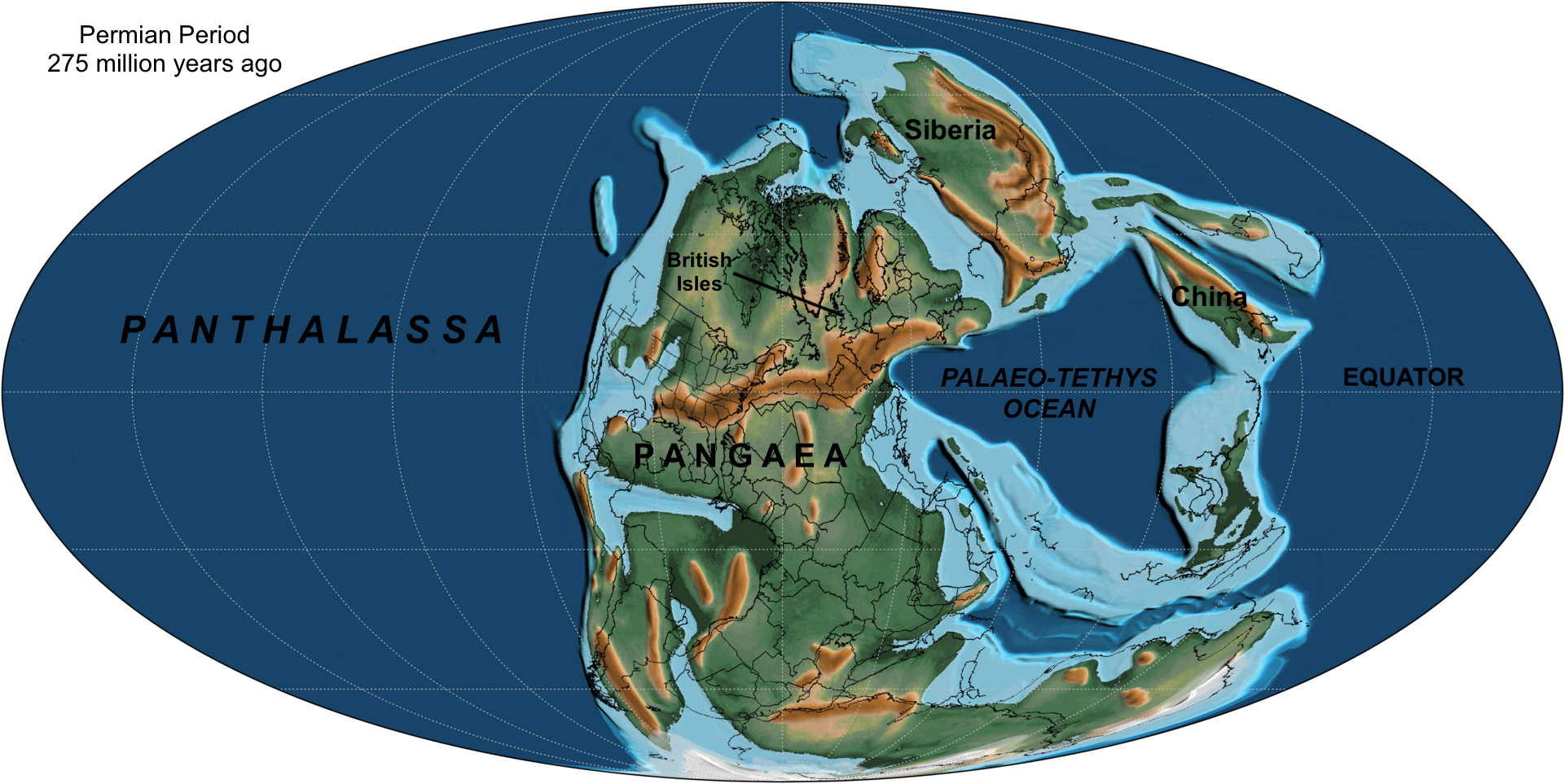
During the Permian Period (300–252 million years ago), Britain was located deep in the interior of Pangaea, where it became a hot, arid desert.
Mesozoic
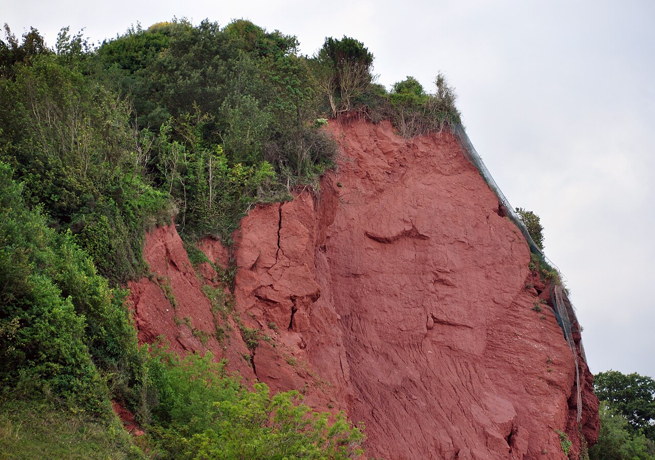
Pangaea drifted northwards during the Triassic Period (252–201 million years ago), taking Britain with it. It now lay between 20° and 30° north. The remnants of the uplands in southern England formed during the Variscan Orogeny, were eroded down through the Permian and Triassic periods, resulting in layers of sand—formed in the desert conditions—being deposited across England. This eventually turned to New Red Sandstone rock, seen in Lancashire, Cheshire, the Midlands and East Devon today.
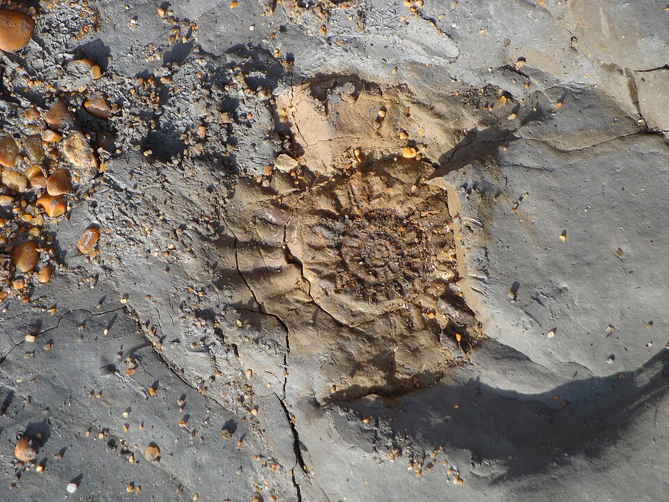
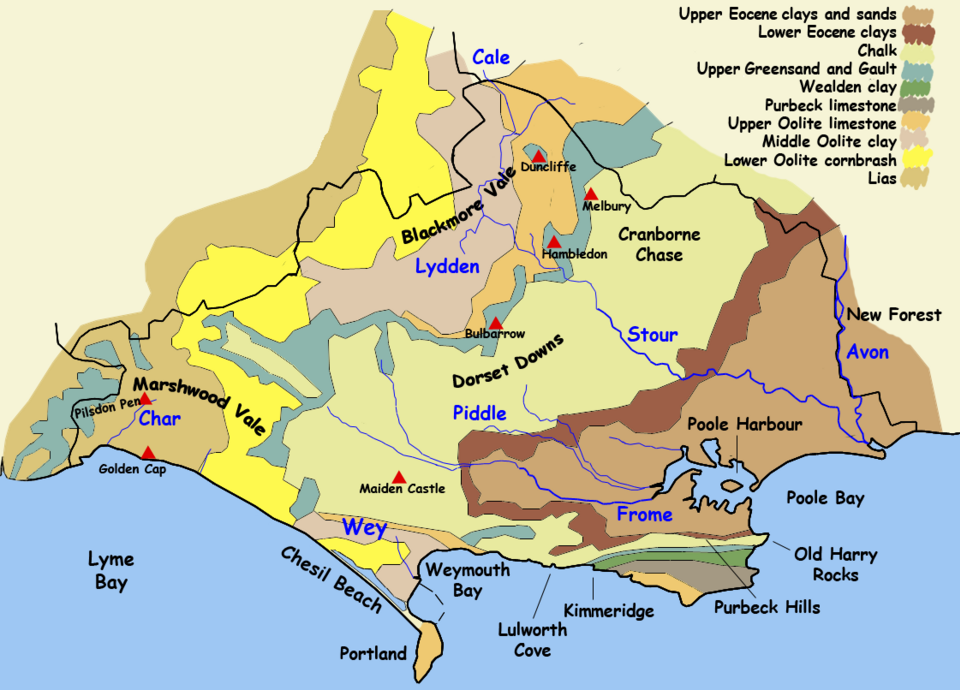
At the start of the Jurassic Period (201 million years ago), Pangaea began to break up into smaller continents once more. Sea levels rose and much of Britain once again was covered with shallow seawater. Marine sediments were deposited and the strata of sandstones, greensands and limestones that formed from them are found today across swathes of central England, from the North York Moors to the Jurassic Coast in Dorset. They include oolitic limestone of the Cotswolds. Those areas of swampland that stood just above sea level were inhabited by dinosaurs.
The burial of algae and bacteria below the mud of the seafloor during this time resulted in the formation of oil and natural gas in the North Sea.
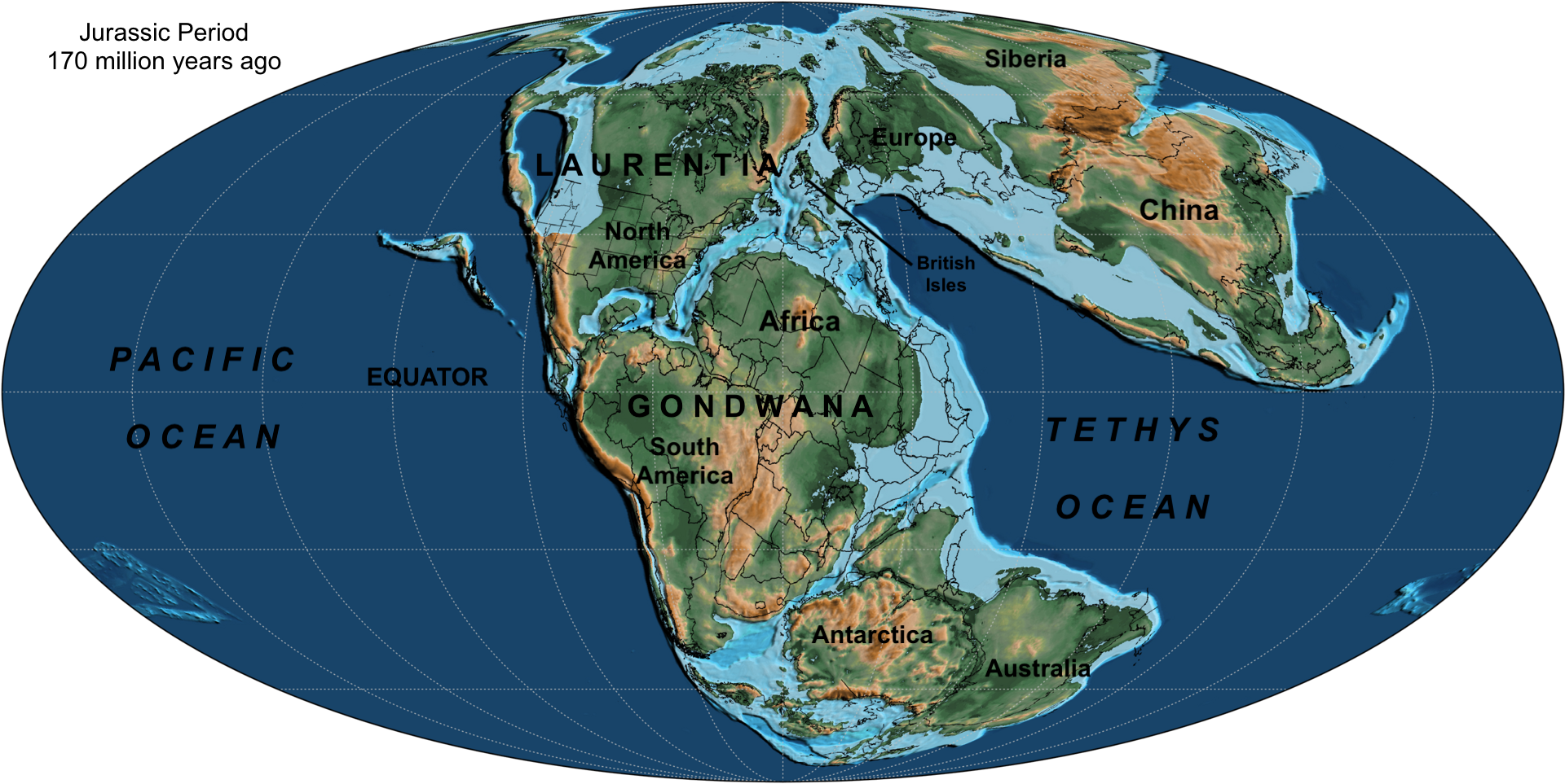
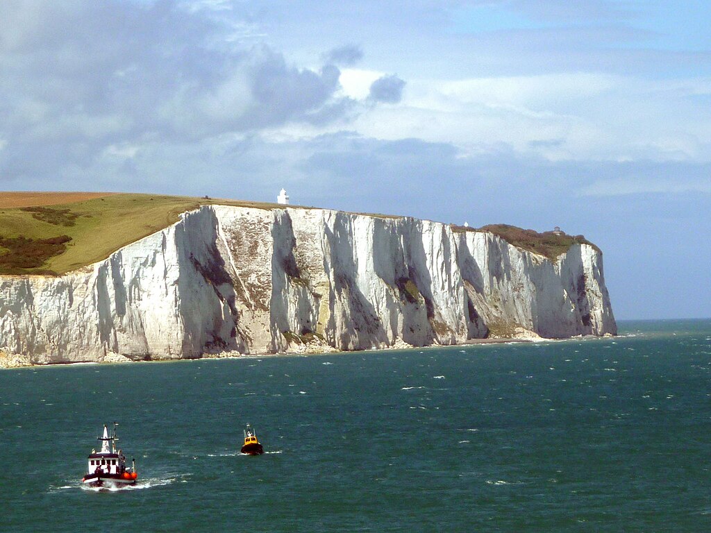
During the Cretaceous Period (143–66 million years ago), the modern continents began to take shape. The Atlantic Ocean started to open up, finally separating northern Scotland from North America. After a series of uplifts had raised Britain above sea level, seawater started to flood the land once more, leaving only small islands exposed above the waves. Around 100 million years ago, sediments from tiny marine creatures, which would later turn to chalk, were deposited over much of Britain. Today, chalk is exposed at the White Cliffs of Dover, the Seven Sisters of Sussex, Lulworth Cove, Dorset, and Flamborough Head, Yorkshire.
Cenozoic
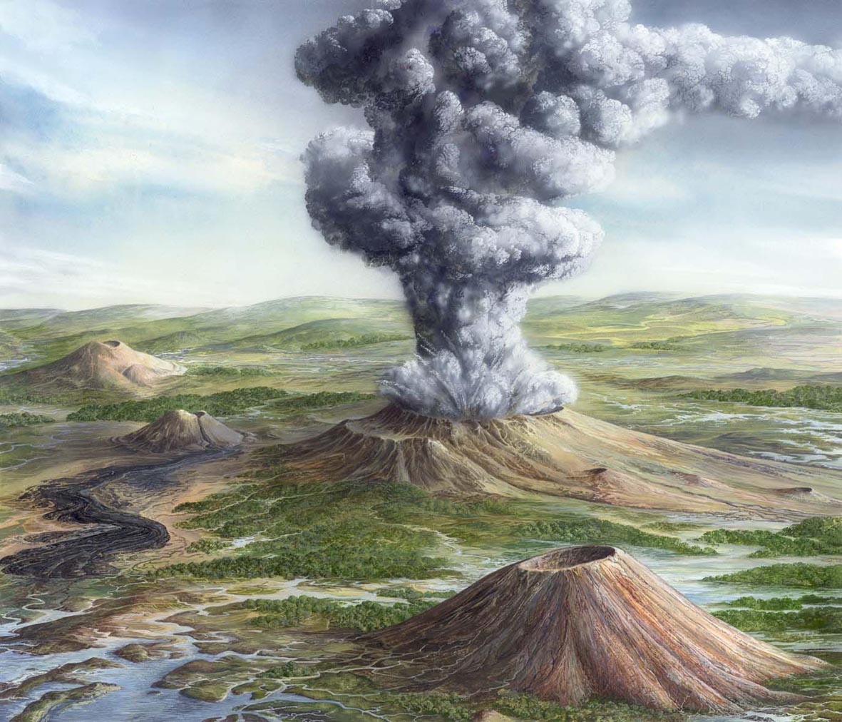
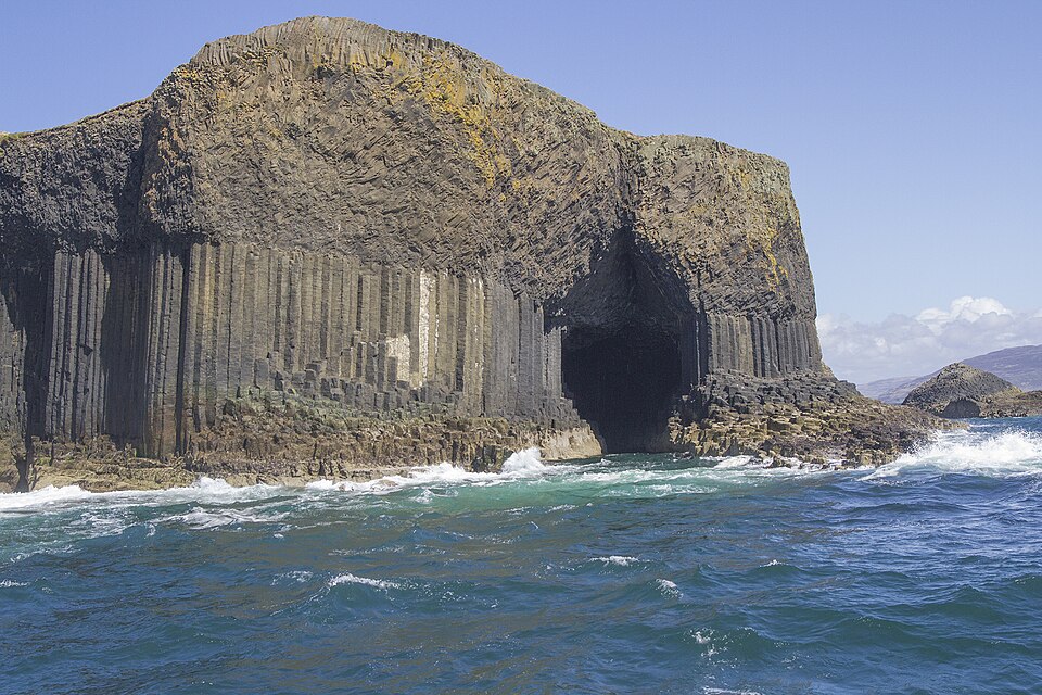
Between 63 and 52 million years ago, major volcanic eruptions at this time—the last to occur in Britain—created Lundy Island in the Bristol Channel, the igneous rocks of some Inner Hebridean islands (Skye, Mull, Staffa, Rum and Arran) and much of Northern Ireland, including the Antrim Plateau and the Giant's Causeway.
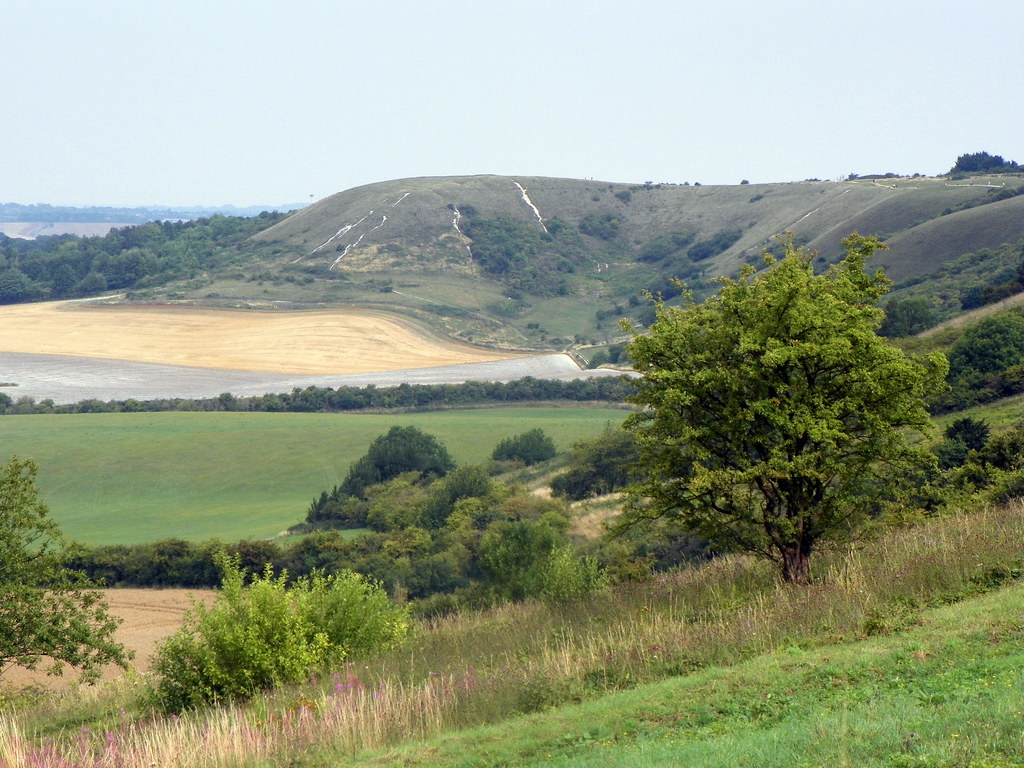
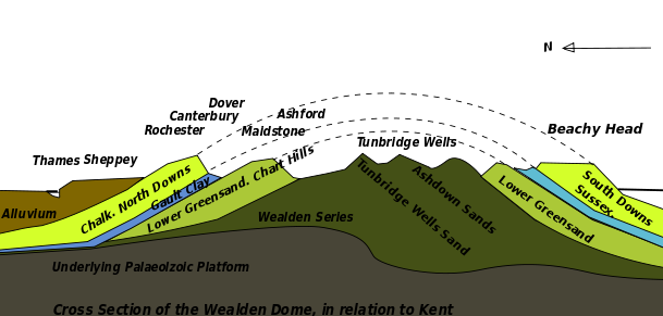
About 50 million years ago, the Alps were forced up as a result of the Eurasian, African, Arabian and Indian tectonic plates colliding. The Alpine Orogeny was also responsible for the relatively gentle folding of rock strata in southern England, producing the London Basin (a syncline or concave fold) and the Weald (an anticline or convex fold). An episode of increased river erosion followed this period of uplift, resulting in the spread of sediments across southern England, including London Clay infilling the London Basin and the New Forest.
Ice Ages
The major changes during the last 2 million years were brought about during the Pleistocene Ice Ages. The most severe glacial period was the Anglian Glaciation, which took place between about 478,000 to 424,000 years ago. Ice up to 1000 metres (3300 feet) thick reached as far south as a line running from London and Bristol.
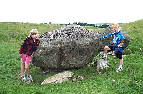
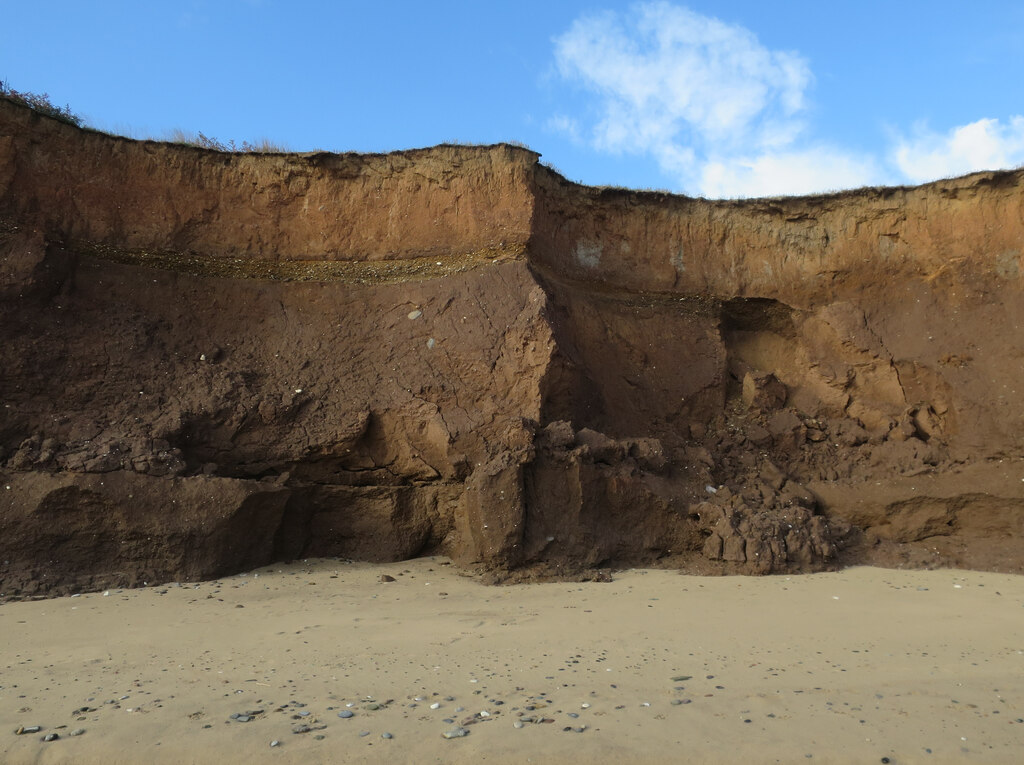
During the most recent glaciation, which probably started around 115,000 years ago and ended 10,000 years ago, glaciers established themselves on the high ground of Britain, rounding and scouring upland areas and gouging out U-shaped valleys in Scotland, the Lake District and North Wales. Many low-lying areas were covered with a layer of glacial till—sand, gravel and boulder clay. Much of this has since been eroded away, but large deposits still remain in East Anglia, East Yorkshire, County Durham, the Cheshire Plain and the Central Valley of Scotland. In East Anglia, the till has produced rich loamy soils. The material is very easily eroded, causing the coastline to be rapidly eaten away by the sea.
Holocene

The last 12,000 years of geological history are known as the Holocene Epoch. The peat deposits of moorland and coastal lowland areas of Britain were formed during this time. Many of the lowland peat deposits, such as the Somerset Levels, the Fens and Romney Marsh, have since been artificially drained for farmland.
Today, Scotland continues to rise as a result of the weight of ice during the Ice Ages being lifted. This process is called isostatic (or post-glacial) rebound. Southern and eastern England, by contrast, is sinking, at a rate estimated at 1 millimetre per year. The London area is sinking at twice that rate, partly due to the compression of the soft clay deposits that fill the London Basin.
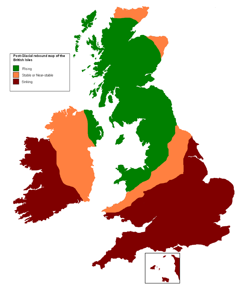
In addition, rising sea levels due to global warming are likely to make low-lying areas of Britain increasingly prone to flooding, while in some areas the coastline continues to erode at a rapid rate.
Consultant: Nicholas Harris
pics

Without in any way limiting Q-files Ltd’s exclusive rights under copyright, any use of this publication to “train” generative artificial intelligence (AI) technologies to generate text is expressly prohibited. Q-files Ltd reserves all rights to license use of this work for generative AI training and development of machine learning language models.