
Geography of India

CITE
We have made every effort to follow citation style rules, but there may be some minor differences. If in doubt, please refer to the appropriate citation style manual.
Geology of India. (2026). In Q-files Encyclopedia, Geography, Geography of India. Retrieved from
https://www.q-files.com/geography/geography-of-india/geology-of-india
"Geology of India." Geography, Geography of India, Q-files Encyclopedia, 31 Mar. 2026.
https://www.q-files.com/geography/geography-of-india/geology-of-india.
Accessed 13 Sep. 2026.
Geology of India 2026. Geography, Geography of India. Retrieved 13 September 2026, from
https://www.q-files.com/geography/geography-of-india/geology-of-india
Geography, Geography of India, s.v. "Geology of India," accessed September 13, 2026.
https://www.q-files.com/geography/geography-of-india/geology-of-india


Geology of India
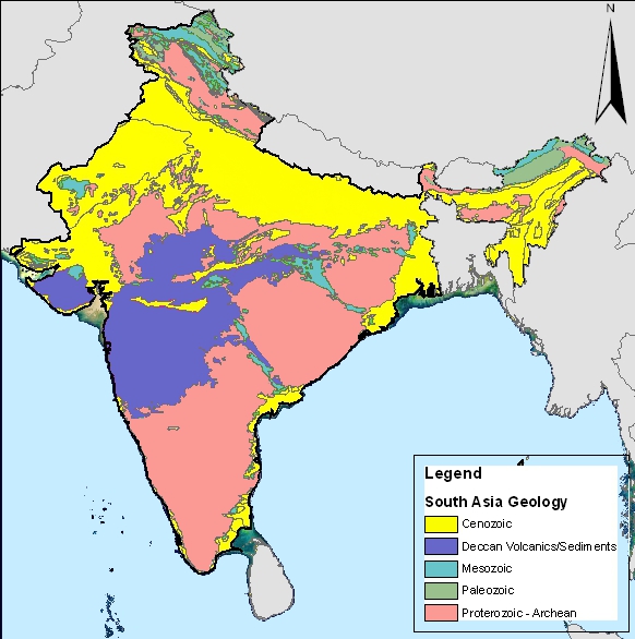
Geology is the branch of science concerned with the structure and formation of the Earth, the rocks of which it consists, and the processes by which they change over time. The mountains, plains and valleys that make up India's major geographic regions—the Peninsular Plateau, the Himalayas and the Indo-Gangetic Plain—have been shaped by a combination of geological processes, especially plate tectonics, as well as its climate.


Indian Shield
Much of India's Peninsular Plateau is made up of what is known as the Indian Shield. Its ancient rocks, gneisses and schists, date back to Precambrian times. Shields are large areas of exposed igneous and metamorphic rocks. Lying far from the edges of tectonic plates, shields are little changed by folding and faulting—although they once formed highlands and mountain ranges billions of years ago. Isolated hills (such as the droogs of Karnataka and Tamil Nadu) rounded by weathering are all that remains of these.
The Dharwar Craton, lying to the south of the Deccan Traps (see below), considered the oldest part of the Indian peninsula, is a part of the Indian Shield. It was formed between 3.6 and 2.5 billion years ago.
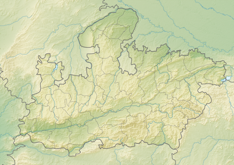
The Narmada Valley is a graben, a block of the Earth's crust that dropped down between blocks on either side due to ancient spreading of the crust. The rift valley through which the Narmada flows today is flanked by the Vindhya and the Satpura ranges. The Malda fault in Eastern India, which separates West Bengal from the Chhota Nagpur Plateau, is another relic of ancient crustal movements.
Deccan Traps
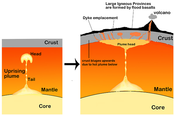
The Deccan Traps are a huge area of igneous rock, mostly basalt, in central India. The area covers almost all of Maharashtra, as well as parts of neighbouring states. The Traps were formed after a series of volcanic eruptions in the region about 66 million years ago. These probably came from a hot-spot volcano, originating in what is known as the Réunion hot spot. This mantle plume—the point beneath the Earth's crust where magma from the mantle wells up to the surface—now lies under Réunion Island in the Indian Ocean. But 66 million years ago it lay beneath India as the Indian tectonic plate drifted northwards away from the African Plate (see below).
The series of eruptions that formed the Deccan Traps (the geological term "trap" comes from the Swedish word for stairs, trappa, referring to the step-like hills typical of the region) may have lasted for 30,000 years. The original area covered by the lava flows was approximately half the size of modern India's entire land area. It has since been reduced to a third of its original size by a combination of erosion and plate tectonics.
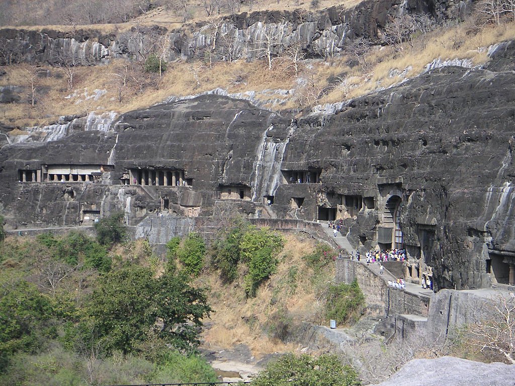
Plate tectonics

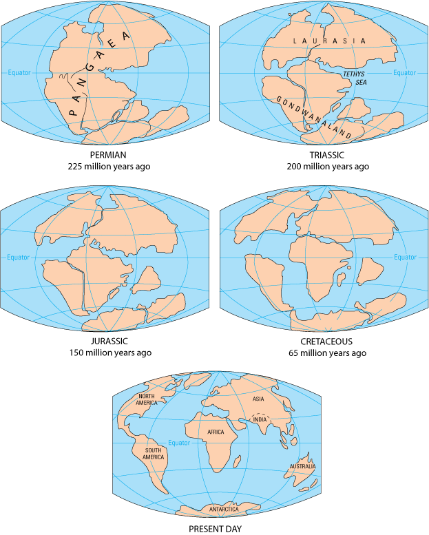
India's geographic position today, and the formation of the Himalayas, are both the result of plate tectonics. This is the continuous movement of vast slabs of crustal rock, called tectonic plates, over an underlying molten layer. The tectonic plates carry the world's great land masses, the continents, along with large parts of the ocean floor, around the globe. About 280 million years ago, all the world's continents, including the Indian subcontinent, came together to form a single “supercontinent” called Pangaea.
During the Jurassic Period (201–145 million years ago), the continents began to drift apart. Pangaea separated into two: Laurasia (made up of North Americas, Europe and Asia) and Gondwana (made up of Antarctica, South America, Africa, Australia, the Arabian Peninsula and India).
India moves north
This drift continued through the Cretaceous Period (145–66 million years ago). By about 100 million years ago, the Indian plate (on which the Indian subcontinent lies) had broken away from Gondwana. It was now a large island situated off the Australian coast and separated from Asia by the Tethys Sea. India began to drift northwards towards Asia. About 80 million years ago, India still lay 6400 kilometres (4000 miles) south of the Asian continent, but now accelerated towards it at a rate of up to 16 centimetres (6 inches) per year.
The Indian plate collided with the Eurasian plate (on which Asia lies) between 55 and 35 million years ago—geologists are not sure exactly when. But, instead of one plate being forced to slide beneath the other, as happened in other parts of the world, both Indian and Eurasian plates crunched together along where the border between India and Nepal now lies. They buckled up, forming the great mountain range we know today as the Himalayas. The Tibetan Plateau, to the north, was forced upwards by the same process.


The Himalayas are still rising by more than a centimetre (roughly half an inch) a year as the India plate continues to push northwards. This causes earthquakes in the region today—such as, for example, the catastrophic quakes that devastated Bihar state in 1934, Gujarat in 2001 and Nepal in April 2015. The forces of weathering and erosion are, however, lowering the Himalaya mountains at about the same rate.
Indo-Gangetic Plain
After its collision with the Eurasian Plate, the Indian Plate was forced downwards just south of the newly formed Himalayan range. This caused the crust in this zone to subside (sink), forming what we know today as the Indo-Gangetic Plain. Rapid erosion of the Himalayas created vast amounts of sediment, carried by fast-flowing mountain streams to fill the subsidence zone and cause it to sink even more. This river-borne sediment, called alluvium, is made up of sand, silt and gravel.


Alluvium continues to accumulate on the Plain to this day. The older alluvium is called Bhangar and forms the slightly higher ground above the flood level of the rivers. Khadar, or newer alluvium, lies in the river channels and flood plains, and produces exceptionally fertile soils. New alluvium is laid down by the flooding of rivers every year.
Consultant: Nicholas Harris
pics
Without in any way limiting Q-files Ltd’s exclusive rights under copyright, any use of this publication to “train” generative artificial intelligence (AI) technologies to generate text is expressly prohibited. Q-files Ltd reserves all rights to license use of this work for generative AI training and development of machine learning language models.