
Geography of India

CITE
We have made every effort to follow citation style rules, but there may be some minor differences. If in doubt, please refer to the appropriate citation style manual.
Indo-Gangetic Plain. (2026). In Q-files Encyclopedia, Geography, Geography of India. Retrieved from
https://www.q-files.com/geography/geography-of-india/indo-gangetic-plain
"Indo-Gangetic Plain." Geography, Geography of India, Q-files Encyclopedia, 31 Mar. 2026.
https://www.q-files.com/geography/geography-of-india/indo-gangetic-plain.
Accessed 13 Sep. 2026.
Indo-Gangetic Plain 2026. Geography, Geography of India. Retrieved 13 September 2026, from
https://www.q-files.com/geography/geography-of-india/indo-gangetic-plain
Geography, Geography of India, s.v. "Indo-Gangetic Plain," accessed September 13, 2026.
https://www.q-files.com/geography/geography-of-india/indo-gangetic-plain


Indo-Gangetic Plain
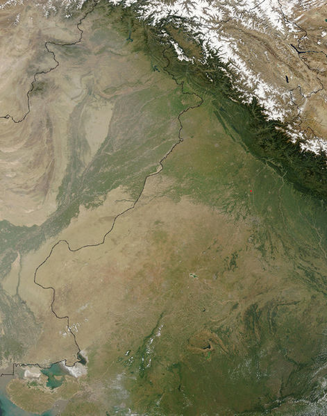
The Indo-Gangetic Plain is a vast, level expanse of alluvium—silt, sand or gravel—laid down by the Himalayan rivers. These are the Indus, Ganges and Brahmaputra, together with their many tributaries. Encompassing an area of 700,000 square kilometres (270,000 square miles), the Indo-Gangetic Plain lies to the south of, and roughly parallel to, the Himalayas, stretching from Punjab in the west to Assam in the east. It is one of the most intensely farmed and densely populated regions in the world.
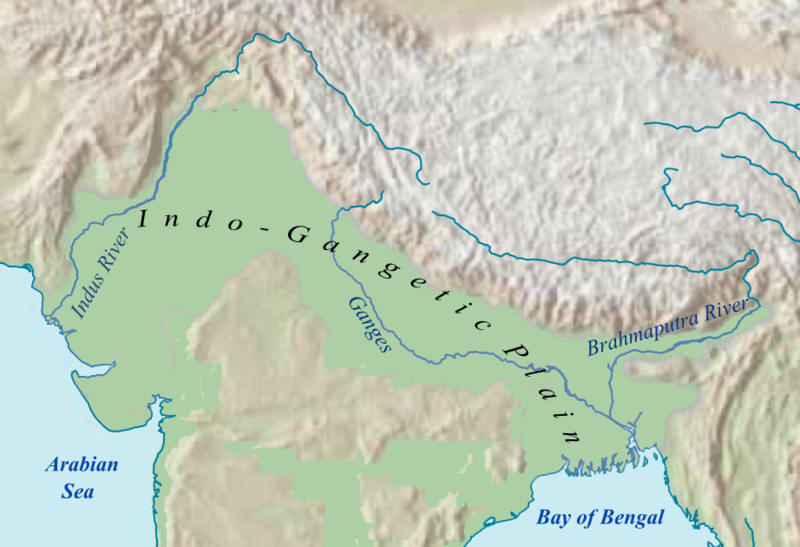

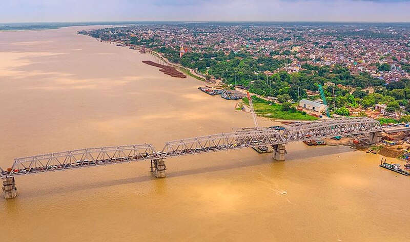
Indus, Ganges and Brahmaputra
Making up the western portion of the Indo-Gangetic Plain is the Indus Plain, formed by the Indus and its tributaries, (mostly lying in Pakistan, but also Punjab and parts of Haryana). The Ganges Plain forms the central and largest part of the Plain, in Delhi, Uttar Pradesh and Bihar. The Bhramaputra Plain lies mainly in Assam, northeastern India.

The Ganges and Brahmaputra rivers merge at the eastern edge of the Plain and form a vast delta. Their combined waters flow into the Bay of Bengal through many channels. Mainly in Bangladesh, the delta also occupies a part of West Bengal.
Bhabar and Terai
The foothills of the Himalayas, the Sivaliks, meet the Indo-Gangetic Plain in a narrow, gently-sloping strip of forested land known as the Bhabar. Varying between 6 and 15 kilometres (4–10 miles) wide, it runs the length of the foothills. The Bhabar is where pebbles and alliuvium that been carried down by mountain streams accumulate. The streams flow underground through this highly porous zone, re-emerging a few kilometres to the south in the Terai belt. The Terai is a region of grassland, scrubland, forest and swamp.

Khadar and Bhangar
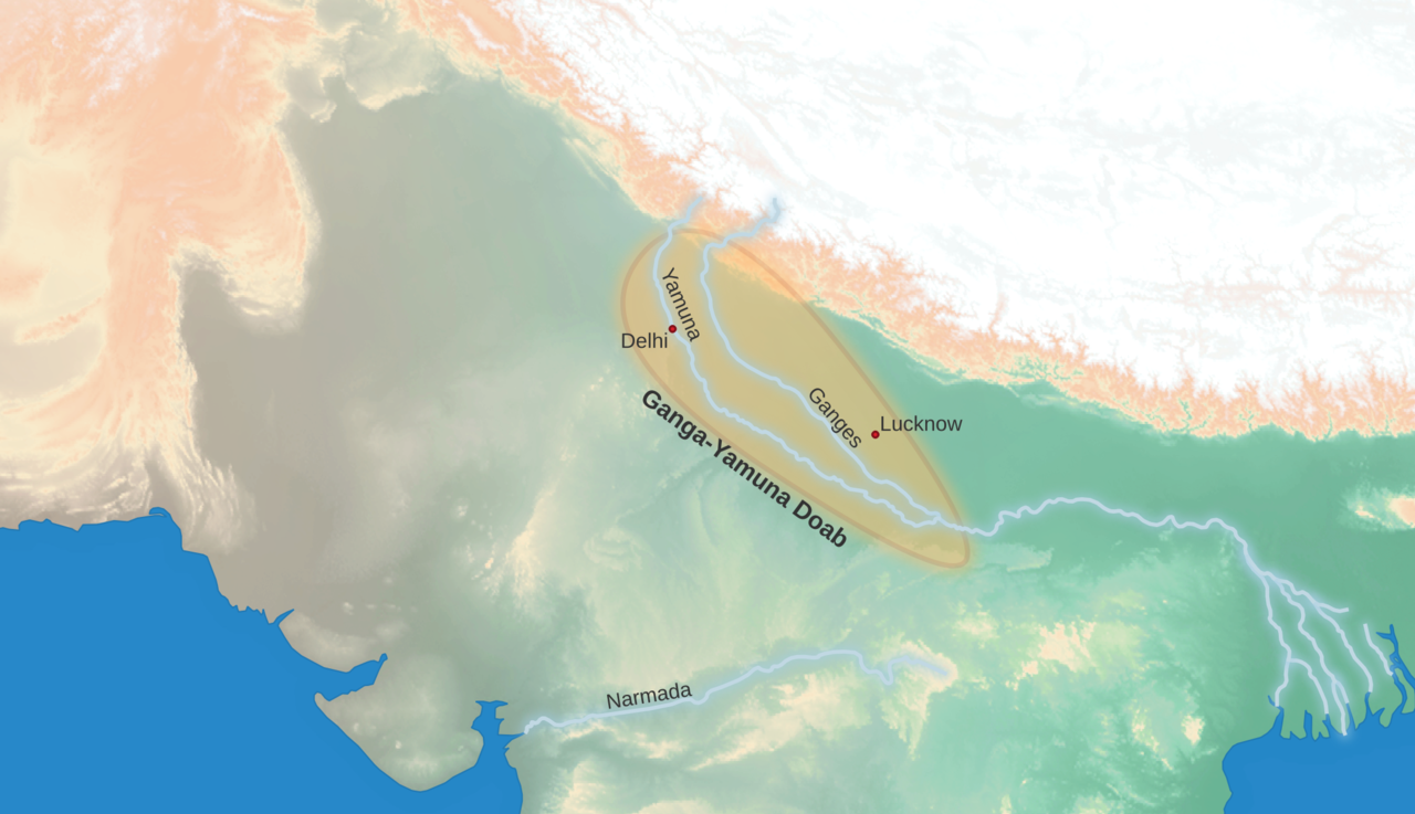
The many tributaries of the Indus and Ganges divide the Indo-Gangetic Plain into doabs. These are long "tongues" of land that extend to where the tributaries meet. The areas lying closest to the river courses in each doab are known as the Khadar. Prone to flooding, they regularly receive fresh alluvium deposited by the rivers overflowing their banks. The soil becomes replenished with new silt each flooding cycle, and is very fertile as a result.

Lying just a little bit higher the Khadar floodplains—and so less prone to flooding—are the alluvial terraces of the Bhangar. Soils in these areas consist of older alluvium containing more sand and so are less fertile than those of the Khadar.
Rich farmland
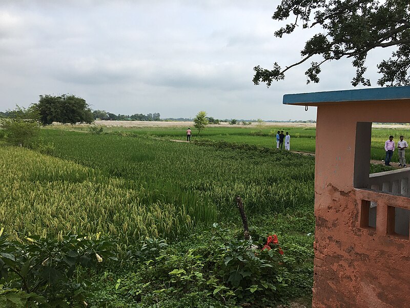
Flat, mostly treeless and covered with fertile silt, the plains are intensely cultivated. Canals criss-cross the plain, bringing irrigation water to the fields. The main crops grown are rice and wheat, grown in rotation. Other crops include maize, sugar cane and cotton. The plain has many towns and cities, but rural areas are still densely populated.
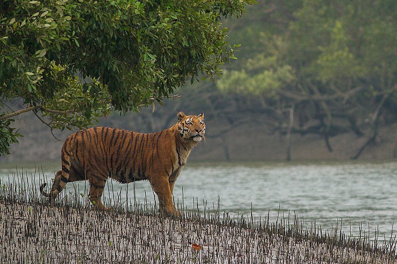
Sundarbans
The Sundarbans are a mangrove forest in the lower reaches of the Ganges Delta. Spreading from West Bengal eastwards across Bangladesh, the trees grow amid a dense network of tidal waterways, mudflats and small islands. The region is known for its wildlife, including a huge variety of bird species, spotted deer, crocodiles and snakes. Its most famous inhabitant is the rare Bengal tiger.
Thar Desert
The Thar Desert occupies a large part of the Indo-Gangetic Plain in western India. It covers more than 60% of Rajasthan, as well as parts of Gujarat, Haryana and Punjab. The desert extends westwards as far as the Indus Valley in Pakistan. In India it is bounded by the Aravalli Range to the east and the Rann of Kutch to the south.
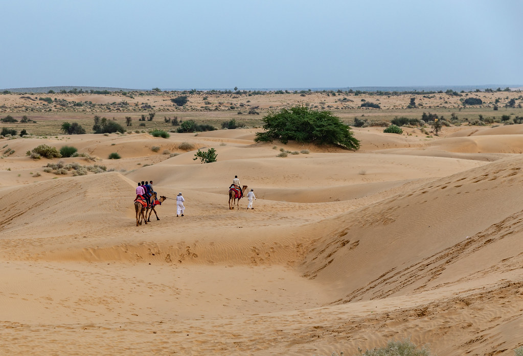
Sandy terrain makes up more than 80% of the Thar's area, a large part of which consists of sand dunes. High winds erode the soil and cause the dunes to shift around. The Marusthali region in the west of the desert is drier than the semi-arid east. Patches of scrub forest are found across the Thar, more so in the less arid eastern regions. The desert also contains a number of salt lakes, fed by intermittent streams (those which have flowing water only after rains).
The only river in the Thar is the Luni. The 650-kilometre (400-mile) Indira Gandhi Canal brings fresh water to the Thar Desert, enabling cultivation and livestock-raising in some parts. Elsewhere, the only sources of water for animals or humans are small ponds, some natural, called tobas, some human-made, known as johads.

Rann of Kutch
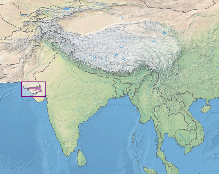
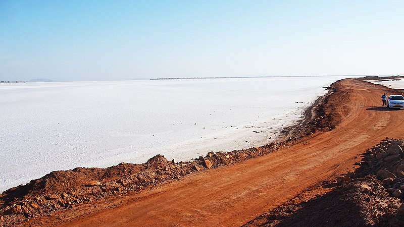
The Rann of Kutch is a flat region of salt marshes in northwestern Gujarat, extending into Pakistan, and merging with the Thar Desert (rann means “desert” in Hindi). It is divided into the Great Rann in the north and Little Rann in the southeast. Once a saltwater lagoon on the edge of the Arabian Sea, the Rann has gradually filled with silt, turning it into an expanse of dry grassland, scrub and salt marsh.
During the monsoon, the Rann mudflats flood to a depth of around 50 centimetres (20 inches) with salt water. The seasonal wetlands provide a habitat for many water birds, including the lesser flamingo. Other animals, such the Indian wild ass, shelter on islands of higher ground, called bets, during the flooding. After the rains have gone, a layer of white, salty clay is left behind.

Consultant: Nicholas Harris
pics
Without in any way limiting Q-files Ltd’s exclusive rights under copyright, any use of this publication to “train” generative artificial intelligence (AI) technologies to generate text is expressly prohibited. Q-files Ltd reserves all rights to license use of this work for generative AI training and development of machine learning language models.