
States and territories of India

CITE
We have made every effort to follow citation style rules, but there may be some minor differences. If in doubt, please refer to the appropriate citation style manual.
Bihar. (2026). In Q-files Encyclopedia, Geography, States and territories of India. Retrieved from
https://www.q-files.com/geography/states-and-territories-of-india/bihar
"Bihar." Geography, States and territories of India, Q-files Encyclopedia, 31 Mar. 2026.
https://www.q-files.com/geography/states-and-territories-of-india/bihar.
Accessed 13 Sep. 2026.
Bihar 2026. Geography, States and territories of India. Retrieved 13 September 2026, from
https://www.q-files.com/geography/states-and-territories-of-india/bihar
Geography, States and territories of India, s.v. "Bihar," accessed September 13, 2026.
https://www.q-files.com/geography/states-and-territories-of-india/bihar


Bihar
Bihar is a state in northern India. It became a state upon India's independence in 1947. In 2000, the southern part of Bihar became the separate state of Jharkhand. Since the late 1970s, Bihar has fallen behind other Indian states in social and economic development. Today, although poverty is still widespread and the state has the lowest GDP per person of all Indian states, Bihar's economy has become one of the fastest-growing in the country.


Geography
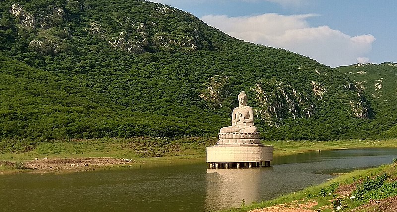
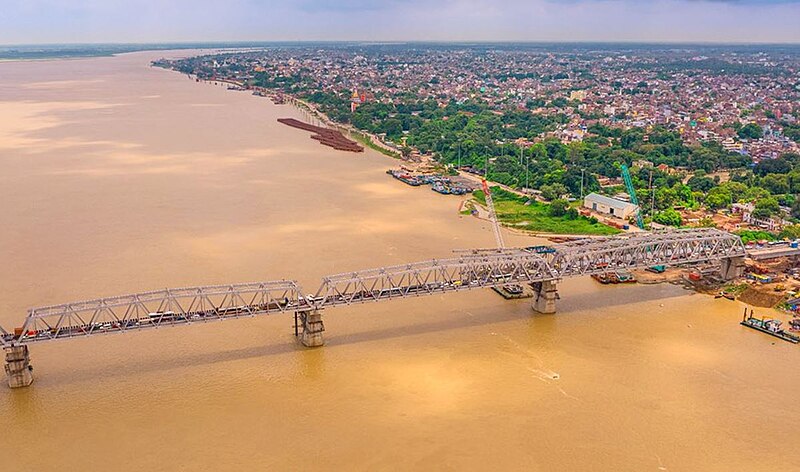
Most of Bihar lies on the Ganges Plain, part of the Indo-Gangetic Plain, over which the River Ganges and its many tributaries (including the Gandak, Kosi and Bagmati) flow—and frequently flood. Fertile and with a hot and humid climate, the plain is intensively farmed, with rice, wheat and sugar cane as the main crops. Most of Bihar's population lives in the central region. To the north, along the border with Nepal, are the foothills of the Himalayas. The forested hills of the Chhota Nagpur Plateau rise in the southern part of Bihar. This part of the state has coal, iron ore and bauxite deposits.
Climate
Bihar has a humid subtropical climate, with hot summers and cool winters. Summer in Bihar lasts from March to June, when temperatures range between 30 and 40°C (86–104°F). The monsoon season, which occurs between July to September, brings heavy rainfall. The arrival of the monsoon is often accompanied by violent thunderstorms. Temperatures fall to between 15 and 20°C (59–68°F) in winter, which lasts from December to February.


Economy
About 80% of the state's population is employed in agriculture. Rice, wheat and sugar cane are the main crops grown in the fertile soils of the Indo-Gangetic Plain, although cultivation can be disrupted by flooding and soil erosion. Bihar is also a significant producer of fruits and vegetables, including lychees, guavas, mangos, pineapples, brinjals, lady's fingers, cauliflowers and cabbages.
Begusarai is Bihar's industrial and financial capital; Hajipur and Munger are also major industrial cities.

History
Founded in 684 BCE, the Kingdom of Magadha was ruled by the Haryanka dynasty, from the city of Rajgriha (modern Rajgir). Expanded under later dynasties, in 325 BCE the kingdom became the Mauryan Empire, India's first empire. The great Mauryan emperor, Ashoka, was born in the capital Pataliputra (present-day Patna). During this time, the religion of Buddhism arose.
The Gupta Empire, which was founded in Magadha in 240 CE, is often regarded as the Golden Age of India in science and philiosophy.


After the region came under the Muslim rule of the Delhi Sultanate in the 13th century, Buddhism in Magadha went into decline. In the early 16th century, Babur defeated the last Sultan of Delhi, Lodi, and established the Mughal Empire. Apart from a brief period under the rule of the Afghan Sur dynasty (1529–56), founded by Sher Shah from his capital at Sasaram, Bihar remained under Mughal control until the mid-18th century. It was then that the British East India Company began to expand their territorial control in Bengal and beyond.

Following their defeat by the British at the Battle of Buxar in 1764, the Mughals (and zamindars, or feudal lords) were forced to sign a treaty granting the East India Company diwani rights, which allowed the British to collect tax revenue from the territories of Bengal, Bihar and Orissa. After the Rebellion of 1857, areas under the control of the Company were transferred to the direct rule of the British crown.
Bihar remained a part the Bengal Presidency of the British Raj until 1912, when Bihar was joined with Orissa to become a separate province with Patna as its capital. The province was partitioned in 1936 into Bihar and Orissa provinces.


Consultant: Nicholas Harris
Facts about Bihar
Area 98,940 sq km (38,200 sq miles) Rank: 12th
Highest point Someshwar Fort 880 m (2890 ft)
Population 130,725,310 Rank: 2nd
Capital and largest city Patna (pop. 1,684,222)
Other large cities Gaya (pop. 474,093), Bhagalpur (400,146), Muzaffarpur (354,462), Bihar Sharif (337,819)
Main languages Hindi (26%), Bhojpuri (25%), Maithili (13%), Magahi (11%), Urdu (8%)
Main religions Hinduism (82%), Islam (18%)
State bird House sparrow
State flower Marigold
State mammal Gaur
State tree Peepal


pics


Without in any way limiting Q-files Ltd’s exclusive rights under copyright, any use of this publication to “train” generative artificial intelligence (AI) technologies to generate text is expressly prohibited. Q-files Ltd reserves all rights to license use of this work for generative AI training and development of machine learning language models.