
States and territories of India

CITE
We have made every effort to follow citation style rules, but there may be some minor differences. If in doubt, please refer to the appropriate citation style manual.
Himachal Pradesh. (2026). In Q-files Encyclopedia, Geography, States and territories of India. Retrieved from
https://www.q-files.com/geography/states-and-territories-of-india/himachal-pradesh
"Himachal Pradesh." Geography, States and territories of India, Q-files Encyclopedia, 9 Jun. 2026.
https://www.q-files.com/geography/states-and-territories-of-india/himachal-pradesh.
Accessed 21 Oct. 2026.
Himachal Pradesh 2026. Geography, States and territories of India. Retrieved 21 October 2026, from
https://www.q-files.com/geography/states-and-territories-of-india/himachal-pradesh
Geography, States and territories of India, s.v. "Himachal Pradesh," accessed October 21, 2026.
https://www.q-files.com/geography/states-and-territories-of-india/himachal-pradesh


Himachal Pradesh
Situated in the western Himalayas, Himachal Pradesh is the northernmost state of India. (Jammu and Kashmir and Ladakh, which border it to the north, are both union territories.) In 1948, following India's independence, the 30 small princely states in the region were merged together to form what was called the Chief Commissioner's Province of Himachal Pradesh. Bilaspur was added in 1954 and Himachal Pradesh became a union territory in November 1956. Ten years later, some upland districts of Punjab state were merged with Himachal Pradesh. It became a state in 1971.


Geography
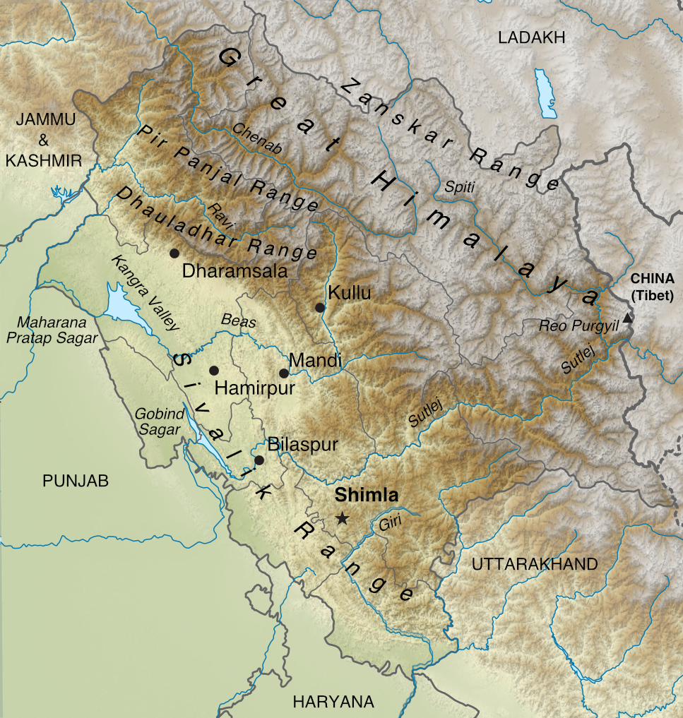
The Himalayas in Himachal Pradesh can be divided into four branches, all running across the state from northwest to southeast. The Outer Himalayas, or Sivalik Hills, are foothills (600 metres or 2000 feet above sea level on average) in the southwest, running parallel to the borders with Punjab and Haryana. To their northeast are the Dhauladhar and the Pir Panjal ranges of the Lesser (or Middle) Himalayas. Their peaks are between 3500 and 6200 metres (11,500–20,000 feet) high.
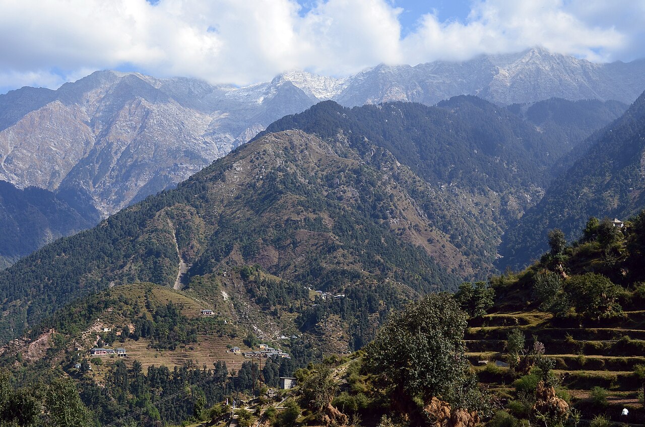
The Great Himalayas, the third branch, lie to the northeast of the Pir Panjal. They rise on the eastern side of the Chenab valley in the north and are cut through by the Sutlej valley near the border with Tibet. Straddling the Tibetan border in the north is the fourth branch of the Himalaya mountains: the Zanskar Range, which reaches altitudes of more than 6800 metres (22,300 feet). Both the Zanskar and the Great Himalaya mountain ranges, permanently capped by snow, contain a number of glaciers.
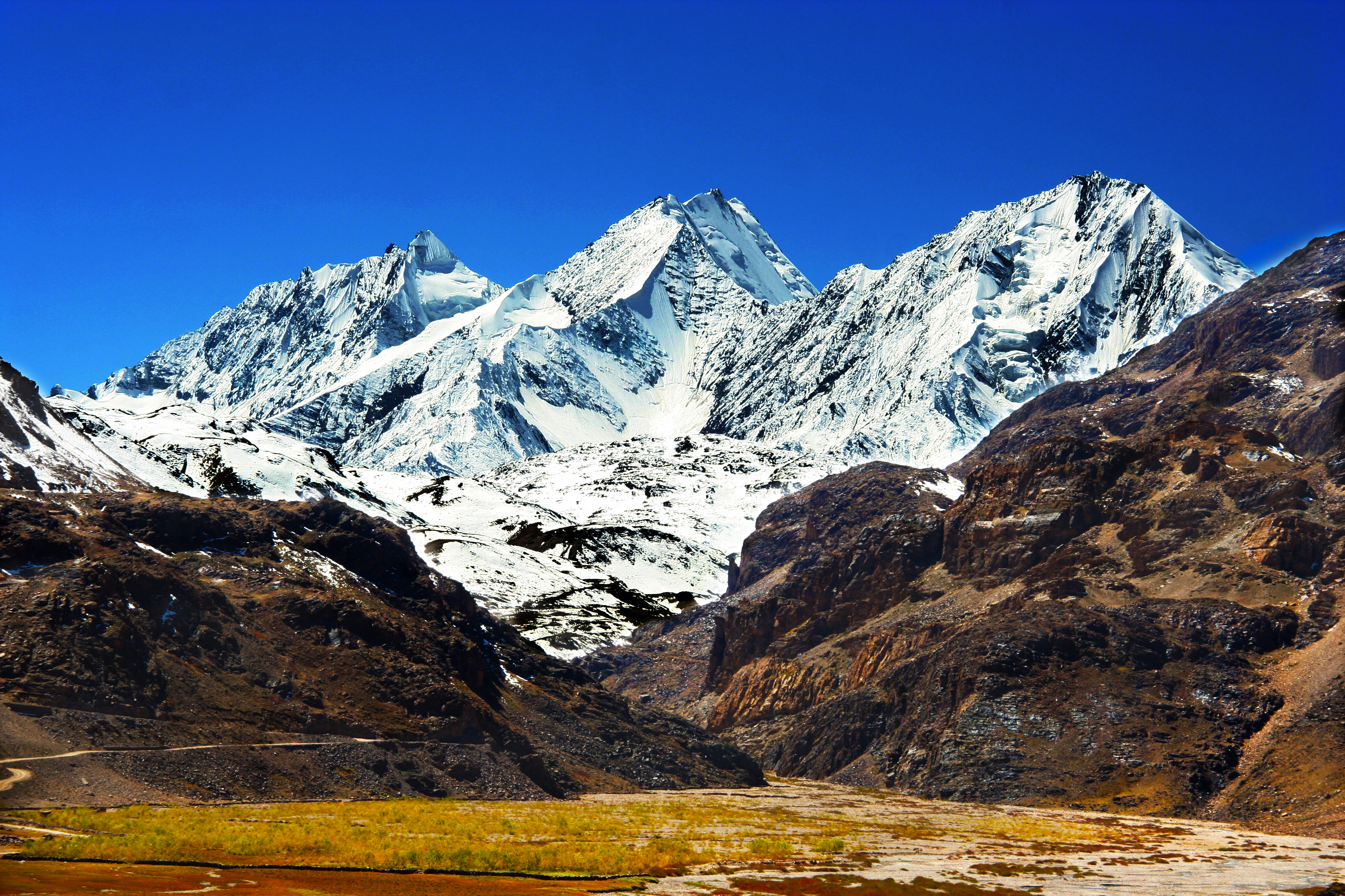
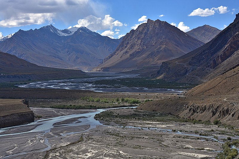
Himalayan rivers criss-cross the state, feeding both the Indus and Ganges basins. Four of the five Punjab rivers, the Chenab, Ravi, Beas and Sutlej, flow through Himachal's maze of valleys. The River Giri in the south of the state flows into the Yamuna, the main tributary of the Ganges.
Climate
Himachal's climate varies from humid subtropical in southwestern parts to montane at high elevations in the northern and eastern ranges. Dharamsala in Kangra district, which borders Punjab, receives heavy monsoon rains, while mountainous areas of the northeast see very little precipitation.
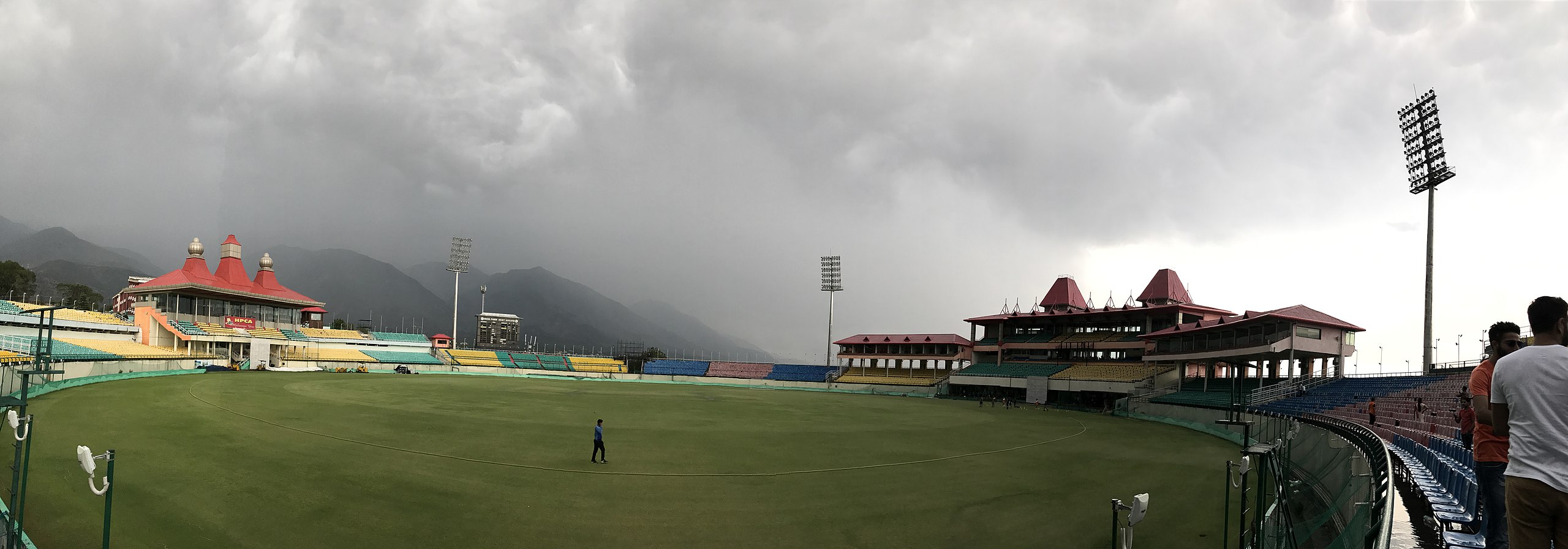

Summer lasts from March until the end of June with the average temperature ranging from 22°C (72°F) in mountain valleys to highs of 37°C (99°F) in the humid southwest. Rains brought by the southwest monsoon blow in between July and September. Winter lasts from October until mid-March. Temperatures in the winter months vary between 0°C and 15°C (32–59°F) in the southwest. In the Great Himalayas, winters are extremely cold and snowy, with temperatures sometimes dropping to -18°C (0°F).
Economy
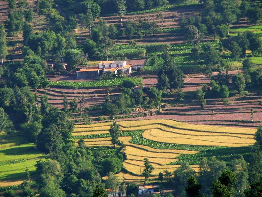
About 90% of Himachal's inhabitants depend on farming. Agriculture employs more than 60% of the state's workforce and accounts for 45% of its domestic product. The main cereals are wheat, maize, rice and barley. Pulses, fruit, vegetables and oilseeds are also grown. The principal cash crop is apples, amounting to about 85% of the state's total fruit production. Tea is cultivated in the Kangra Valley.


Hydro-electric power is one of the major sources of income for Himachal. A number of dams and power stations have been constructed on the state's mountain rivers. Surplus electricity is sold on to other states, including Punjab and West Bengal as well as Delhi. Himachal's manufacturing industries include food processing, electrical goods, pharmaceuticals, paper and cement.
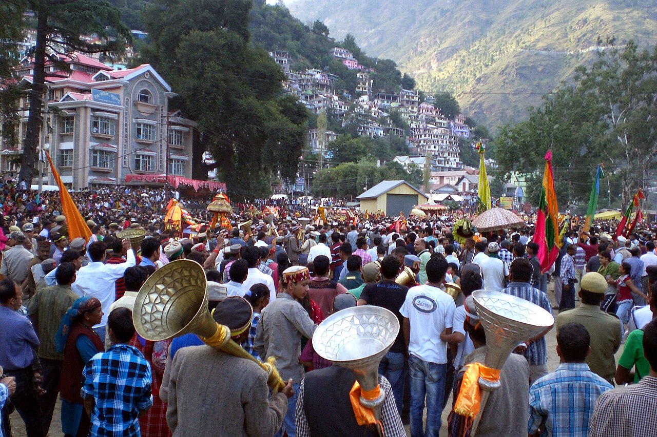
Tourism in Himachal is a major contributor to the state's economy. The Himalaya mountains, with their hill stations, pilgrimage sites and activity sport centres, attract visitors from all over the world. The Kalka-Shimla narrow-gauge railway is a UNESCO World Heritage Site.

History
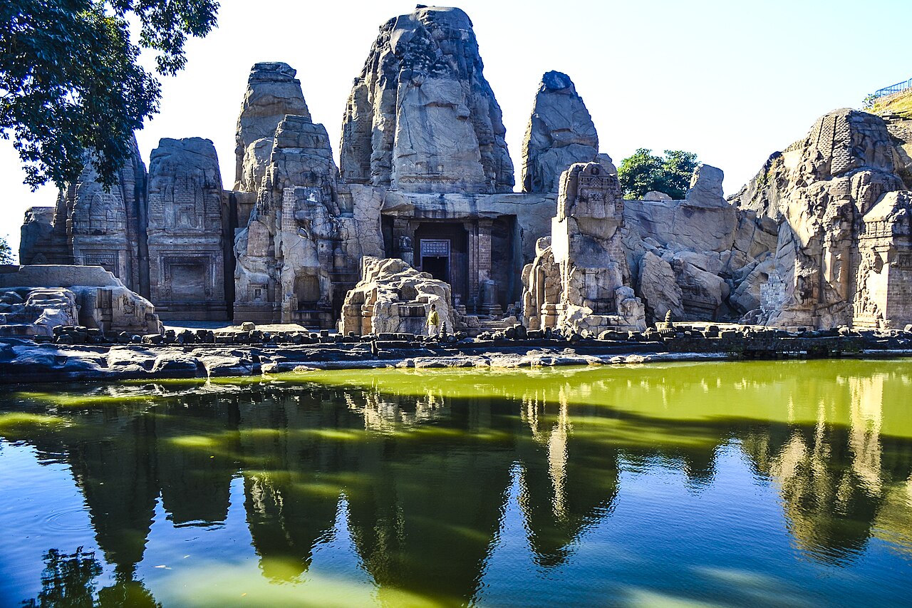
During the Vedic period (c. 1500–c. 500 BCE), Aryan peoples settled in the region now called Himachal Pradesh. Several small republics, known as janapadas, were established, eventually falling to the Gupta Empire in the 5th century CE. After the Guptas' decline, the region was divided up into several local kingdoms. Rulers kept their independence by paying tribute to the powerful empires of northern India: the Delhi Sultanate and their successors, the Mughals.
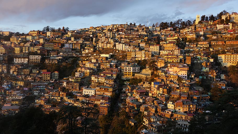
Conquered first by Ranjit Singh, Maharajah of the Sikh Empire, then the Gurkhas of Nepal in the early years of 19th century, the region came under the rule of the British East India Company, following their victories in the Gurkha War of 1814-16 and the Anglo-Sikh Wars of the 1840s. To escape the extreme heat of the northern plains, the British established a number of hill stations in Himachal. Shimla, which they called Simla, became British India's summer capital in 1864.

Consultant: Nicholas Harris
Facts about Himachal Pradesh
Area 55,673 sq km (21,495 sq miles) Rank: 18th
Highest point Reo Purgyil 6813 m (22,352 ft)
Population 7,555,000 Rank: 20th
Capital and largest city Shimla (pop. 169,578)
Other large cities Dharamsala (pop. 53,543), Solan (47,418), Mandi (41,348), Palampur (40,385)
Main languages Pahari (32%), Kangri (16%), Hindi (16%), Mandeali (9%), Punjabi (4%), Bilaspuri or Kahluri (4%), Kullui (3%), Gaddi (2%)
Main religions Hinduism (95%), Islam (2%)
State bird Western tragopan
State flower Pink rhododendron
State mammal Snow leopard
State tree Deodar cedar

pics

Without in any way limiting Q-files Ltd’s exclusive rights under copyright, any use of this publication to “train” generative artificial intelligence (AI) technologies to generate text is expressly prohibited. Q-files Ltd reserves all rights to license use of this work for generative AI training and development of machine learning language models.