
Geography of India

CITE
We have made every effort to follow citation style rules, but there may be some minor differences. If in doubt, please refer to the appropriate citation style manual.
Himalayas. (2026). In Q-files Encyclopedia, Geography, Geography of India. Retrieved from
https://www.q-files.com/geography/geography-of-india/himalayas
"Himalayas." Geography, Geography of India, Q-files Encyclopedia, 9 Jun. 2026.
https://www.q-files.com/geography/geography-of-india/himalayas.
Accessed 13 Sep. 2026.
Himalayas 2026. Geography, Geography of India. Retrieved 13 September 2026, from
https://www.q-files.com/geography/geography-of-india/himalayas
Geography, Geography of India, s.v. "Himalayas," accessed September 13, 2026.
https://www.q-files.com/geography/geography-of-india/himalayas


Himalayas
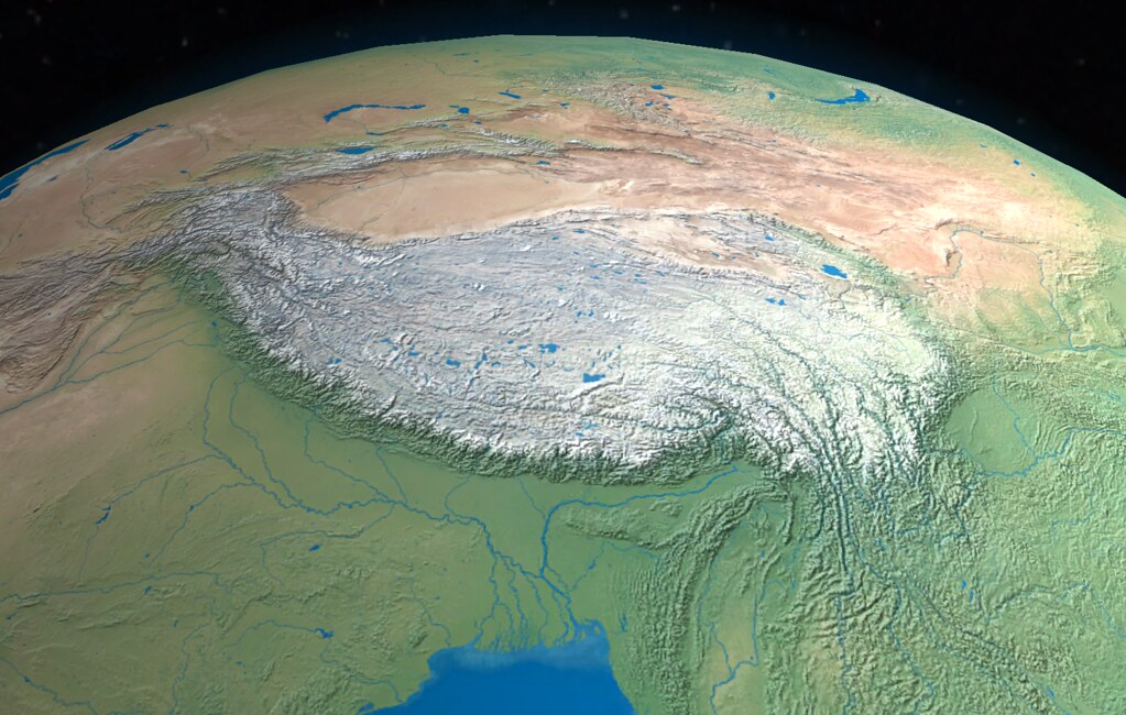
A broad arc of high mountain ranges—the Himalayas, the Karakoram and, to the northwest, the Hindu Kush—marks the northern edge of the Indian subcontinent. These mountains were formed by the collision of tectonic plates: the Indian plate drifting north crashing into the Eurasian plate. The Himalayas (the name comes from two words in the ancient Sanskrit language: hima, meaning “snow” and alaya, “abode”) are divided into three belts: the Great, Lesser and Outer Himalayas.


Great Himalayas
The northernmost belt, ranging between 50 to 75 kilometres (30–45 miles) wide, is known as the Great Himalayas, or Himadri. Lying mainly above 4900 metres (16,000 feet) in elevation, the mountains are permanently snow-covered and contain most of the Himalayan glaciers. The Great Himalayas include most of the world's highest peaks. Among them are Kangchenjunga (8586 metres / 28,169 feet) on the Sikkim–Nepal border, which is India's highest mountain. Nanda Devi (7817 metres / 25,646 feet), Kamet (7755 metres / 25,446 feet) and Trisul (7120 / 23,359 feet), all in Uttarakhand, are Great Himalayan peaks.
Lesser Himalayas
Separating the Lesser Himalayas from the Great Himalayas are several long valleys; in India, the largest of these is the Vale of Kashmir. The Lesser Himalayas, also called the Middle Himalayas or Himachal, range from 3600 to 4600 metres (11,900–15,100 feet) in height. The mountains are carved into by many deep gorges formed by swift-flowing streams, which are fed by the glaciers and snowfields to the north. The Pir Panjal is the largest range of the Lesser Himalayas.


Outer Himalayas
The foothills of the Outer Himalayas, known as the Sivalik Hills (also spelt Shivalik Hills), average between 1500–2000 metres (4900–6600 feet) in height. They form a belt 10–50 kilometres (6–30 miles) wide between the mountains and the plain to the south. Heavily eroded by fast-flowing mountain streams, the Sivaliks provide much of the sediment carried down to the Indo-Gangetic Plain.

Kashmir region
The Kashmir region encompasses the India-administered territories of Jammu and Kashmir and Ladakh, the Pakistan-administered territories of Azad Kashmir and Gilgit-Baltistan, and the Chinese-administered territory of Aksai Chin.

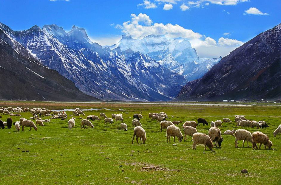
In the north and northeast of the Kashmir region, separated from the Great Himalayas by the upper reaches of the River Indus, lies the Karakoram Range. About 500 kilometres (310 miles) long, the range contains many glaciers, including the 76-kilometre (47-mile) Siachen Glacier. The Ladakh Range, which rises to the north of the Indus and to the west of the River Shyok, is an extension of the Karakoram. The Zanskar Range, part of the Great Himalayas, lies to the south of the Indus.
Patkai
The Patkai, or Purvanchal, Range rises near India's eastern border with Myanmar. The mountains were created by the same tectonic processes that led to the formation of the Himalayas. The Patkai mountains have conical peaks, steep slopes and deep valleys. Thickly forested, the range extends across Arunachal Pradesh, Nagaland, Manipur and Mizoram states.

Himalayan rivers

The Himalayan rivers of India rise in glaciers or snowfields and have a constant supply of water throughout the year. The Ganges (Ganga) is India's longest river, measuring 2510 kilometres (1560 miles) in length. Its main headwater, the Bhagirathi, emerges from the Gangotri Glacier in Uttarakhand. Flowing out of the mountains, the Ganges arcs southeastwards across the Ganges Plain, eventually draining into the Bay of Bengal. The Yamuna and Gomti rivers also rise in the western Himalayas and meet the Ganges on the Ganges Plain. Other tributaries, such as the Ghaghara and the flood-prone Kosi, rise in the central Himalayas of Nepal.
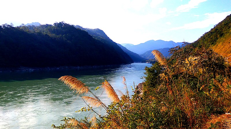
The Brahmaputra originates in Tibet, China, where it is known as the Yarlung Tsangpo. Flowing eastwards through southern Tibet, it carves through the Himalayas in great gorges. It enters India in Arunachal Pradesh (as the Siang) then flows west through the Assam valley.
Most of northwestern India lies in the Indus basin, which India shares with China, Afghanistan and Pakistan. The Indus and its longest tributary, the Sutlej, both rise in Tibet. The Indus flows northwestwards through Ladakh before entering the Pakistani-administered portion of Kashmir. It then flows southwestwards through Pakistan to reach the Arabian Sea. The Sutlej flows across Himachal Pradesh and Punjab before entering Pakistan, where it meets the Indus.
Other major tributaries of the Indus, the Chenab, Ravi and Beas, also flow across northwestern India into Pakistan. Although the Punjab plains are semi-arid, the constant run-off from the Himalayas ensures a year-round flow of water from the Indus and its tributaries.


Consultant: Nicholas Harris
pics

Without in any way limiting Q-files Ltd’s exclusive rights under copyright, any use of this publication to “train” generative artificial intelligence (AI) technologies to generate text is expressly prohibited. Q-files Ltd reserves all rights to license use of this work for generative AI training and development of machine learning language models.