
History of London

CITE
We have made every effort to follow citation style rules, but there may be some minor differences. If in doubt, please refer to the appropriate citation style manual.
London since 1900. (2026). In Q-files Encyclopedia, History, History of London. Retrieved from
https://www.q-files.com/history/history-of-london/london-since-1900
"London since 1900." History, History of London, Q-files Encyclopedia, 3 Jun. 2026.
https://www.q-files.com/history/history-of-london/london-since-1900.
Accessed 2 Sep. 2026.
London since 1900 2026. History, History of London. Retrieved 2 September 2026, from
https://www.q-files.com/history/history-of-london/london-since-1900
History, History of London, s.v. "London since 1900," accessed September 2, 2026.
https://www.q-files.com/history/history-of-london/london-since-1900


London since 1900
By the beginning of the 20th century, 6.5 million people—one fifth of the entire British population—lived in London. In the early 1900s, city planners began to transform some parts of the inner city (residential areas close to the City and Westminster), clearing slums and replacing narrow streets with wide roads such as Kingsway and Aldwych. The Mall, leading from Trafalgar Square to Buckingham Palace, was turned into a ceremonial route for grand royal parades. The East End, however, remained largely undeveloped. Many of London's poor were forced to live in overcrowded housing—damp, dilapidated, lacking electricity and running water—near to the factories and docks where they worked.
Suburbia
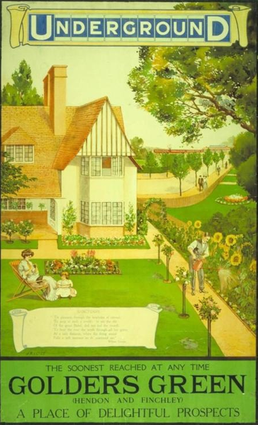
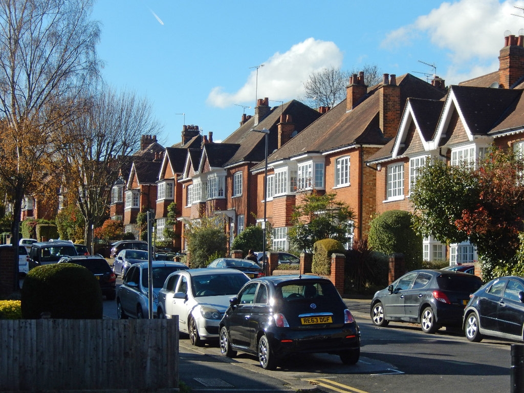
During World War I (1914–18), London’s docks and East End were bombed by German zeppelins (airships) and, later, aeroplanes. After the war was over, the government attempted to solve London's housing shortage, building three million new homes between 1918 and 1939. As the Underground (tube) network expanded—along with electrified railways and new routes for trams and buses—the suburbs, neighbourhoods that offered London's growing middle classes better-quality, affordable housing and surroundings more suitable for bringing up families, ballooned in size. The smarter parts of suburbia, as it is sometimes called, grew up north and northwest of London ("Metroland") and around its southern fringes. Existing towns and villages in surrounding counties were absorbed into London's urban area. Manufacturing industries also relocated from inner London to industrial estates, such as Park Royal, lining the main roads leading out from the centre.
While London's urban area as a whole—including the suburbs—rose from 7.5 million in 1921 to 8.6 million in 1939, its inner city population fell by nearly 450,000.
The Blitz
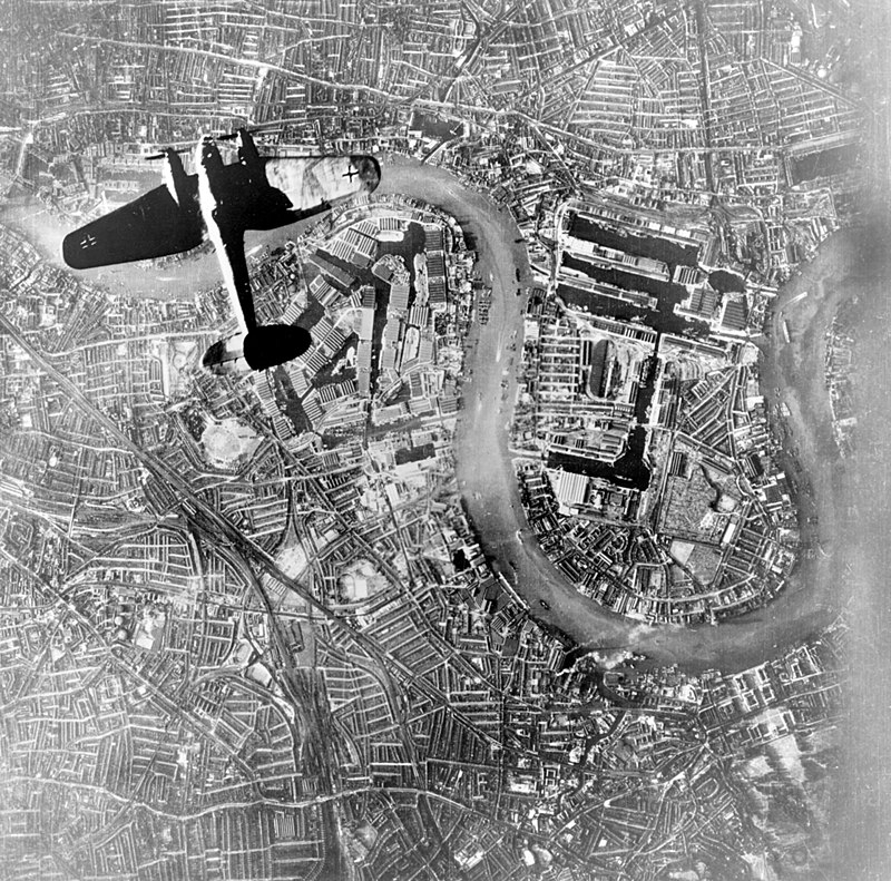
During World War II (1939–45) London suffered extensive damage from aerial bombing. This was especially severe during a six-month period of air raids by German planes, September 1940 to May 1941, known as the Blitz (the German word for "lightning"). The bombing destroyed tens of thousands of buildings in London. To begin with German aircraft targeted munitions factories and docks, but later bombed residential areas as well. Some parts of the East End and Westminster were completely devastated. The docklands area, along the River Thames east of the City, suffered especially heavy damage. The aerial assault on London renewed in June 1944 with V-1 flying bombs and V-2 rockets, and continued almost to end of the war.
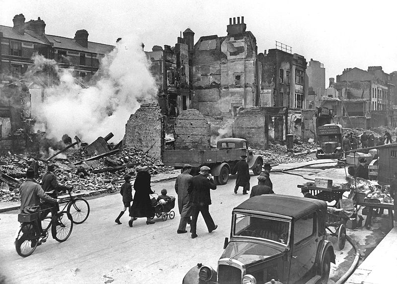
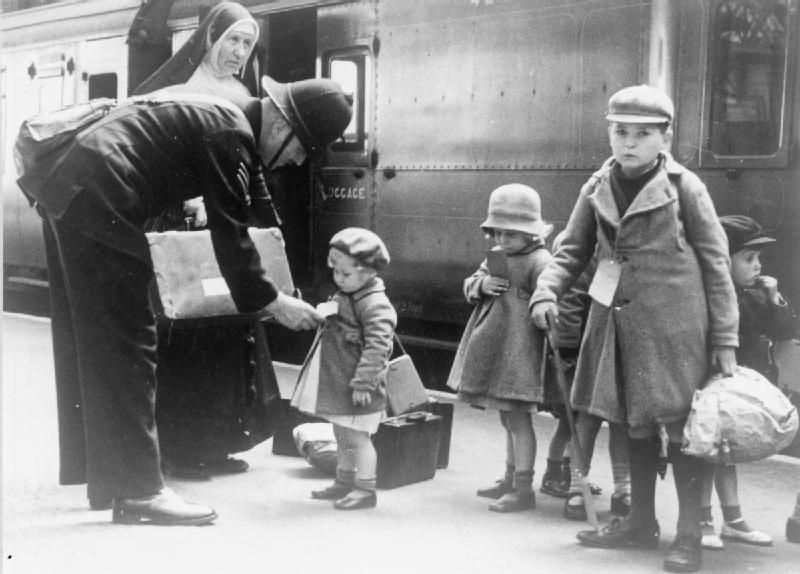
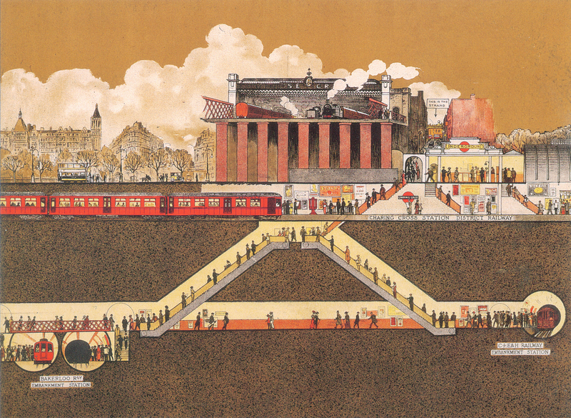
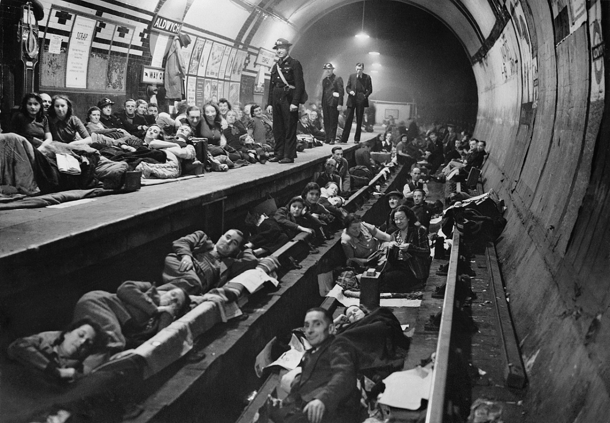
Nearly 700,000 children were sent out of London in September 1939 to safer places in other parts of the country, where they stayed with families as evacuees (although many returned to London before the Blitz began). Many Londoners sheltered from the air raids in Underground stations. The bombing killed some 30,000 people in London, and injured many more.
Postwar London
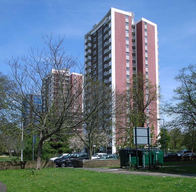
The devastation of the war accelerated the government's plans to rid London of its slums, those decaying remnants of the Victorian city—particularly in the East End. This involved building multi-storey blocks of flats to replace areas of closely packed terraced homes, but this policy did little to tackle the long-standing problems of deprivation and crime.
During the 1950s, immigrants from the Caribbean and South Asia started to arrive in London in significant numbers. They tended to settle in certain areas, leading to the establishment of distinct communities by the end of the 20th century—for example, Jamaicans in Brixton, Punjabis in Southall and Bangladeshis in Tower Hamlets.
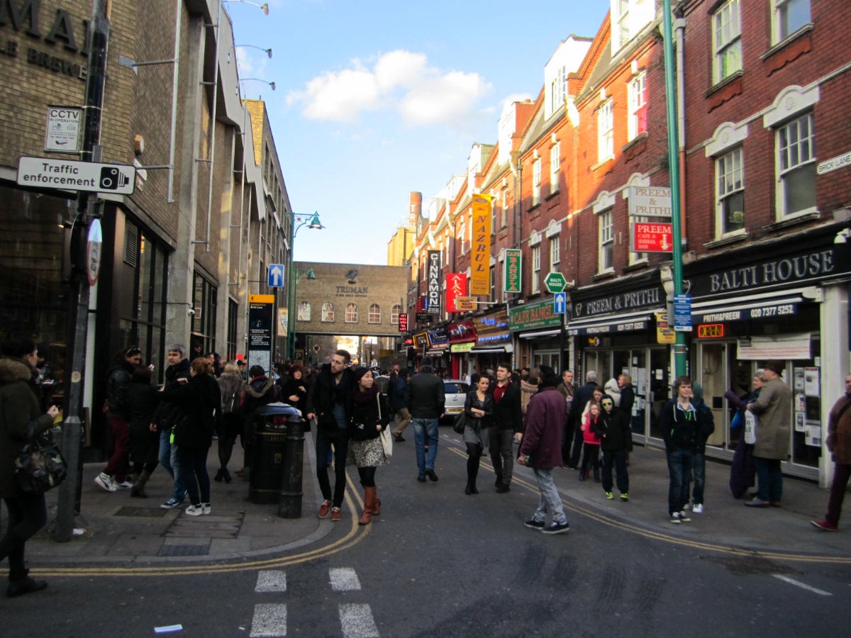
Some immigrant communities replaced former ones. By the late 1970s, the Brick Lane area, just to the east of the City, had become mostly Bangladeshi, replacing the former Jewish community. Jews had migrated to outlying suburbs of London, many mixing with other British people. In Brick Lane, some (but not all) Jewish bakeries were turned into curry houses, jewellery shops became sari stores and synagogues were converted into dress factories or mosques. Today, Brick Lane is a popular attraction and a centre of art and fashion, hosting many exhibitions.
Big Smoke
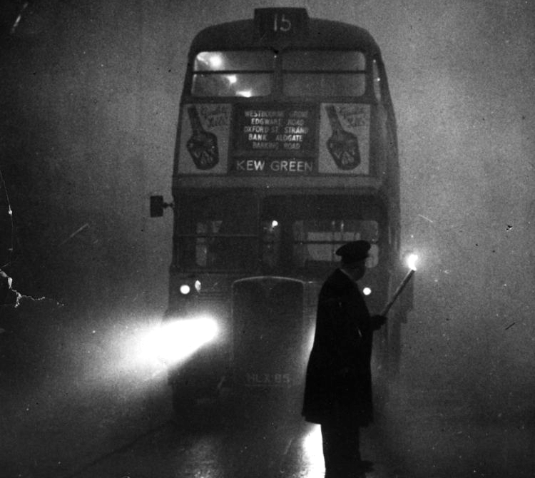
Since the 18th century, Londoners had been using coal to heat their homes, and the smoke from their fires created huge clouds of smog (a combination of smoke and fog) over the city. London became known for these “pea-soupers”, which earned the city its nickname, “The Big Smoke”. The smogs were sometimes so thick that streetlights had to stay on all day so people could find their way around. After the particularly severe Great Smog of December 1952, which caused the deaths of 4000 people, the passing of the Clean Air Act in 1956, which made the use of smokeless fuels compulsory, made London a safer and healthier place to live.
Green Belt
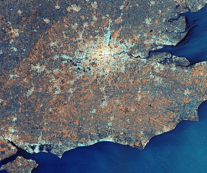
During the 1950s and 60s, suburbanization continued apace as more and more people who could afford to move out from the centre did so. Commuting by rail or Underground became a way of life for many with office jobs in central London. There was a danger that unchecked urban sprawl would start to merge with towns and villages in the surrounding countryside. In order to prevent this, planners created a Green Belt: a large area of open space circling London that could not be built on. As people continued to move to the outer suburbs, or to towns and villages in or beyond the Green Belt, London's population fell from its 8.7 million pre-war total to 6.7 million by 1990.
Gentrification
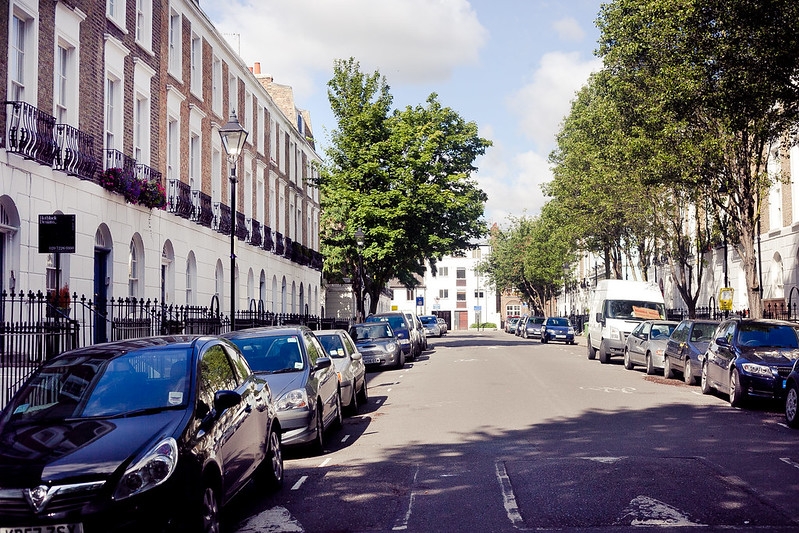
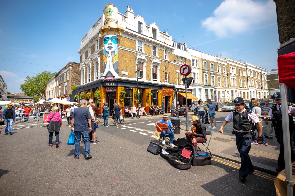
Meanwhile, certain run-down inner suburbs, such as Islington or Notting Hill, which contained fine, but now dilapidated, houses built during Georgian and Victorian times, started to become attractive once more to London's professional classes. As working class residents moved out, whole neighbourhoods became "gentrified" during the 1960s, 70s and 80s, as comparatively well-off newcomers moved in and local shops and restaurants were set up to cater for them.
Docklands
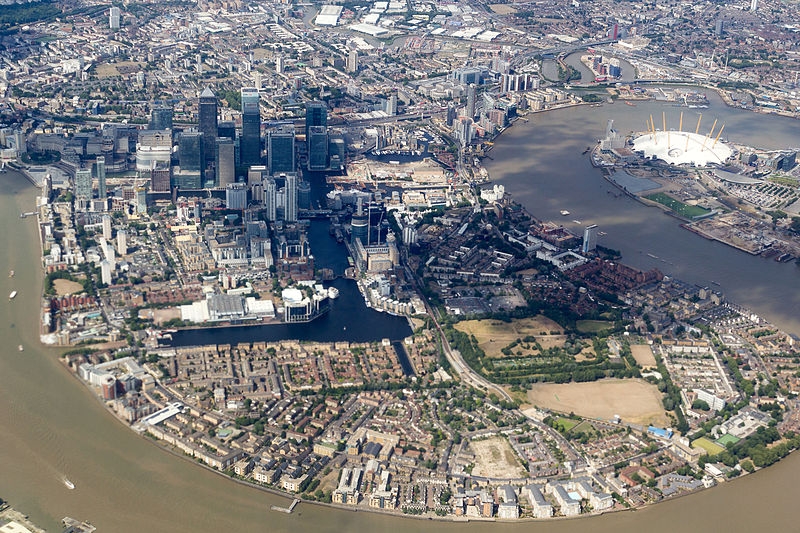
As container ships came into use for transporting cargo by sea, so, from the 1960s onwards, London’s docks, which were suitable only for 19th century sailing ships and steamers, started closing down. New docks opened instead at Tilbury, nearer the mouth of the Thames. By the 1980s, the last of London’s docks had closed, and the Docklands area was developed into a second financial centre, Canary Wharf.
Modern London
Greater London, containing most of London's urban area, was created in 1965. It was divided into 32 metropolitan boroughs, plus the City of London, and is today administered by the Mayor of London together with the London Assembly. Greater London's population has risen again to around 9.1 million people, making it the third most populous city in Europe after Moscow and Paris.
Today, London is one of the world’s leading financial centres and a major cultural centre, famous for its museums, theatres, architecture and universities. It attracts more than 65 million tourists each year, making it among the most visited cities in the world. London is also one of the world’s most multicultural cities, home to around three million people born outside the UK, and many more with parents who were born abroad. More than 300 languages are spoken by the city's residents.
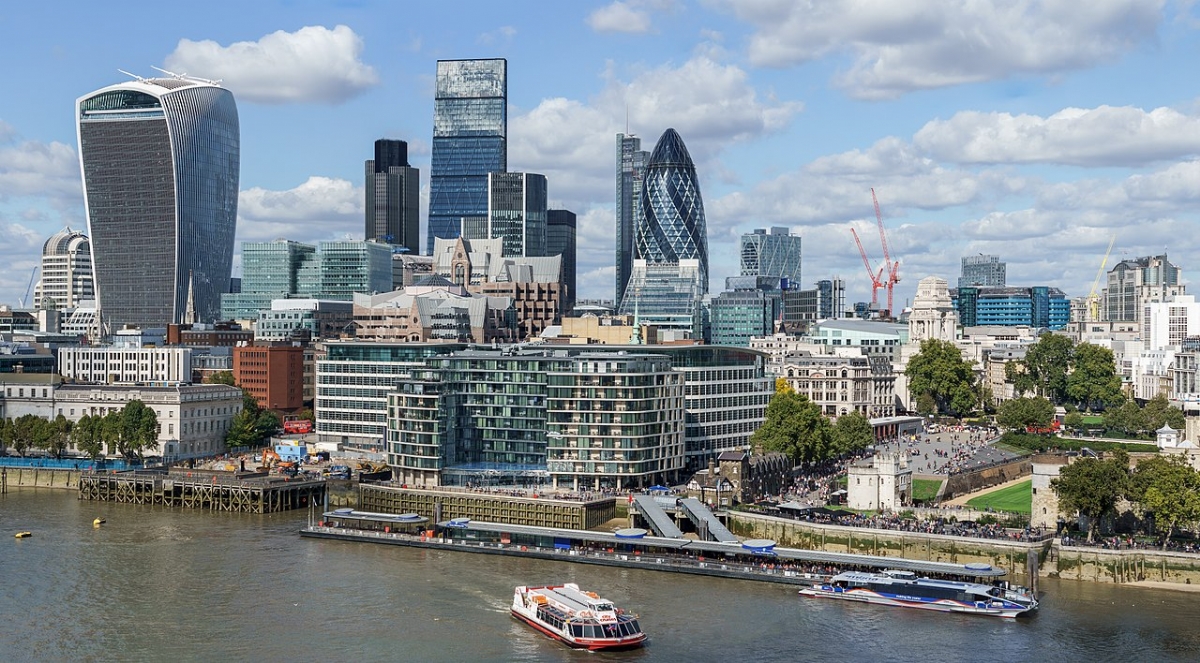
London has five airports (Heathrow, Gatwick, Stansted, Luton, City and Southend), 18 terminal railway stations, the world's third longest metro system, and is encircled by the M25 motorway. In the 2000s, new skyscrapers were built in both the Canary Wharf and City of London financial districts, including the award-winning 30 St Mary Axe, known as the "Gherkin”. The Shard, London’s tallest building, was completed in 2012. It stands 309.6 metres (1016 feet) tall.
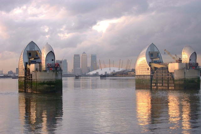
London is built on the tidal River Thames. The risk of flooding has become greater over the years, as southeast England slowly sinks and the level of high tides rises. To counter this, the Thames Barrier was constructed in 1982. Its floodgates are raised 90º from their lowered positions to hold back incoming tides when necessary.
Consultant: Philip Parker
pics
Without in any way limiting Q-files Ltd’s exclusive rights under copyright, any use of this publication to “train” generative artificial intelligence (AI) technologies to generate text is expressly prohibited. Q-files Ltd reserves all rights to license use of this work for generative AI training and development of machine learning language models.