
Geography of the US

CITE
We have made every effort to follow citation style rules, but there may be some minor differences. If in doubt, please refer to the appropriate citation style manual.
Great Lakes. (2026). In Q-files Encyclopedia, Geography, Geography of the US. Retrieved from
https://www.q-files.com/geography/geography-of-the-us/great-lakes
"Great Lakes." Geography, Geography of the US, Q-files Encyclopedia, 28 Aug. 2026.
https://www.q-files.com/geography/geography-of-the-us/great-lakes.
Accessed 5 Oct. 2026.
Great Lakes 2026. Geography, Geography of the US. Retrieved 5 October 2026, from
https://www.q-files.com/geography/geography-of-the-us/great-lakes
Geography, Geography of the US, s.v. "Great Lakes," accessed October 5, 2026.
https://www.q-files.com/geography/geography-of-the-us/great-lakes


Great Lakes
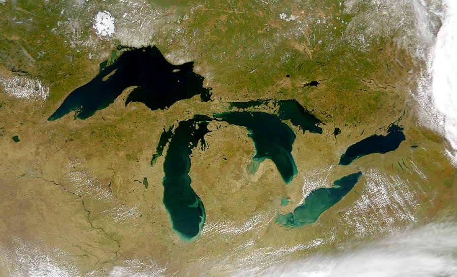
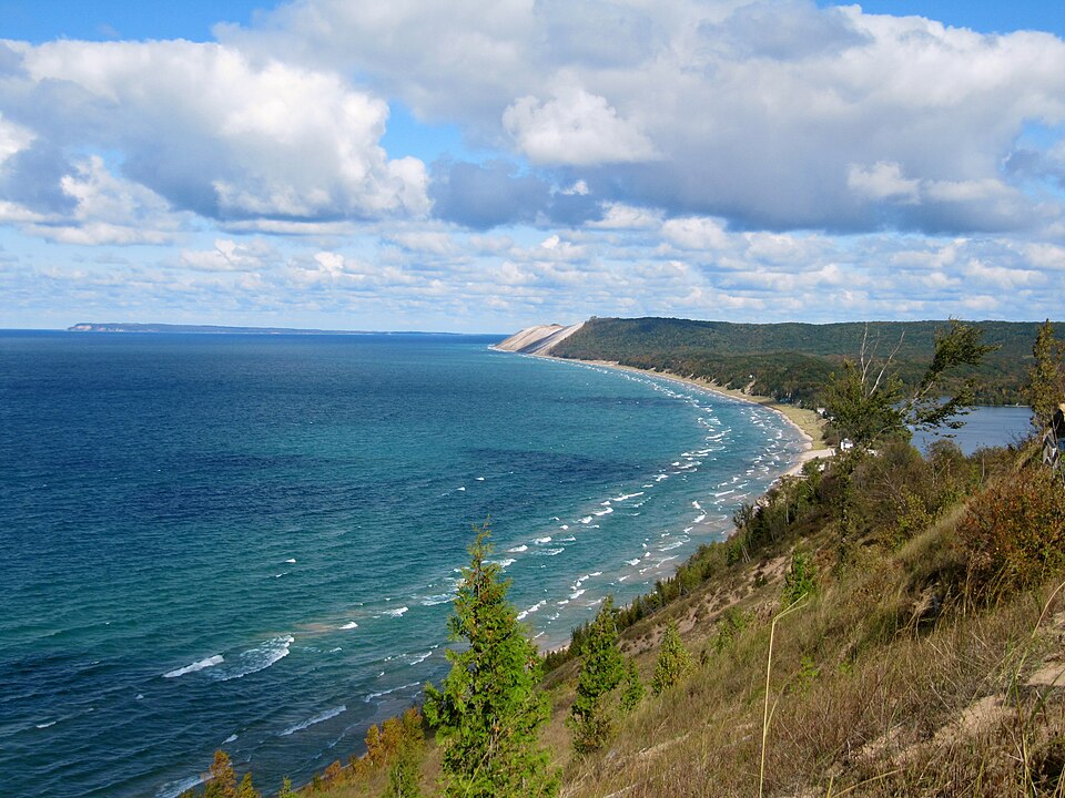
The five main lakes making up the North American Great Lakes—Superior, Michigan, Huron, Erie and Ontario—lie along or near the border between the United States and Canada (except Lake Michigan, which is entirely within the US). They form the largest group of freshwater lakes on Earth by surface area. They are connected by rivers, and eventually drain through the St Lawrence River towards the Atlantic Ocean.

Formation
At the Last Glacial Maximum (the maximum extent of the most recent glacial) around 26,500 years ago, a vast ice sheet, known as the Laurentide Ice Sheet, covered most of present-day Canada and extended south into the northern United States. The massive weight of the ice depressed the Earth's crust while the moving ice gouged out basins. These became filled with water as the ice sheet melted and now form the Great Lakes.
Minnesota lakes
At the same time, another massive lake, Lake Agassiz, formed by meltwater from the retreating Laurentide Ice Sheet, appeared in central Canada, northern Minnesota and eastern North Dakota. At its height, it was larger than all of today's Great Lakes combined. Lake Agassiz eventually drained into what is now Hudson Bay, leaving behind Lake Winnipeg, Lake of the Woods and Red Lake.
Thousands of blocks of "dead" ice were also left behind by the retreating ice sheet buried in glacial sediment. When these ice blocks melted, they formed the countless kettle lakes that pepper the central and northern regions of Minnesota, known as “the Land of 10,000 Lakes".


Superior Upland
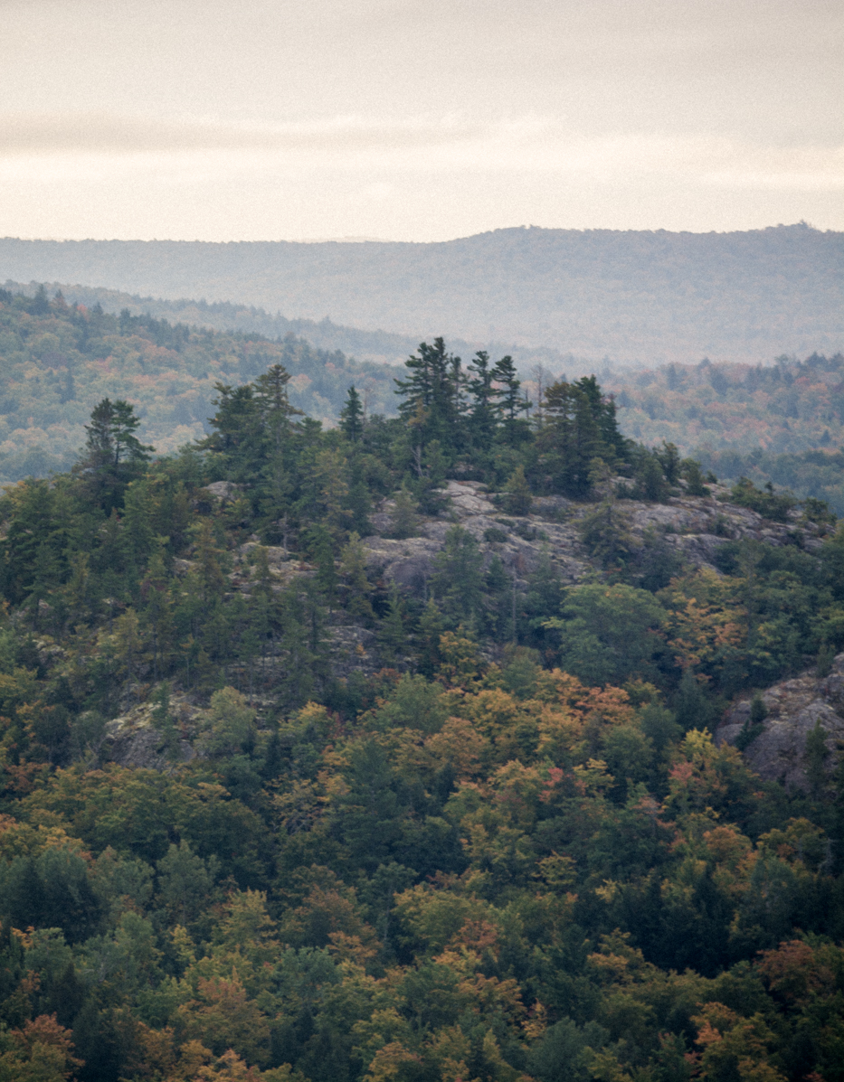
To the west and south of Lake Superior, in parts of northern Minnesota, Wisconsin and Michigan, lies a geological area known as the Superior Upland. It is mostly flat with isolated hills rounded by weathering, called monadnocks. Here the ancient rocks of the Canadian Shield are blanketed by thick layers of till left behind when glaciers melted at the end of the Pleistocene Ice Ages.
Niagara Falls
The Niagara Escarpment is northward-facing escarpment, a steep, cliff-like slope, that arcs through the Great Lakes region. It begins south of Lake Ontario and curves around the lakes Ontario, Huron and Michigan as far as Wisconsin, a distance of approximately 1000 kilometres (650 miles). The escarpment is the cliff over which the Niagara River plunges at the Niagara Falls.
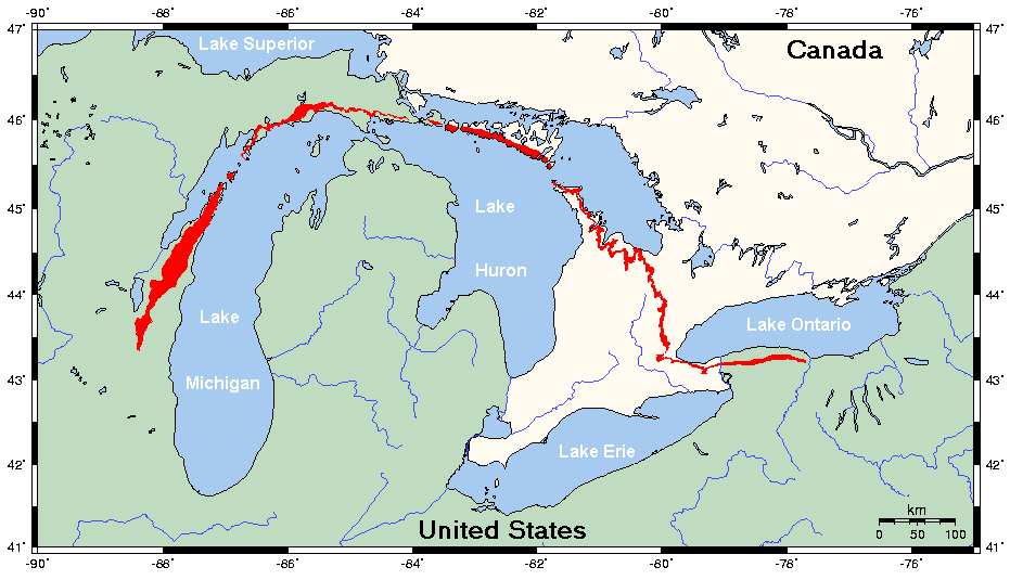
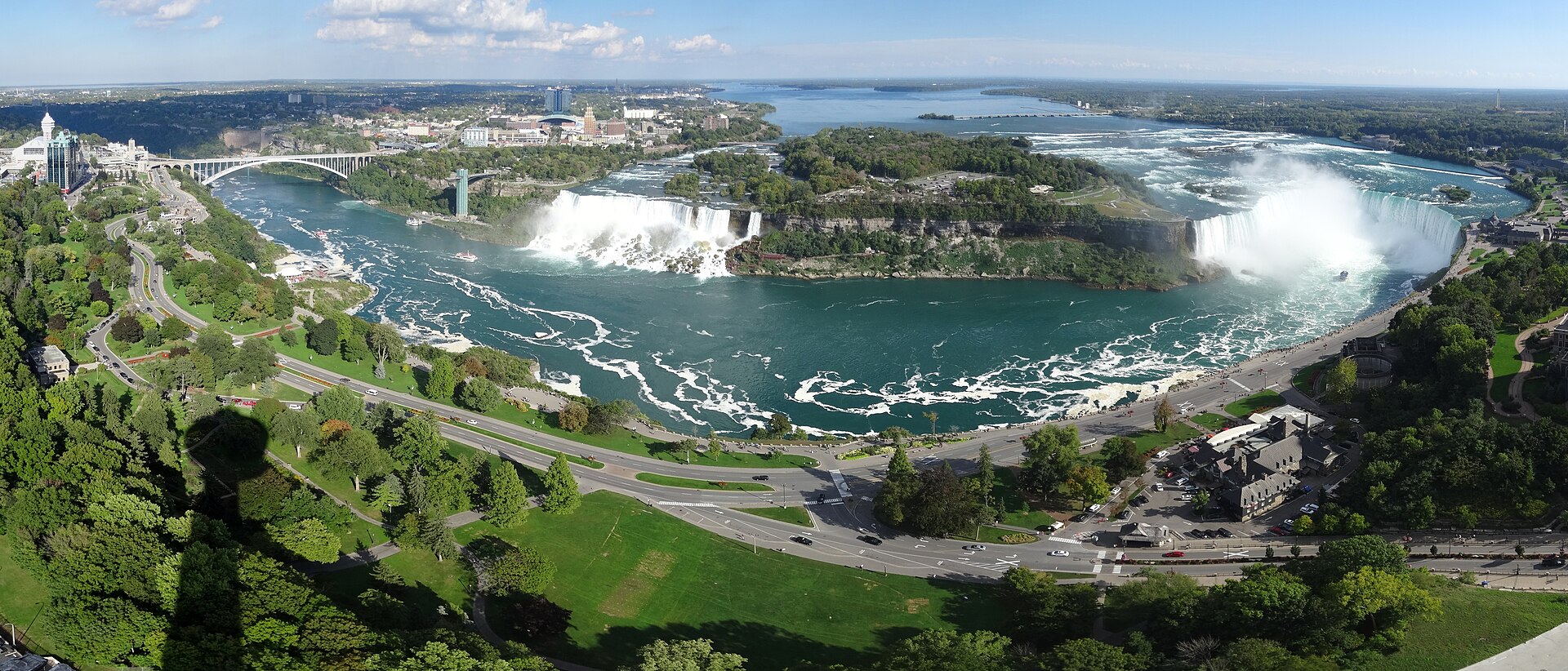
The melting of the Laurentide Ice Sheet about 11,000 years ago left behind a large amount of meltwater, filling what are now the Great Lakes. Water from upper Great Lakes emptied into the Niagara River, which began to flow over the Niagara Escarpment, creating a spectacular waterfall.
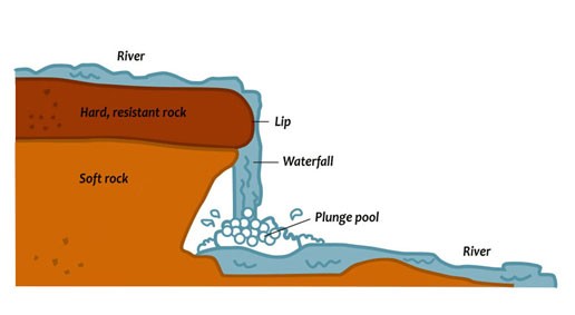
The rocks over which the river flows have not eroded evenly: the resistant upper layer (known as the "caprock") of dolomitic limestone erodes more slowly than the underlying shale. Over time, the river eroded the soft layer that supported the caprock, which repeatedly gave way in chunks. This has caused the falls to recede farther and farther upstream, leaving a deep gorge downstream. The force of the river current in the gorge is one of the most powerful in the world.
Consultant: Nicholas Harris
pics
Without in any way limiting Q-files Ltd’s exclusive rights under copyright, any use of this publication to “train” generative artificial intelligence (AI) technologies to generate text is expressly prohibited. Q-files Ltd reserves all rights to license use of this work for generative AI training and development of machine learning language models.