
Geography of the US

CITE
We have made every effort to follow citation style rules, but there may be some minor differences. If in doubt, please refer to the appropriate citation style manual.
Atlantic Coastal Plain. (2026). In Q-files Encyclopedia, Geography, Geography of the US. Retrieved from
https://www.q-files.com/geography/geography-of-the-us/atlantic-coastal-plain
"Atlantic Coastal Plain." Geography, Geography of the US, Q-files Encyclopedia, 19 Aug. 2026.
https://www.q-files.com/geography/geography-of-the-us/atlantic-coastal-plain.
Accessed 20 Aug. 2026.
Atlantic Coastal Plain 2026. Geography, Geography of the US. Retrieved 20 August 2026, from
https://www.q-files.com/geography/geography-of-the-us/atlantic-coastal-plain
Geography, Geography of the US, s.v. "Atlantic Coastal Plain," accessed August 20, 2026.
https://www.q-files.com/geography/geography-of-the-us/atlantic-coastal-plain


Atlantic Coastal Plain
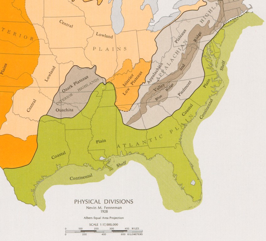
The Atlantic Coastal Plain lies along the eastern and southern edge of the United States, stretching from Cape Cod, Massachusetts, to South Padre Island, Texas, a distance of approximately 3100 kilometres (1900 miles). Bordering the Atlantic Ocean and the Gulf of Mexico, it is a low-lying region with sand, clay and other sediments deposited by rivers and the sea in many areas. The plain slopes gently seawards from the highlands inland, continuing far out into the sea, where it forms the continental shelf. Along the coast there are many wide beaches, barrier islands, lagoons, salt marshes and estuaries.
Central and southern Atlantic plain


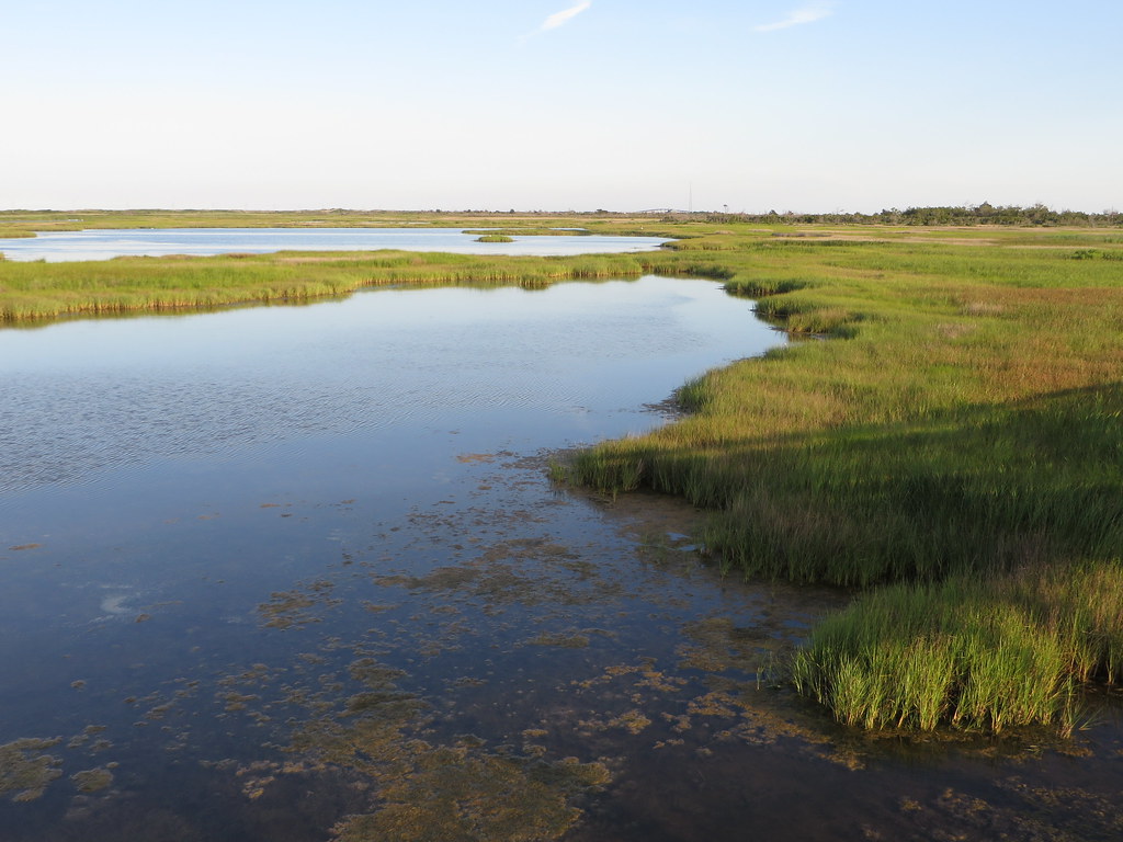
The coastal Atlantic Plain features nearly continuous sandy barrier islands, interrupted by inlets and rias (submerged river valleys), with extensive wetlands and marshes. Sloping gently seawards from the Atlantic Seaboard Fall Line in a series of terraces, the plain widens the farther south you go. In the Carolinas, Georgia and Florida it extends far inland.
The boundary between land and sea is often indistinct, especially along stretches of the Everglades in southern Florida. This is a wetland area where slow-moving waters flow through sawgrass marshes and mangrove forests.
At the southern tip of Florida are the Florida Keys, a chain of coral islands.

Gulf Coastal Plain
The Gulf Coastal Plain extends from the Florida Panhandle (the northwestern part of the state) in the east as far as the Mexican border in the west. It includes the alluvial plain of the Mississippi Valley, a tongue of land that reaches as far north as the southern tip of Illinois and includes parts of Kentucky, Tennessee, Missouri and Arkansas.

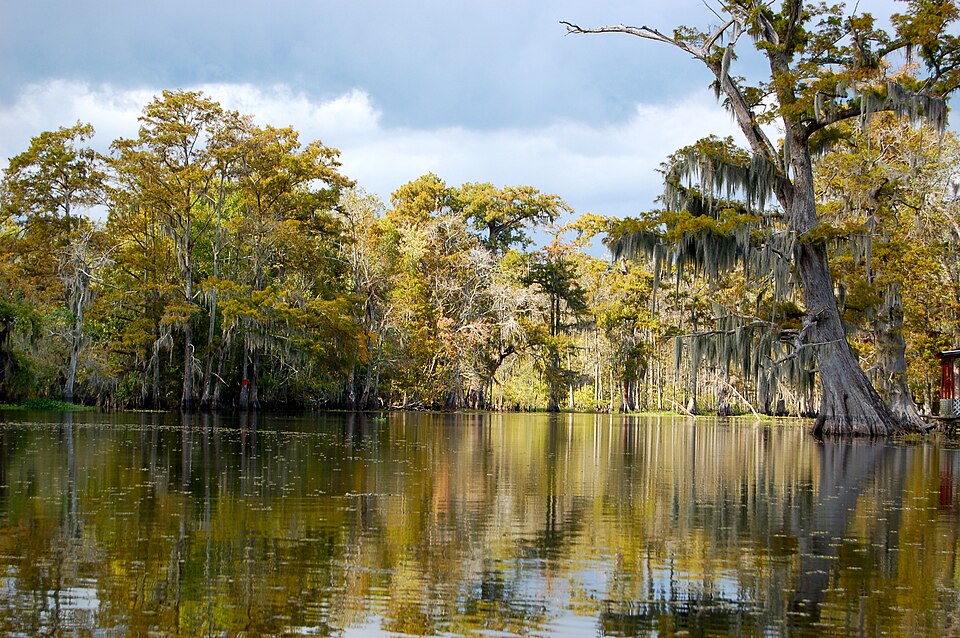
In the south, the coastal plain slopes seawards from inland escarpments. The eastern portion has flat lowlands with, in Alabama, an inland belt of rich black soil, ideal for agriculture. Near the sea, the land becomes flat and marshy. West of the Mississippi River Delta are the marshes and bayous (slow-moving streams) of Louisiana, including the Atchafalaya Basin, the largest wetland and swamp ecosystem in the United States. The plain in Texas features grasslands, cultivated fields, pasture and pine forests. The Coastal Bend is marked by long barrier islands, such as Padre Island, protecting shallow bays.

Mississippi River
South of its confluence with the Ohio River, the Mississippi River flows through what is known as the Mississippi Embayment, a trough lying between the Appalachians to the east and the Ozark Plateau and Ouachita Mountains to the west. It is a wide, flat, fertile alluvial plain, created by the river's regular flooding over many thousands of years. That portion lying in the state of Mississippi is known as the Mississippi Delta, although this not the river's real delta, which is in Louisiana.
Called the Mississippi River Delta (or the Birdfoot Delta, after its shape) this sticks out from the Gulf Coastal Plain into the Gulf of Mexico. Formed over the last 4500 years, it has been built by mud, silt and sand carried from the Interior Plains and deposited on its banks when the river slows as it reaches a sea.

Consultant: Nicholas Harris
pics
Without in any way limiting Q-files Ltd’s exclusive rights under copyright, any use of this publication to “train” generative artificial intelligence (AI) technologies to generate text is expressly prohibited. Q-files Ltd reserves all rights to license use of this work for generative AI training and development of machine learning language models.