
Geography of the US

CITE
We have made every effort to follow citation style rules, but there may be some minor differences. If in doubt, please refer to the appropriate citation style manual.
Climate of the US. (2026). In Q-files Encyclopedia, Geography, Geography of the US. Retrieved from
https://www.q-files.com/geography/geography-of-the-us/climate-of-the-us
"Climate of the US." Geography, Geography of the US, Q-files Encyclopedia, 28 Aug. 2026.
https://www.q-files.com/geography/geography-of-the-us/climate-of-the-us.
Accessed 29 Oct. 2026.
Climate of the US 2026. Geography, Geography of the US. Retrieved 29 October 2026, from
https://www.q-files.com/geography/geography-of-the-us/climate-of-the-us
Geography, Geography of the US, s.v. "Climate of the US," accessed October 29, 2026.
https://www.q-files.com/geography/geography-of-the-us/climate-of-the-us


Climate of the US
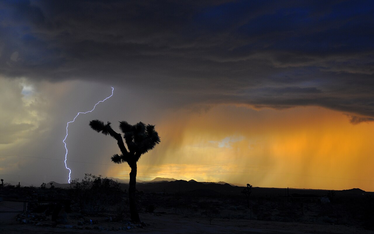
The 48 states that form the contiguous United States stretch from the Atlantic Ocean in the east to the Pacific Ocean in the west. Alaska reaches far into the Arctic, while Hawaii lies in the tropical Pacific. The size and span of the US gives one of the widest ranges of climate types found in any single country in the world. They are: the humid continental climate of the northeast and Midwest, the humid subtropical climate of the southeast, the semi-arid climate of the Great Plains, the desert climate of the southwest, the Mediterranean climate of coastal California, the maritime climate of the Pacific northwest, the subarctic and tundra climate of Alaska and the tropical climate of Hawaii and southern Florida.

Influences on climate
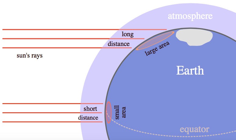
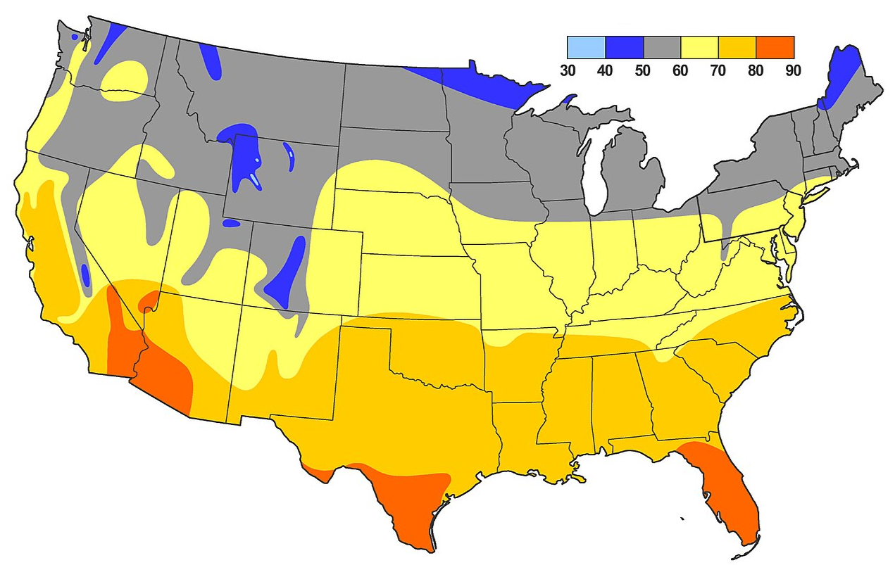
Latitude is one of the most important influences on a region's climate. Areas nearer the equator receive the sun’s rays at a higher angle for more months of the year than those nearer the poles, so temperatures are generally higher: Florida and southern Texas are much warmer in winter than North Dakota or Maine. Alaska is much colder because it lies far to the north. Northern Alaska sees very little sunlight during the winter months.
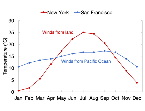
Distance from the sea is another important factor. Water cools more slowly than the land. This means that winds blowing in from over the sea in autumn and winter bring relatively warmer temperatures to coastal areas than areas farther inland. Water also heats up more slowly than the land, meaning the winds blowing in from the sea in summer bring cooler temperatures to coastal areas. In the central states of the US, far from either ocean, temperatures can rise or fall rapidly as the seasons change (and even from one day to the next).
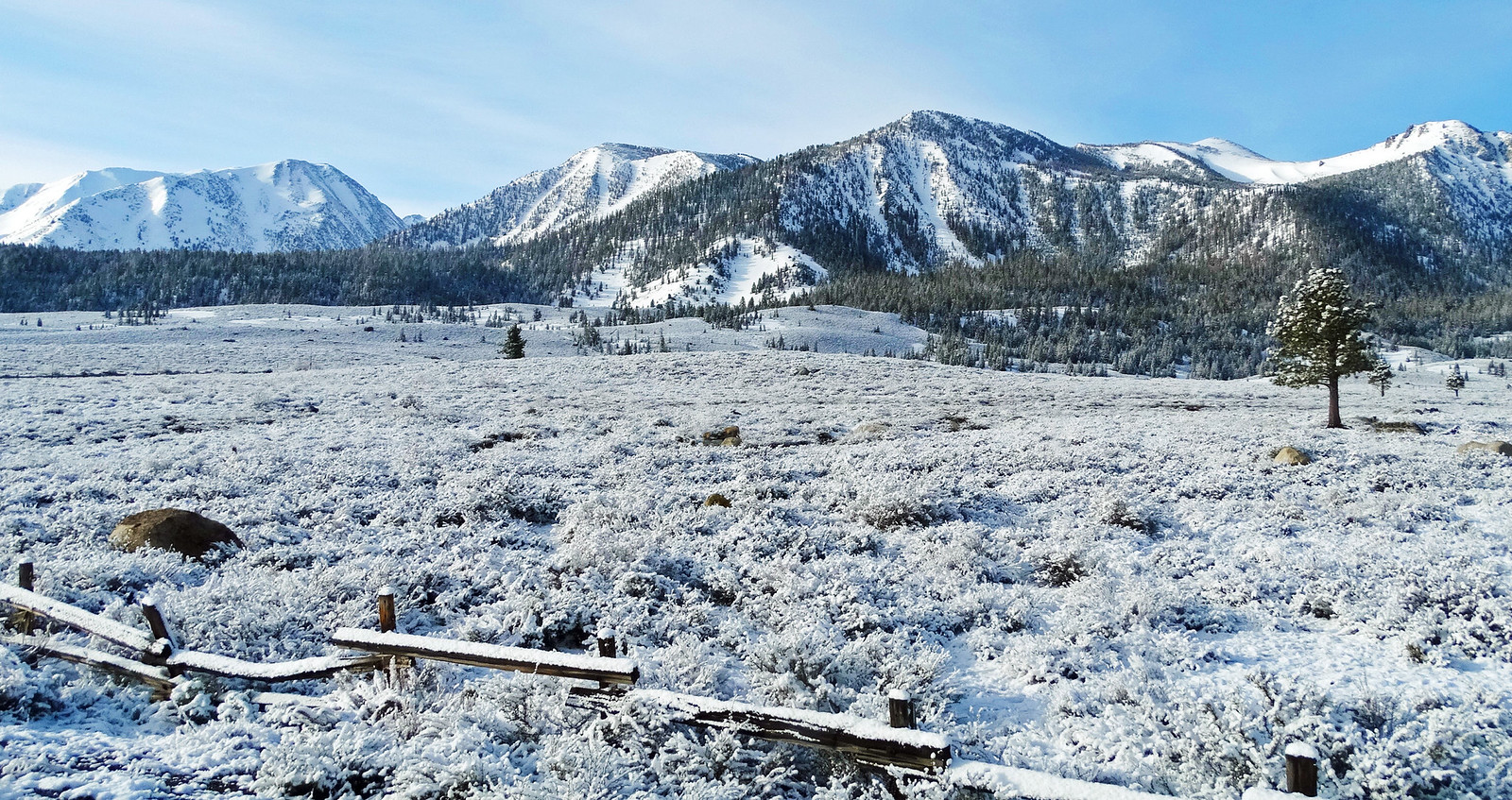
Height above sea level affects temperature. Air temperature usually falls with altitude, which means mountaintops are cooler than nearby lowlands. The Rocky Mountains, Sierra Nevada and Cascade Range may have a covering of snow while valleys nearby bask in warm sunshine.
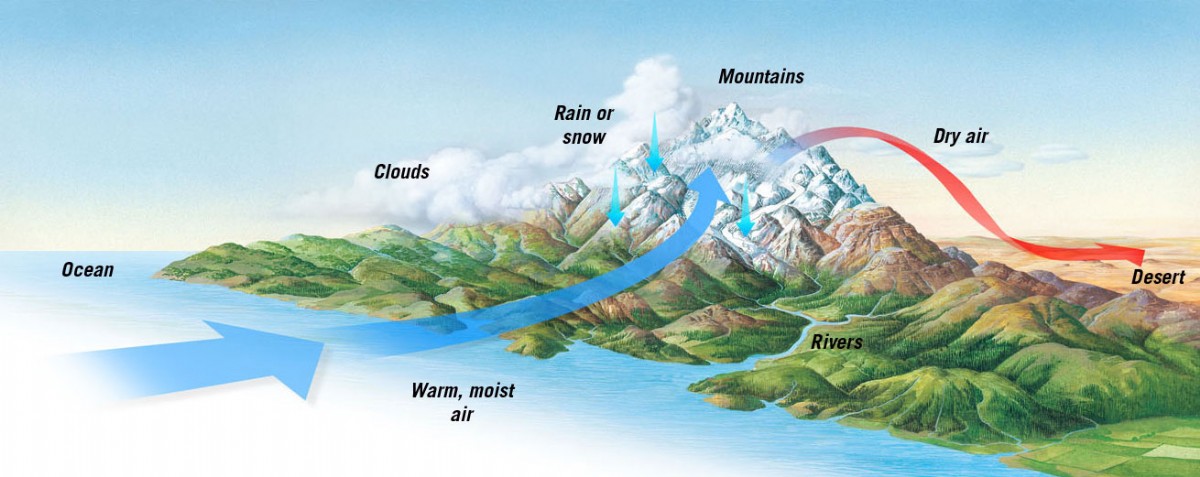
High ground also affects rainfall patterns. As air moves across mountains, it is forced to rise. Rising air cools, water vapour condenses, and rain or snow may fall on the windward side of the range. The leeward side, where the falling air contains very little moisture, is usually drier. This is known as the rain-shadow effect.
The moisture in the air mostly originates in the oceans. The Gulf of Mexico supplies most of the warm, moist air for the central United States. The Pacific Ocean has a strong influence over western coastal regions, especially in winter when storms move inland from the ocean. The Atlantic Ocean has a great effect on the climate of the country's east coast, bringing storms and, occasionally, hurricanes.
Jet stream

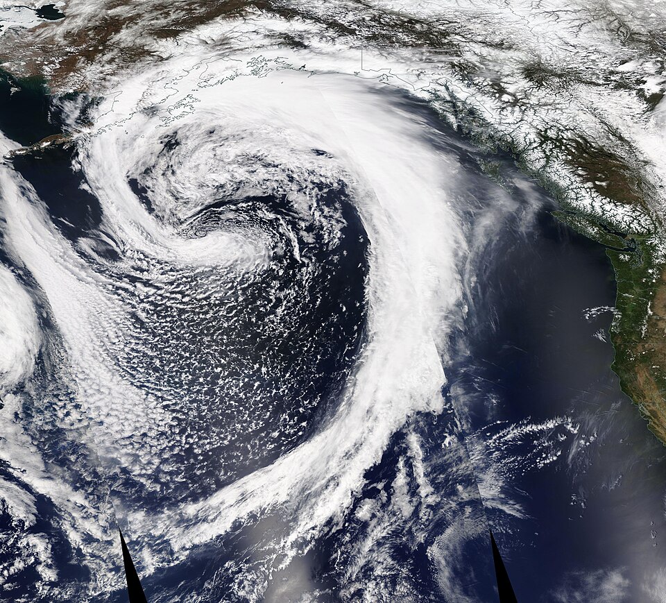
Jet streams are narrow bands of air that travel at high altitude (between 8 to 11 kilometres or 5–7 miles) above the Earth’s surface and at great speed. One jet stream flows in a long, wavy path west–east along the boundary between cold polar air and warm tropical air in the Northern Hemisphere, and therefore plays a big part in shaping the weather across the US.
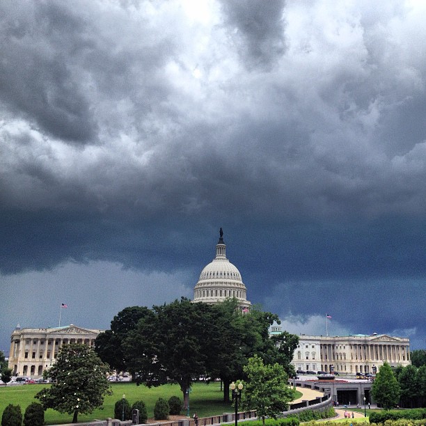
In winter, the jet stream often dips to the south, bringing cold, moist air to large parts of the country. Parts of southern US (Florida, the Gulf Coast, the southwest and southern California), however, usually have more stable weather as the jet stream's impact rarely reaches that far south.
In summer, the jet stream usually shifts northwards, allowing warm, humid air to spread with it. In the east, this sometimes brings thunderstorms as heat builds in the afternoon.
Air masses
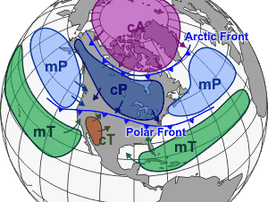
The jet stream affects the movement of air masses across North America. Air masses are large bodies of air that have a similar temperature and moisture levels. Continental polar air from Canada is cold and dry. Maritime tropical air from the Gulf of Mexico and western Atlantic is warm and moist. Maritime polar air from the North Pacific is cool and moist. Continental tropical air from Mexico and the southwestern desert regions is hot and dry. Where these air masses meet, weather fronts form, creating low pressure systems. These often bringing rain and thunderstorms, or snowfall, to some regions in winter.

The northeast
The northeastern United States, including New England and parts of New York, New Jersey and Pennsylvania, has a humid continental climate. Winters are cold, with average highs of 3.5°C (38°F), while summers are warm and humid, with average highs of 26.7°C (80°F) of more. Precipitation occurs throughout the year with snow common in winter, especially in the north and at higher elevations.
The region's climate arises from its being a meeting place for two air masses: in winter, cold air often moves south from Canada, while in summer, warm, humid air often pushes north from the Atlantic and Gulf of Mexico. The weather can change rapidly when low-pressure systems are formed at the front between the two air masses.
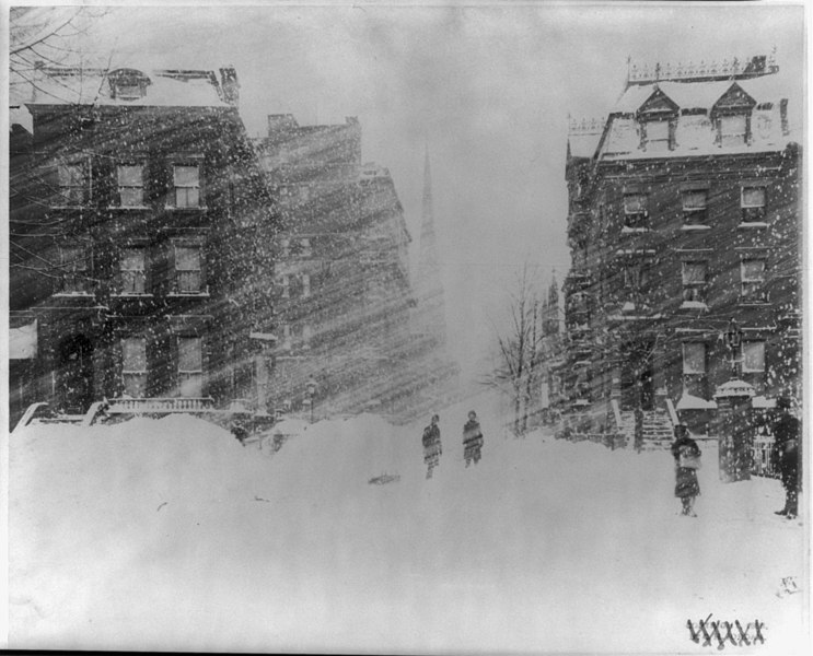
Coastal areas are usually milder in winter than inland areas, but they can experience powerful storms from the Atlantic Ocean. The nor’easter is a low-pressure system that sometimes moves down the east coast from the northeast. It can bring heavy rain, coastal flooding and blizzards, especially from autumn to spring.

Great Lakes and upper Midwest

The Great Lakes and upper Midwest, a region including Michigan, Wisconsin, Minnesota, Iowa, Illinois, Indiana and Ohio, also has a humid continental climate. Winters are cold, and summers are warm or hot. But the seasonal temperature range is greater than in the northeast because the region lies far from the ocean.

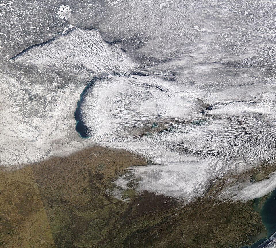
The Great Lakes have a significant effect on local climates. In autumn and early winter, the lake waters may still be relatively warm. When cold air moves across the lake's surface, it picks up moisture from the water and drops it as snow on shores downwind of the lakes. This is called lake-effect snow. The lakes also reduce temperature extremes near their shores, with winds bringing milder temperatures in summer and slightly warmer temperatures in winter.
The southeast
The southeast region, which includes much of the Atlantic and Gulf coastal plains, extending inland into parts of Tennessee, Arkansas and Oklahoma, has a humid subtropical climate. Summers are hot and humid, with temperatures often above 30°C (90°F) while winters are mild, averaging around 16°C (60°F), although cold fronts sometimes bring short spells of colder weather. Warm winds from over the Gulf of Mexico carry moisture inland for most of the year, so rainfall occurs in all seasons. The heat and humidity often bringing afternoon thunderstorms in summer—especially common in Florida and along the Gulf Coast.


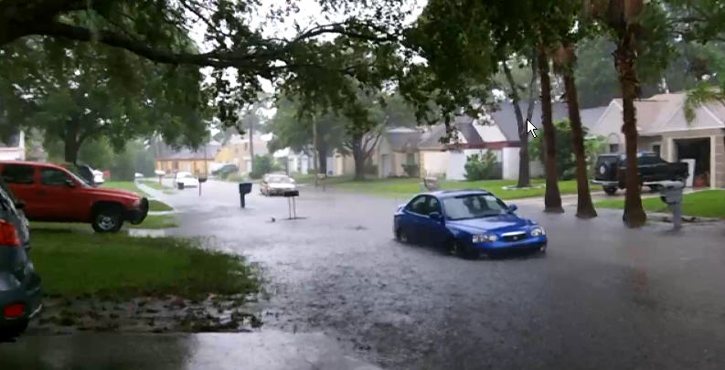
The southeast is one of the main hurricane-affected regions of the United States. Hurricanes form over warm ocean water and can move into the Gulf Coast or Atlantic Coast, bringing powerful—sometimes destructive—winds, storm surges, heavy rainfall and flooding.
Southern Florida

Northern and central Florida are humid subtropical, while southern Florida has a tropical climate. Temperatures remain warm or hot throughout the year, with all months averaging higher than 18°C (65°F), and summer highs around 32°C (90°F). Southern Florida's wet season usually occurs in the warmer months, when sea breezes and high humidity lead to frequent thunderstorms. The drier season occurs in the slightly cooler months when the air is more stable. Being surrounded on three sides by warm water exposes Florida to tropical storms and hurricanes. High winds, heavy rain and storm surges can cause flooding and sometimes extensive damage.
Great Plains
The Great Plains lie to the east of the Rocky Mountains and west of the Midwest (in the north) and the Gulf Coastal Plain (in the south). They stretch from Texas in the south through Oklahoma, Kansas, Nebraska and the Dakotas, then on into Canada in the north. Moving westwards from the Mississippi Valley towards the Rocky Mountains, average rainfall generally decreases. The humid eastern plains receive enough rain to support a range of crops, while the western plains, naturally covered by shorter grasses, are semi-arid.

In the western plains, rainfall is unreliable from year to year. Drought is a regular occurrence. and can be made worse by high temperatures and strong winds, which increase rates of evaporation. In the 1930s, these conditions led to the Dust Bowl, when wind erosion removed large amounts of topsoil from many parts of the southern plains.
Moist air from the Gulf of Mexico frequently moves northwards but generally fails to reach western parts. This is because hot, dry air flowing northeastwards across from the southwestern US and Mexican deserts creates a barrier, known as the Dryline.
In winter, Arctic air can move freely southwards, but in summer, warm, air spreads north from the Gulf of Mexico and the southwestern states. Where these air masses meet, commonly in the southern Plains, the result is often severe storms, most likely from April to June. Thunderstorms break out frequently in central and eastern Texas, Oklahoma and Kansas, while May is the highest-risk month for tornadoes in "Tornado Alley", a region extending from northern Texas across Oklahoma, Kansas and Nebraska towards South Dakota and Iowa, where tornadoes are especially common.

Interior West
West of the Great Plains, much of the Interior West (or Intermontane Plateaus) region—which lies far from the ocean and contained within mountain barriers—has an arid climate. Along the region's western edge, the Sierra Nevada and Cascades force moist air flowing eastwards from the Pacific Ocean to rise and release precipitation on their windward sides. Air reaching the inland basins and plateaus is therefore usually empty of moisture.
The Columbia Plateau in the north has a semi-arid climate with hot, dry summers and cold winters. Average summer temperatures often exceed 32°C (90°F), while winter lows often drop below freezing. The region is receives between 18 and 64 centmetres (7 to 25 inches) of precipitation annually, depending on local topography.
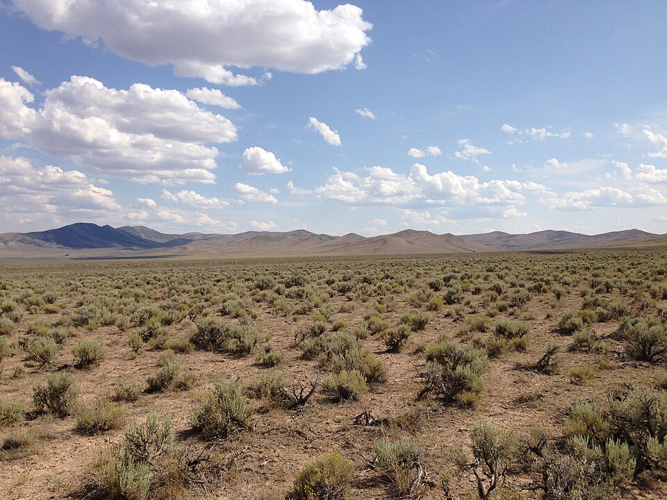
The Great Basin, covering Nevada and parts of Utah, Oregon, Idaho and California, has a hot, semi-arid to arid climate. Summer temperatures average 32°C (90°F), while winters can be cold, especially at higher altitudes. Annual rainfall is low: 15 to 30 centimetres (6 to 12 inches).
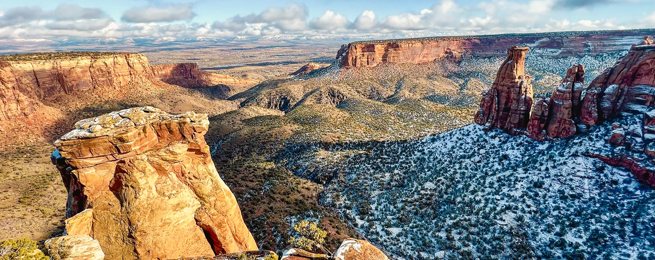
The Colorado Plateau in the south is cooler thanks to its higher elevation. Snow can fall in winter, while thunderstorms may occur in places reached by the North American monsoon rains (see below).
The southwest
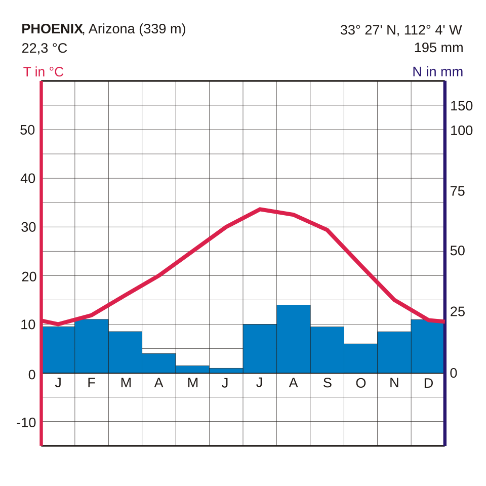
Southwestern US has a hot desert climate. Desert climates form where evaporation is greater than rainfall over long periods. Temperatures regularly climb over 38°C (100°F) during the summer months, with lows in the 20s or 30s°C (70s–80s°F). In winter, temperatures are cooler, averaging around 10°C (50°F).
The Mojave, Sonoran and Chihuahuan deserts—some of the driest and hottest parts of the country—cover parts of Nevada, southern California, Arizona, New Mexico and Texas. Summer temperatures in Death Valley, in the Mojave Desert, can be particularly high because descending warm air becomes trapped in the basin surrounded by mountains. The temperature there once reached 56.7°C (134°F), officially the highest temperature ever recorded on Earth.


As the land across the southwest heats up strongly in summer, cooler moist air from the Gulf of California, the eastern Pacific Ocean and the Gulf of Mexico is sometimes drawn northwards into the region. These seasonal winds, called the North American monsoon, bring thunderstorms, especially to high ground, often leading to flash flooding in areas that are sparsely covered by vegetation. The Sonoran Desert in southern Arizona and southeastern California, and the Chihuahuan Desert, farther east and higher in altitude, both receive summer rain from the North American monsoon.
California
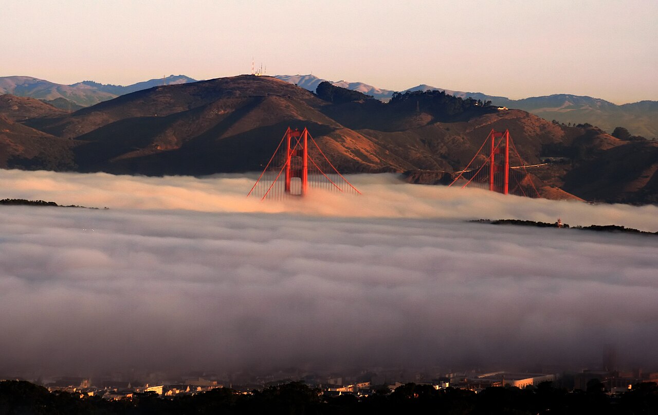
Much of coastal, northern and central California has a Mediterranean climate: mild, quite wet winters and warm or hot, dry summers. Temperatures range from 16°C (65°F) in winter to 27°C (80°F) in summer. Lying between the Coast Ranges and the Sierra Nevada, the Central Valley, has hot, dry summers, with daytime temperatures often over 30°C (90°F), and cool, sometimes foggy, winters.

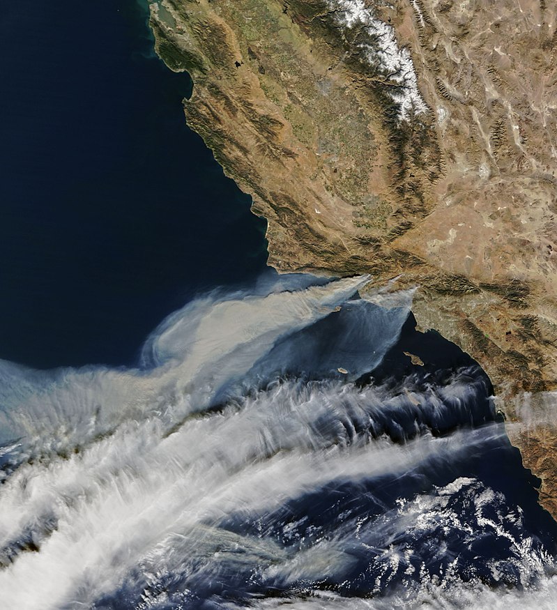
In winter, the jet stream often shifts southwards, allowing low-pressure systems that have formed over the Pacific Ocean to bring rain to California, or snow to its mountain ranges. In summer, high pressure over the eastern Pacific brings long dry spells, especially in central and southern parts of the state.
California is prone to wildfires. Vegetation grows during wetter periods, then dries during summer and autumn. In autumn, easterly mountain winds bringing hot, dry air across the Sierra Nevada from the arid Great Basin, known as the Diablo winds in northern California and the Santa Ana winds in the south, help spread the fires quickly.
Pacific northwest
The Pacific Northwest region, encompassing the western parts of the states Washington and Oregon, has a maritime climate, dominated by the Pacific Ocean. Winters are mild—temperatures seldom drop below freezing—and wet, while summers are usually cooler (21 to 26°C or 70 to 75°F) and drier than farther south.

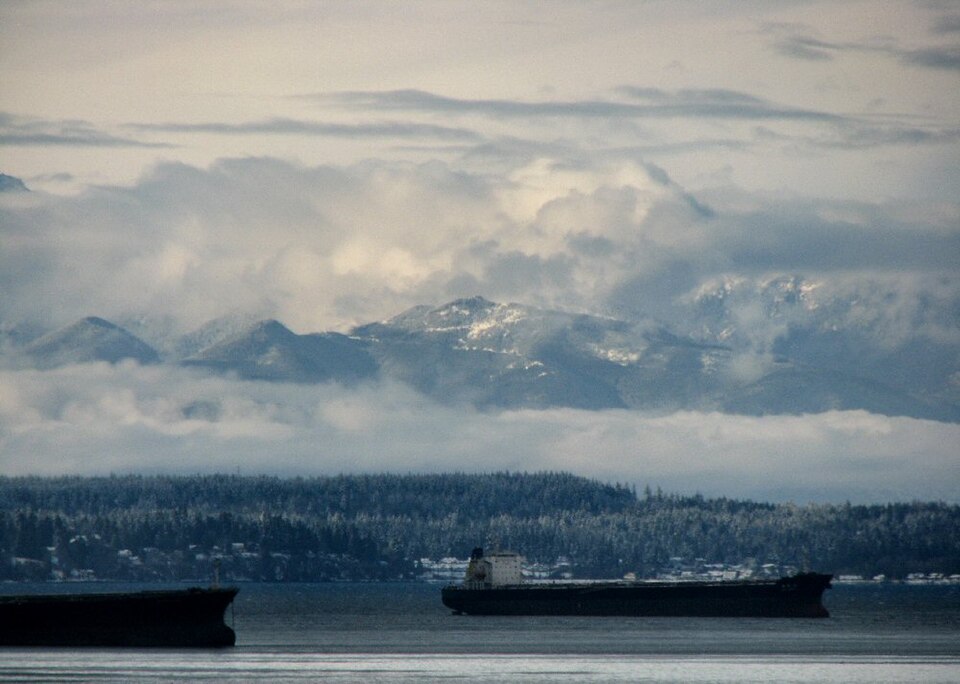
Moist air from the Pacific frequently moves westwards across the region. Forced to rise over the Coast and Cascade ranges, it releases rain or snow on the windward slopes. Rainfall is greater here than anywhere else in the continental US, with some areas having an annual average of 348 centimetres (137 inches) of precipitation. Areas east of the Cascades are much drier with annual precipitation averaging less than 38 centimetres (15 inches) because they lie in a rain shadow.

Long, narrow bands of water vapour that travel long distances—sometimes thousands of kilometres—through the atmosphere, known as atmospheric rivers, occasionally bring heavy storms to the region in winter. These may bring flooding, landslides and heavy mountain snowfall. Atmospheric rivers originating over Hawaii and flowing towards North America, arriving at latitudes from California to the Pacific Northwest and British Columbia, are known as Pineapple Express storms.


Alaska
Alaska has several climate types. Northern Alaska has a tundra climate, with long, cold winters and short, cool summers. Even in July, the temperatures in Barrow average just 34°F (1°C). Precipitation is low in the north, with many places averaging less than 10 inches (25 cm) per year, mostly as snow. Central Alaska has a subarctic continental climate. Lying far from the coast means winters are very cold. Summers can be warm because daylight lasts many hours. Southern and southeastern Alaska have a more maritime climate. The nearby ocean keeps temperatures less extreme than in the interior, but moist air brings more rain and snow than in other regions.

Hawaii
Although Hawaii, a group of islands in the central Pacific Ocean, is situated in the tropics, only its coastal areas experience a tropical climate. At sea level, it is hot all year round, with only a small temperature range: temperatures seldom rise above 90°F (32°C) or drops below 65°F (18°C). It is cooler at higher altitudes, with the highest peaks often receiving snowfall during the winter.
The islands receive most of their rainfall from the prevailing westerly trade winds on their northern and eastern sides. Storms bringing heavy especially rainfall in winter months (October to April). Mount Waialeale on Kauai has the second-highest average annual rainfall on Earth: about 1200 centimetres (460 inches) per year.


Climate change
From 2015 to 2024, the United States experienced its hottest 10-year peirod on record—a pattern that can only be explained by human-caused climate change through rising emissions of greenhouse gases. Extreme weather events, such as drought, heatwaves, wildfires and flooding are becoming both more frequent and more severe. The impact of climate change on hurricane wind speeds, rainfall intensity and storm surge levels, together with the threat of rising sea levels, have a particular effect on southern and eastern coastal regions.
Heatwaves


A heatwave is caused by what meteorologists describe as a "heat dome", an area of high pressure in the atmosphere lasting for several days up to several weeks. As warm air tries to rise, the high-pressure system lying above it pushes it back down to the Earth's surface. The air becomes denser and hotter as it is compressed. At the same time, the heat dome shuts off the normal flow of any cool air flowing inwards from the ocean.
Such an event used to happen only rarely, once every one to three decades. Experts say human-caused climate change is expected to increase the intensity, duration and frequency of such extreme weather events.
pics





Without in any way limiting Q-files Ltd’s exclusive rights under copyright, any use of this publication to “train” generative artificial intelligence (AI) technologies to generate text is expressly prohibited. Q-files Ltd reserves all rights to license use of this work for generative AI training and development of machine learning language models.