
Geography of the US

CITE
We have made every effort to follow citation style rules, but there may be some minor differences. If in doubt, please refer to the appropriate citation style manual.
Geology of the US. (2026). In Q-files Encyclopedia, Geography, Geography of the US. Retrieved from
https://www.q-files.com/geography/geography-of-the-us/geology-of-the-us
"Geology of the US." Geography, Geography of the US, Q-files Encyclopedia, 19 Aug. 2026.
https://www.q-files.com/geography/geography-of-the-us/geology-of-the-us.
Accessed 20 Aug. 2026.
Geology of the US 2026. Geography, Geography of the US. Retrieved 20 August 2026, from
https://www.q-files.com/geography/geography-of-the-us/geology-of-the-us
Geography, Geography of the US, s.v. "Geology of the US," accessed August 20, 2026.
https://www.q-files.com/geography/geography-of-the-us/geology-of-the-us


Geology of the US
Laurentia, also known as the North American craton, is the geological core of the North American continent. A craton is an ancient and stable area of continental crust that has remained undeformed by tectonic movements since the Precambrian. In eastern and central Canada (along with a few places in the northernmost United States), much of the craton is exposed at the surface as the Canadian Shield. Here, Precambrian igneous and metamorphic bedrock is exposed at the surface, blanketed by glacial till in some areas, thin soils in others. The southern and central portion of Laurentia forms what geologists call a platform in the Midwest and Great Plains regions of the US. Here, the craton's ancient rocks lie beneath layers of sedimentary rock: limestones, sandstones and shales deposited 650–290 million years ago.

PRECAMBRIAN
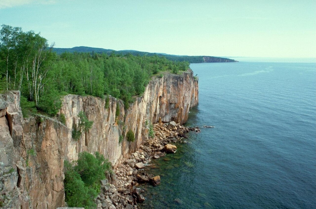
The oldest rocks in the United States, dating to between 3.5 and 3.6 billion years ago, are found in a region known as the Superior Upland, the southern tip of the Canadian Shield, which is found in parts of present-day Wisconsin, Minnesota and Michigan west and south of Lake Superior. Today a relatively flat region, billions of years ago it was mountainous. The peaks have long since been eroded away, with only isolated hills rounded by weathering, called monadnocks, remaining.
In most parts of the Superior Upland, the ancient rocks are blanketed by layers of glacial till left behind when the ice sheet melted at the end of the Pleistocene Ice Ages.
PALAEOZOIC ERA
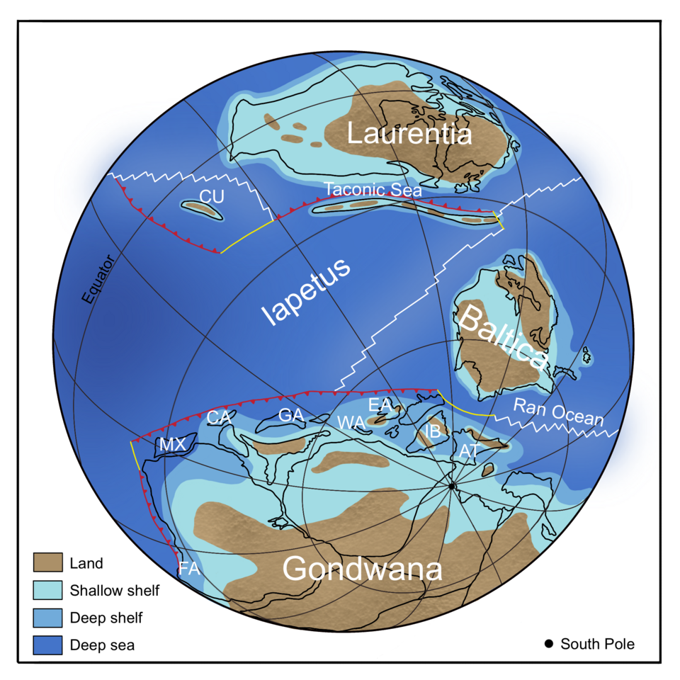
At the beginning of the Palaeozoic Era, the Cambrian Period (539–487 million years ago), Earth's continents were positioned around the globe completely differently to how they are today. The southeastern part of the US was connected to South America and Africa. Together, they formed the supercontinent of Gondwana, which lay close to the south pole. Laurentia, then joined together with the northwestwestern part of Great Britain, was located near the equator. Large parts of Laurentia was covered over by warm, shallow seas and thick layers of marine sediment.

Taconic Orogeny
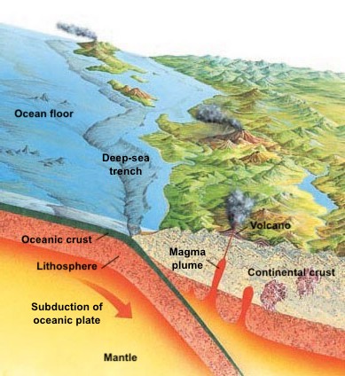
Over the course of the Ordovician Period (487–443 million years ago), the ancient ocean separating Laurentia from the continent of Baltica, the Iapetus Ocean, began to close up as the two small continents drifted towards one another. The Iapetus oceanic plate slid beneath Laurentia, forming a subduction zone. A period of mountain-building, known as the Taconic Orogeny, followed. Volcanoes began to erupt along Laurentia's southeastern edge while folding and faulting caused the sedimentary rock layers in the region to crumple and uplift, producing a mountain range we know today as the Appalachians. As the mountains rose, weathering and erosion wore them down again. Rivers and streams carried sediments away and deposited them in nearby lowlands.

Alleghenian Orogeny
The Taconic was just one of a series of mountain-building episodes that, over hundreds of millions of years, formed the Appalachians as they appear today.
By around 320 million years ago, during the Pennsylvanian (Late Carboniferous), the continent of Euramerica (Laurussia)—the combined landmass resulting from the collision between Laurentia and Baltica—had started to push up against another ancient continent, Gondwana, which lay to the south. The two continents would join together to form Pangaea, the giant supercontinent making up nearly all Earth's landmasses, surrounded by one vast ocean, the Panthalassa. As a result, the region that is now the southeastern United States, which was originally part of Gondwana, now became joined to the rest of North America.

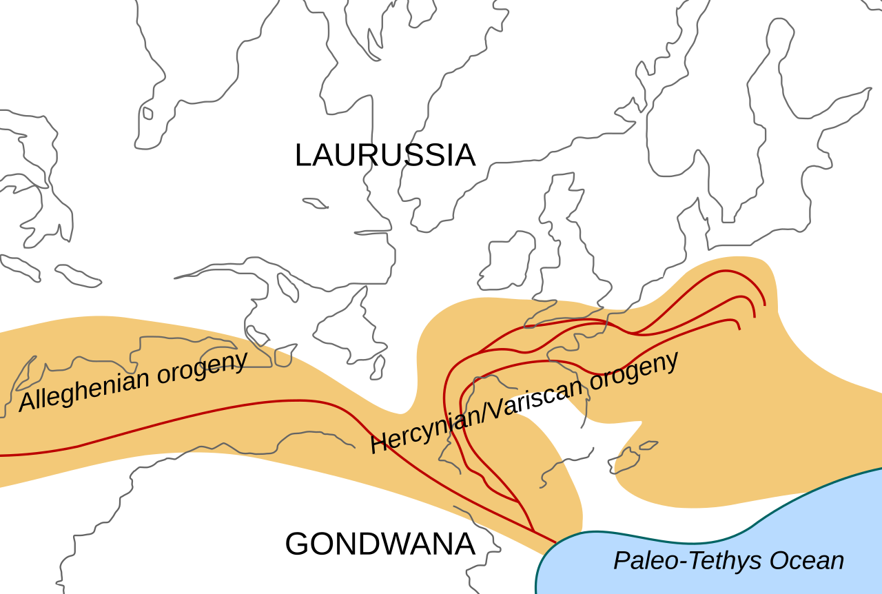
The collision between Laurussia and Gondwana led to a new episode of mountain-building. This is known as the Variscan (or Hercynian) Orogeny in Europe and the Alleghenian Orogeny in the United States and Canada. As the two tectonic plates pressed together, that part of the Earth's crust in the collision zone—consisting not only of the Appalachians but also the Ozark-Ouachita region through to the Marathon Mountains of Texas—started to buckle. By the time the orogeny came to an end (260 million years ago, during the Permian) the mountains had been pushed up to towering, Himalayan-like heights.
MESOZOIC ERA
The world's landmasses remained locked together as the supercontinent of Pangaea for the rest of the Permian and throughout the Triassic Period. Most of the eastern US was hot and arid, while for much of the time the western part lay under warm, shallow seas.
Break-up of Pangaea
About 200–175 million years ago, at the beginning of the Jurassic, Pangaea began to break up into separate continents once more. Rift valleys opened up between the continental plates as North America, Europe and Africa moved apart. With the gash between the spreading continents becoming wider and wider, seawater flooded in, forming a new ocean basin: the Atlantic Ocean.
During the rifting, a trough formed between the southern Appalachians and the Ouachita-Ozark Highlands—until then, a continuous mountain range. The trough was flooded by seawater. When sea levels dropped later, the Mississippi River extended its course into the trough, which gradually became filled with alluvium. Today this trough is known as the Mississippi Embayment.
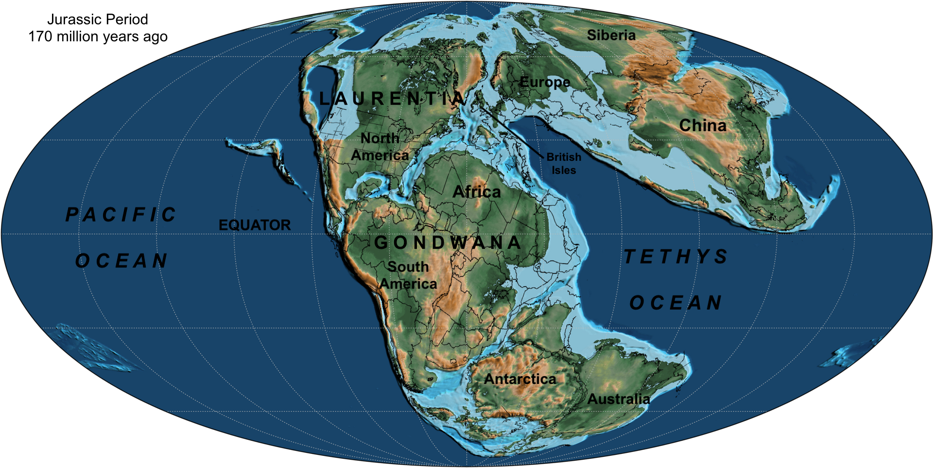
Through the Jurassic Period (201–144 million years ago), the Atlantic sea floor continued to spread, moving North America westwards. The Atlantic coast, the outer edge of the continental plate, sloped gently down to meet the adjacent oceanic plate under seawater. The climate of the Atlantic plain also became wetter, as the newly formed Atlantic Ocean brought it into contact with more humid air.

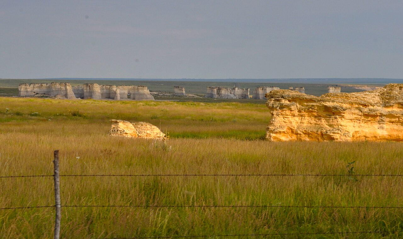
On several occasions during the Jurassic, rising seas flooded the low-lying areas of the continent's interior, creating the Sundance Sea. Sediments eroded by rivers from the highlands to the west were washed into it. Preserved in this sand, mud and clay were the remains of countless dinosaurs that lived and died in the lowlands along the Sundance coast. The seam of sedimentary rock where the fossils are found today, a region centred on in Wyoming and Colorado, is known as the Morrison Formation.
Farallon plate subduction
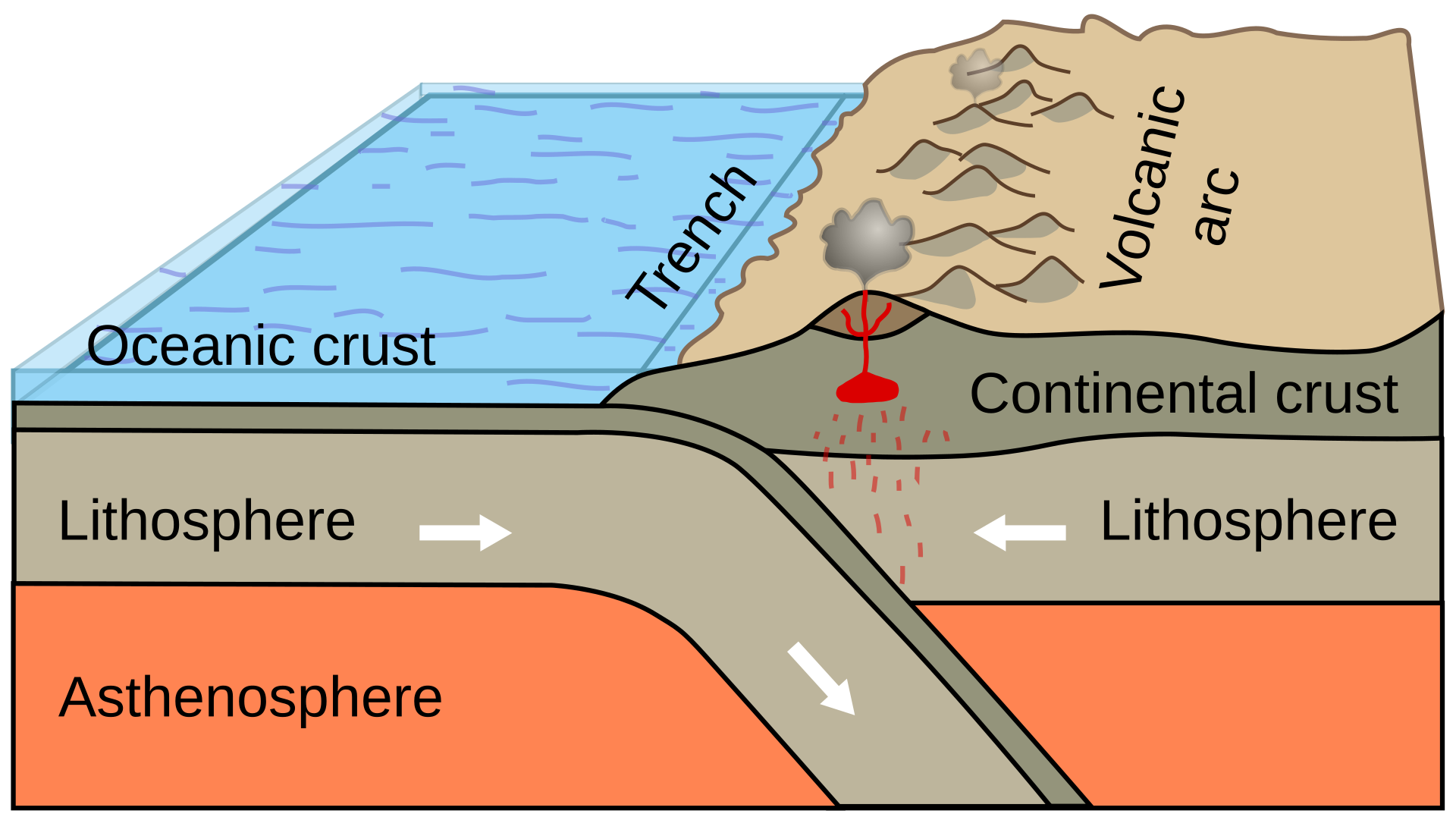
In the west, the Farallon plate, one of the tectonic plates then making up the Pacific Ocean crust, forced its way under the North American plate during the Jurassic, continuing on through the Cretaceous. The subduction triggered extensive volcanic eruptions, pushing up volcanic mountain ranges in the western US. At the same time inland, vast masses of magma rose up into the North American continental crust. By the end of the Cretaceous, 66 millon years ago, much of western North America had been added in the form of small slivers of continental crust, known as terranes, that were wedged into position, or accreted, by the Farallon subduction.


Western Interior Seaway
Also during the Cretaceous Period (144–66 million years ago), the waters of the Gulf of Mexico rose and spread northwards, reaching as far as Alaska. A large part of North America's low-lying interior thus became submerged beneath this vast shallow sea, known as the Western Interior Seaway. It covered the majority of states of Texas, New Mexico, Oklahoma, Colorado, Kansas, Nebraska, the Dakotas and Wyoming. The continent was now divided in two: Laramidia in the west, Appalachia in the east. The Atlantic and Gulf plains also lay under shallow seas during the Cretaceous.
CENOZOIC ERA
Laramide Orogeny
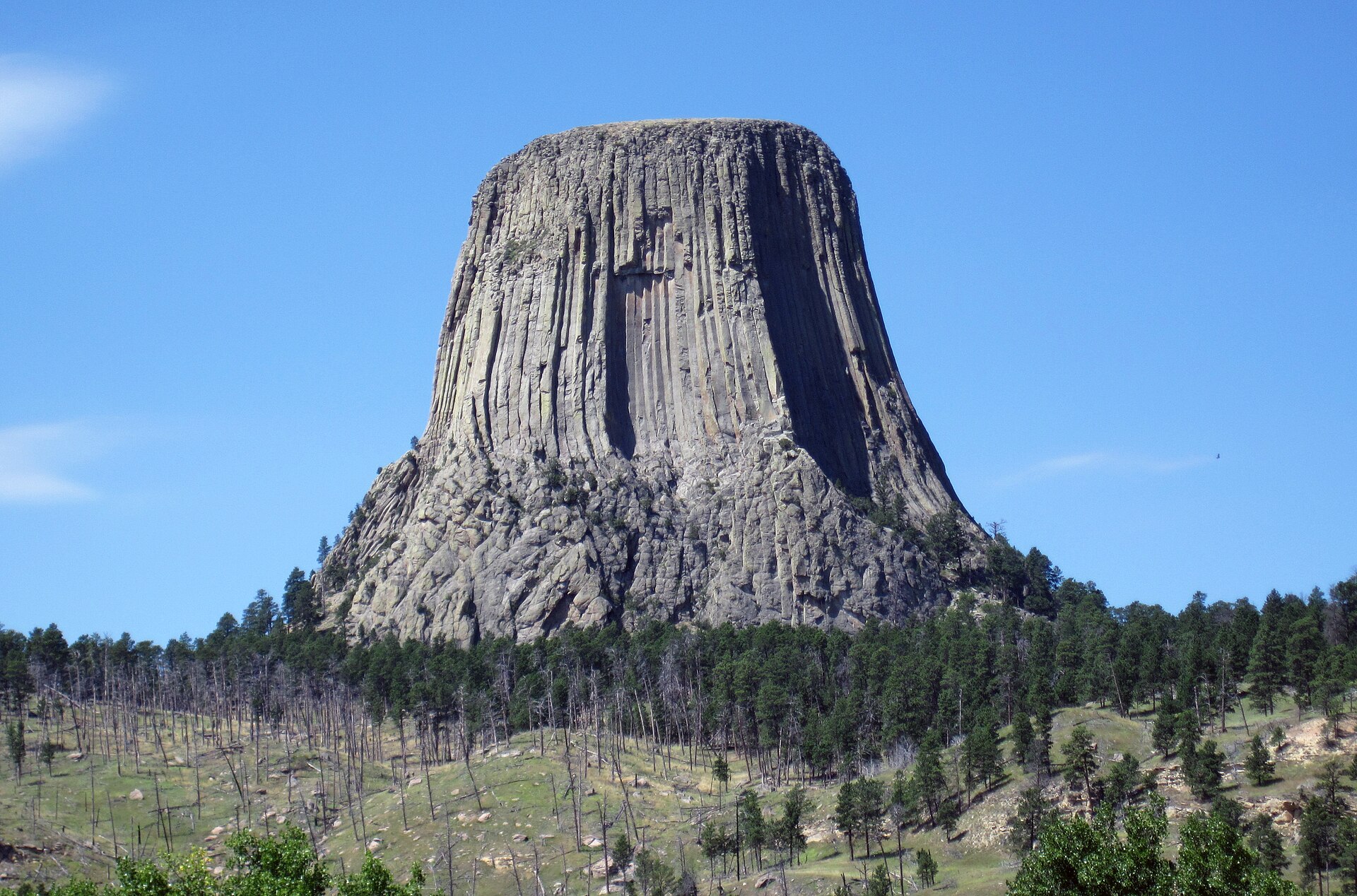
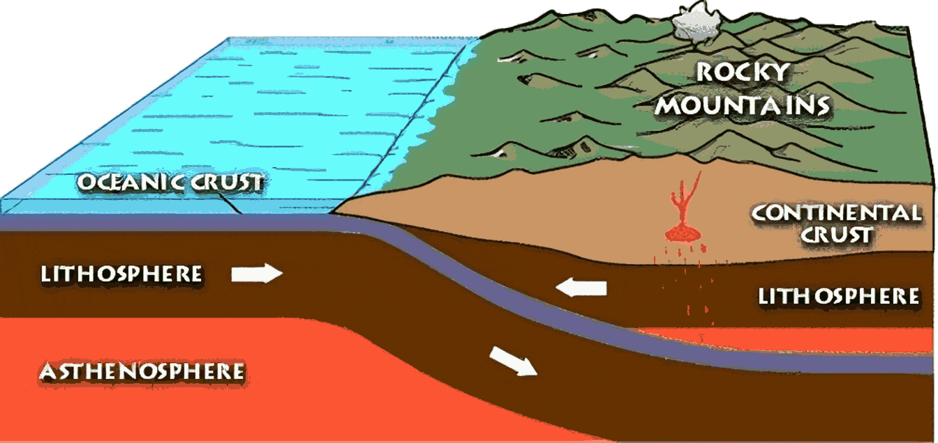
A new geological era began after the mass extinctions at the end of the Cretaceous 66 million years ago: the Cenozoic Era. With the Pacific plate continuing to slide under the North American plate in the west, the pressure caused the ancient rocks of Idaho, Utah and Wyoming to buckle and fold, beginning the process that would form the Rocky Mountains and the Black Hills. The Laramide Orogeny, which lasted between roughly 70 and 40 million years ago, saw a high plateau pushed up roughly 6000 metres (20,000 feet) above sea level. Since then, erosion gnawed away at the summits, forming the current landscape of the Rockies. Periods of glaciation during the Pleistocene epoch (2.6 million–11,700 years ago) left their mark, with the creation of U-shaped valleys, sharp arêtes and other glacial features.

San Andreas Fault
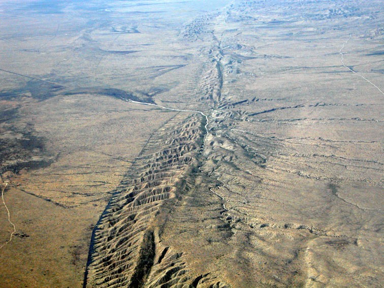
Around 30 million years ago, the Pacific and North American plates came together in California. Instead of pressing into one another, or one sinking beneath the other, the plates began sliding past each other, creating what is known as a strike-slip (or transform) fault line. Still active today, the 1200-kilometre-long (750-mile) horizontal sliding boundary is known as the San Andreas Fault.
The Pacific plate has moved about 300 kilometres (about 200 miles) northwestwards relative to the North American plate since the fault came into existence. Moving at 5 to 7 centimetres (2–3 inches) a year, the San Andreas is one of the most active fault zones in the world and the potential site of major earthquakes.

Basin and range
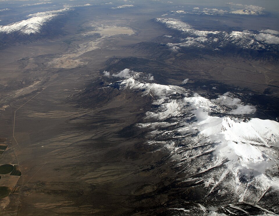
During the Miocene epoch, less than 20 million years ago, tectonic movements began to stretch the continental crust east of the Sierra Nevada in an east–west direction. The crust thinned and cracked, producing long faults running in a north-south direction. Along these fault lines, mountains were uplifted and valleys dropped.
As the mountain ranges rose up, the exposed bedrock was attacked by water, ice and wind. Rock fragments were washed down the mountainsides by rivers, collecting as sediment in the adjacent valleys. The result is basin and range topography, a landscape of long, north-south aligned ridges separated by tracts of flat desert, extending from eastern California to central Utah, and from southern Idaho to the state of Sonora in Mexico.
Colorado Plateau
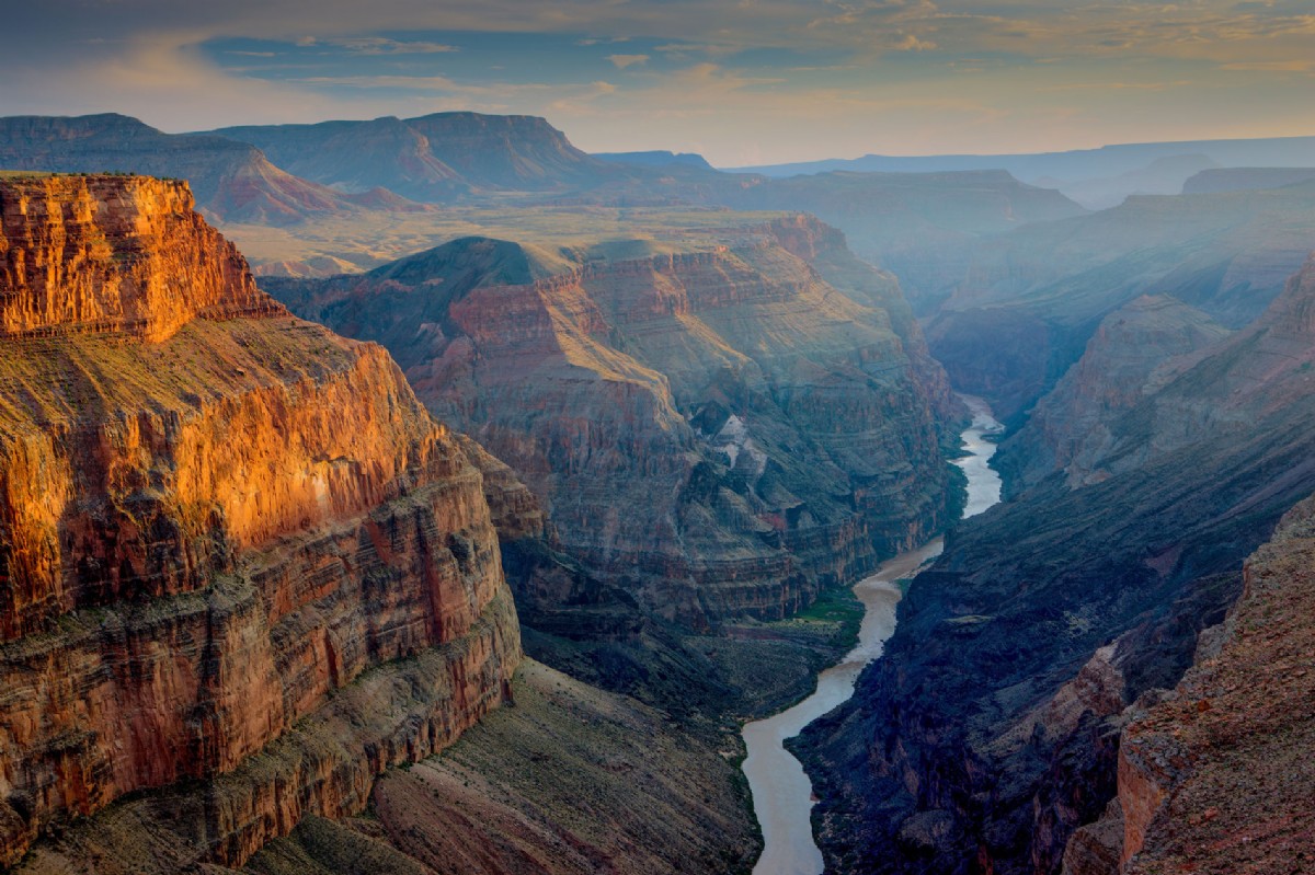
At the same time as the Basin and Range mountain ranges were being uplifted, so the Colorado Plateau to the south rose about 3 kilometres (2 miles). As it did so, the river and streams flowing across it cut deeper and deeper channels. One, the Colorado River, began to carve the Grand Canyon, probably around 6 million years ago. The forces of erosion have exposed a roughly horizontal sequence of rock layers laid down over many hundreds of millions of years.
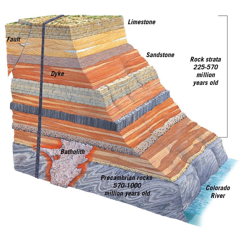
Ancient Precambrian rocks make up the basement of the Colorado Plateau. Most are metamorphic rocks formed deep within the Earth's crust billions of years ago. During the Palaeozoic Era, the Colorado Plateau region was periodically flooded by seawater. Thick layers of sediment were laid down in the shallow waters, later compacting to form limestone, sandstone, siltstone and shale. Layer upon layer of sedimentary rock accumulated, followed by vast deposits of sand from the deserts that formed here later, hardening into sandstone.
While tectonic forces thrust up the Rocky Mountains to the north and east, and crust-stretching tension created the Basin and Range Province to the west and south, the Colorado Plateau experienced relatively little faulting or folding within the last 600 million years.
Sierra Nevada

Less than 5 million years ago, the Sierra Nevada in California began to be uplifted. The block of land to the west of a north-south fault line rose, while the area to the east dropped down. The onset of the Pleistocene Ice Ages about 2.6 million years ago saw glaciers carving out deep U-shaped valleys and sharpening ridges between valleys into narrow arêtes. The landscape of the Yosemite National Park was created during this period.

Cascades
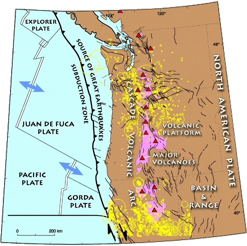
The Cascade Range is the product of thousands of volcanic eruptions, out of which has risen a chain of large active volcanoes such as Mount St Helens. They form part of the Ring of Fire that runs round the eastern, northern and western rim of the Pacific Ocean. More than 3000 vents have erupted since around 5 million years ago, triggered by the Cascadia subduction zone, where the oceanic Explorer, Juan de Fuca and Gorda plates (all remnants of the Farallon plate, see above) slide beneath the continental North American plate. Earthquakes are a common occurrence in the Cascadia zone, with Seattle and Tacoma, Washington, and Portland, Oregon, at risk.
Columbia Plateau
Far inland from the subduction zone abutting the Pacific coast of the US lies the Columbia Plateau. Spanning parts of the states of Washington, Oregon and Idaho, this arid lowland area is bordered by the Cascades, the Rockies and the Blue Mountains in Washington. The plateau was formed from a massive outpouring of lava, probably originating as a hot spot, the place where an extremely hot plume of magma from the Earth's mantle, rises to the surface. The hot spot is stationary, but the North American plate is moving over it in a westwards direction, making the hot-spot track appear to be travelling eastwards.
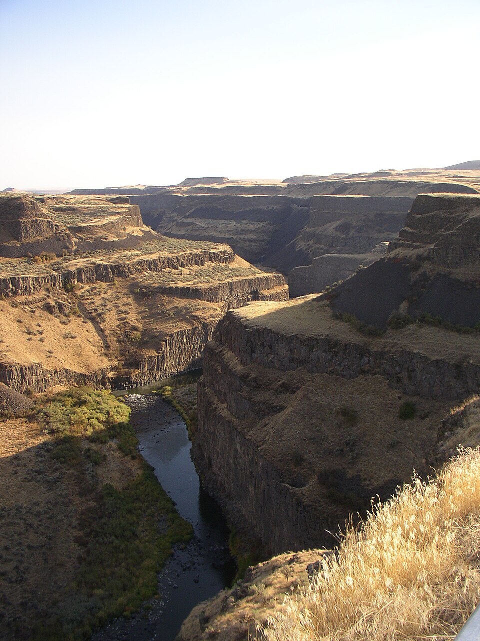

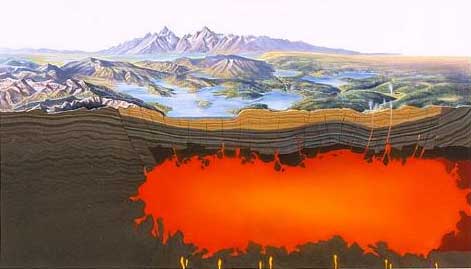
The western Columbia Plateau, the Columbia River basalts, is the oldest part (and farthest west of the hot spot), formed between 17 and 6 million years ago. To the east, the Snake River Plain formed 5–1.6 million years ago. Today, the most volcanically active area is focused on Yellowstone, located in the northwest corner of the state of Wyoming. Beneath it lies the Yellowstone Caldera, the largest supervolcano in North America, currently dormant.
Appalachian Mountains
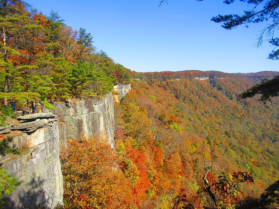
After millions of years of weathering and erosion, the Appalachian Mountains wore away, so that by the end of the Mesozoic Era, they were an almost flat plain. During the Cenozoic, the region was uplifted, possibly as recently as 8 to 12 million years ago, in the Miocene epoch. As the landscape rose, rivers and streams cut downwards at a rapid pace, slicing through resistant rock layers to create the deep valleys and gorges seen today.
Ice Ages
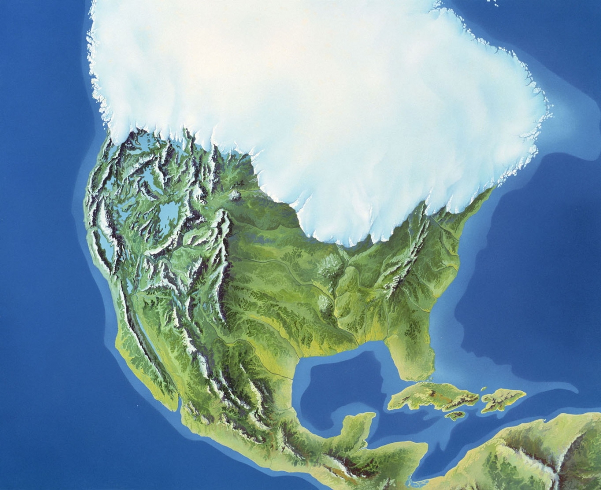
Large parts of North America were once covered by ice. Between around 2.6 million years and 11,700 years ago, the Pleistocene epoch, ice sheets and glaciers advanced and retreated on several occasions. During the colder periods, known as glacials, ice sheets expanded across North America. At the Last Glacial Maximum (the maximum extent of the most recent glacial), around 26,000 to 20,000 years ago, the Laurentide Ice Sheet covered most of present-day Canada and extended south into the northern US. The massive weight of the ice depressed the Earth's crust while the moving ice gouged out giant basins. These became filled with meltwater as the ice sheet retreated and now form the Great Lakes.
As the ice sheet melted, rock fragments of all sizes that had been plucked from the ground and carried along by the icy mass were left behind, covering much of the Superior Upland landscape. This material, called glacial till, consists mostly of clay, silt and sand, but with scattered pebbles, cobbles and boulders.

Consultant: Nicholas Harris
pics


Without in any way limiting Q-files Ltd’s exclusive rights under copyright, any use of this publication to “train” generative artificial intelligence (AI) technologies to generate text is expressly prohibited. Q-files Ltd reserves all rights to license use of this work for generative AI training and development of machine learning language models.