
States of the US

CITE
We have made every effort to follow citation style rules, but there may be some minor differences. If in doubt, please refer to the appropriate citation style manual.
Wyoming. (2026). In Q-files Encyclopedia, Geography, States of the US. Retrieved from
https://www.q-files.com/geography/states-of-the-us/wyoming
"Wyoming." Geography, States of the US, Q-files Encyclopedia, 1 Apr. 2026.
https://www.q-files.com/geography/states-of-the-us/wyoming.
Accessed 6 Aug. 2026.
Wyoming 2026. Geography, States of the US. Retrieved 6 August 2026, from
https://www.q-files.com/geography/states-of-the-us/wyoming
Geography, States of the US, s.v. "Wyoming," accessed August 6, 2026.
https://www.q-files.com/geography/states-of-the-us/wyoming


Wyoming
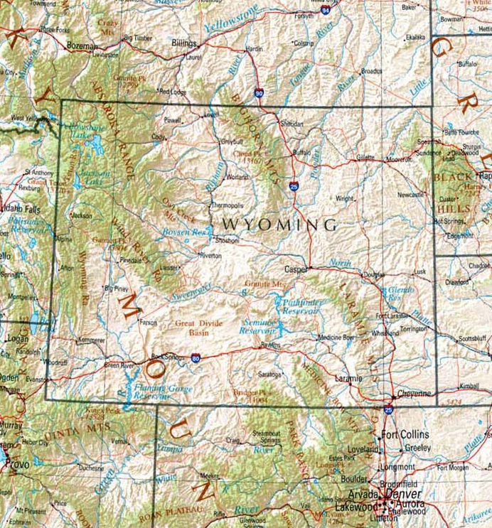
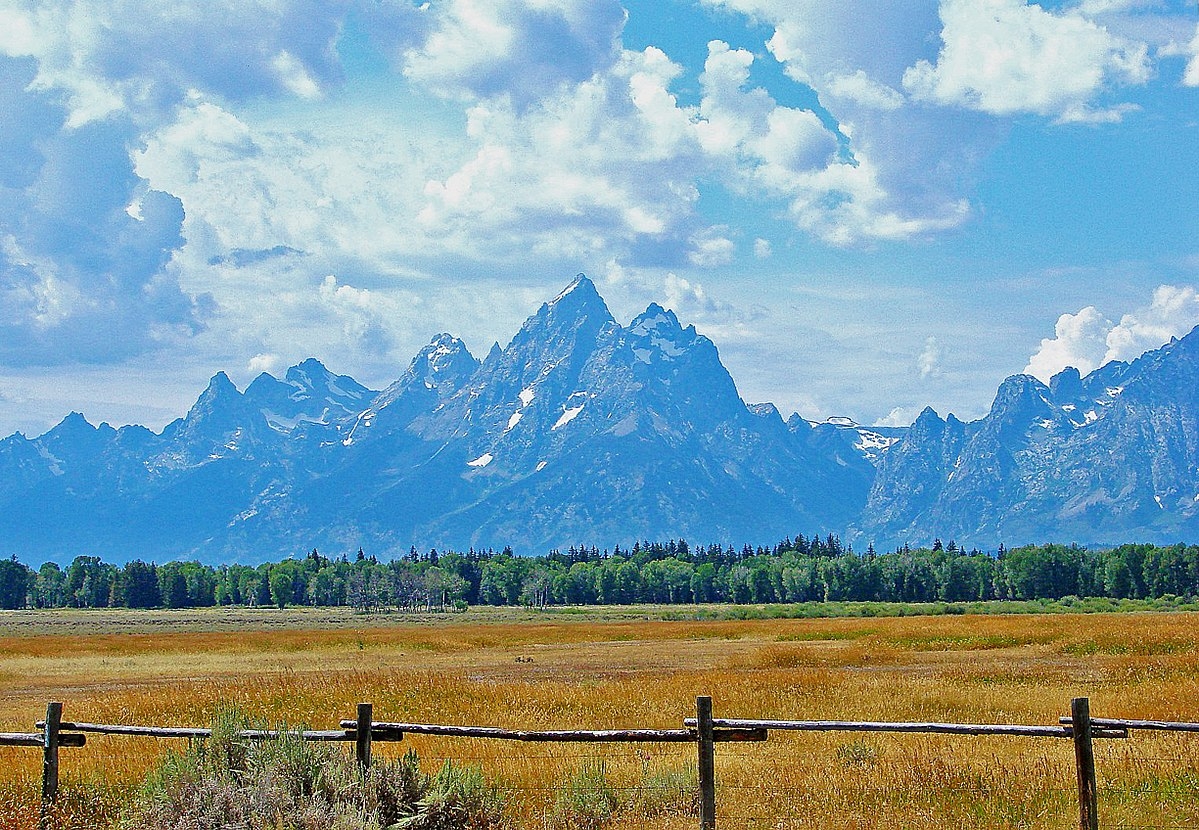
Wyoming is a state in the western region of the United States. The western two-thirds of the state is dominated by the foothills and ranges of the Rocky Mountains. In southwestern Wyoming, the arid Great Divide Basin lies across the Continental Divide (westward-bound travellers along the Oregon Trail in the 1840s took the South Pass just to the north of the Basin.) Wyoming has two national parks: Grand Teton, which includes the highest peaks of the Teton Range, and Yellowstone, which takes up the northwestern corner of the state. Eastern Wyoming forms part of the Great Plains, a high tableland once covered with prairie grasses and sagebrush. Today, farms and ranches occupy this region.
Name
Wyoming received its name from the US Congress when Wyoming Territory came into existence in 1868. It was named after the Wyoming Valley in Pennsylvania, made famous by the Battle of Wyoming (1778) during the Revolutionary War, when British troops and their Iroquois allies inflicted defeat on the American Patriots. Why the name was given to the distant western territory remains a mystery. The name Wyoming originally came from the Native American Munsee Delaware word chwewamink, meaning "at the big river flat”.
Climate
Wyoming's climate is generally semi-arid with less than 10 inches (250 mm) of rainfall per year—apart from mountainous areas, which may receive up to twice that amount, often as snow in winter. Summers are hot and dry, with cooler temperatures in the mountains. Winters are cold, although Chinook winds from the west sometimes bring milder temperatures. The southeast corner is the most vulnerable to tornado activity.


Economy
Wyoming's vast plains provide grazing lands for sheep and cattle. Horses and pigs are also raised. Principal crops, grown in irrigated southeastern areas, include wheat, oats, sugar beet, maize, barley and alfalfa hay.
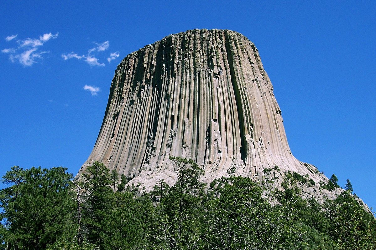
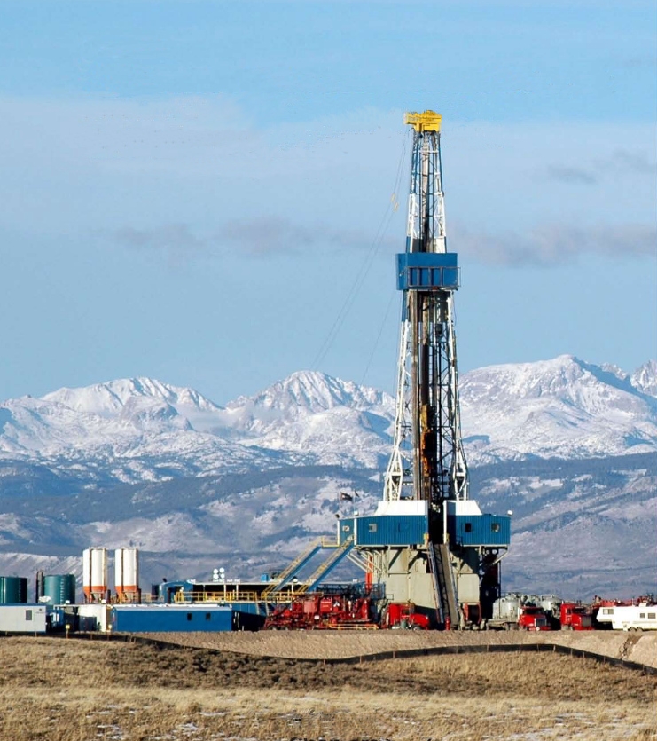
Wyoming has abundant mineral resources, and mining is important to the state's economy. Coal, oil, natural gas, uranium and sodium carbonate (natrona or trona, a mineral used in the manufacture of glass, paper, soap, baking soda and pharmaceuticals) are the chief products. With Grand Teton National Park, Yellowstone National Park, Devils Tower National Monument, Independence Rock and Fossil Butte National Monument as major attractions, tourism is vital to the economy. Chief manufactures include processed foods and clay, glass and wood products.
Facts about Wyoming
Area 97,914 sq miles (253,600 sq km)
Highest point Gannett Peak 13,809 ft (4209 m)
Population 584,057
Capital Cheyenne
Largest cities Cheyenne, 65,168; Casper, 58,720; Gillette, 33,496; Laramie, 32,152; Rock Springs, 22,954
Nickname The Equality State
State bird Western meadowlark
State flower Indian paintbrush
State tree Cottonwood


Consultant: Nicholas Harris
History of Wyoming
before 18th century
Several Native American peoples live in the region now known as Wyoming at the time of the arrival of the first European explorers. They include the Crow, Arapaho, Lakota and Shoshone
late 18th century
French-Canadian fur trappers from Québec and Montréal explore the region
1803
The US acquires an area that includes a major portion of Wyoming from France as part of the Louisiana Purchase
1807
John Colter, a fur-trapper and member of the Lewis and Clark Expedition, explores the Yellowstone area. He returns to St Louis in 1810 with accounts of the geysers and canyons he found there
1812–13
Robert Stuart pioneers the Oregon Trail across Wyoming, crossing the Rockies via the South Pass
1834
Fort William, later Fort Laramie, the first permanent fur-trading post in Wyoming, is built
1840s
The route west through Wyoming is in regular use by migrants heading towards Oregon; as the fur trade declines, many former trappers settle along the Trail, selling horses and other supplies to the migrants
1846
Western Wyoming is obtained by the US in the Oregon Treaty with Great Britain
1848
What is now southwestern Wyoming is ceded to the United States from Mexico at the end of the Mexican–American War
1850
Jim Bridger locates what is now known as Bridger Pass, a route through the Rocky Mountains
1860s
Native Americans hostile to settlers on their hunting grounds force the re-routing of stagecoaches to the south
1868
Completion of the Wyoming sector of the Union Pacific Railroad. Towns, such as Cheyenne, spring up beside it
1868
Wyoming Territory is established, with Cheyenne as its capital
1869
Wyoming women become the first in the US to obtain the right to vote
1870s
Native American resistance is crushed: the Arapaho and Shoshone are moved on to the Wind River Reservation
1872
Yellowstone National Park, the world's first national park, is created
1880s–90s
Cattle rustling (thieving) becomes common, along with lawlessness such as bank and train robberies
1890
Wyoming is admitted to the Union as the 44th state
1921–23
Teapot Dome scandal: Secretary of the Interior Albert Bacon Fall leases Navy petroleum reserves at Teapot Dome in Wyoming to private oil companies at low rates without competitive bidding. Fall is convicted of accepting bribes from the oil companies and goes to prison. The affair greatly damages the reputation of the administration of President Warren G. Harding
1924
Wyoming becomes the first state to elect a female governor, Nellie Tayloe Ross
1975
Wyoming Infrared Observatory (WIRO), located 40 km (25 miles) southwest of Laramie on Jelm Mountain, is founded
1988
Yellowstone fires form the largest wildfire in the recorded history of Yellowstone National Park. Starting as many individual fires, the flames quickly spread out of control due to drought conditions and increasing winds, combining into one large wildfire which burns for several months. About 36% of the park is affected
pics
Without in any way limiting Q-files Ltd’s exclusive rights under copyright, any use of this publication to “train” generative artificial intelligence (AI) technologies to generate text is expressly prohibited. Q-files Ltd reserves all rights to license use of this work for generative AI training and development of machine learning language models.