
States of the US

CITE
We have made every effort to follow citation style rules, but there may be some minor differences. If in doubt, please refer to the appropriate citation style manual.
South Dakota. (2026). In Q-files Encyclopedia, Geography, States of the US. Retrieved from
https://www.q-files.com/geography/states-of-the-us/south-dakota
"South Dakota." Geography, States of the US, Q-files Encyclopedia, 1 Apr. 2026.
https://www.q-files.com/geography/states-of-the-us/south-dakota.
Accessed 20 Aug. 2026.
South Dakota 2026. Geography, States of the US. Retrieved 20 August 2026, from
https://www.q-files.com/geography/states-of-the-us/south-dakota
Geography, States of the US, s.v. "South Dakota," accessed August 20, 2026.
https://www.q-files.com/geography/states-of-the-us/south-dakota


South Dakota
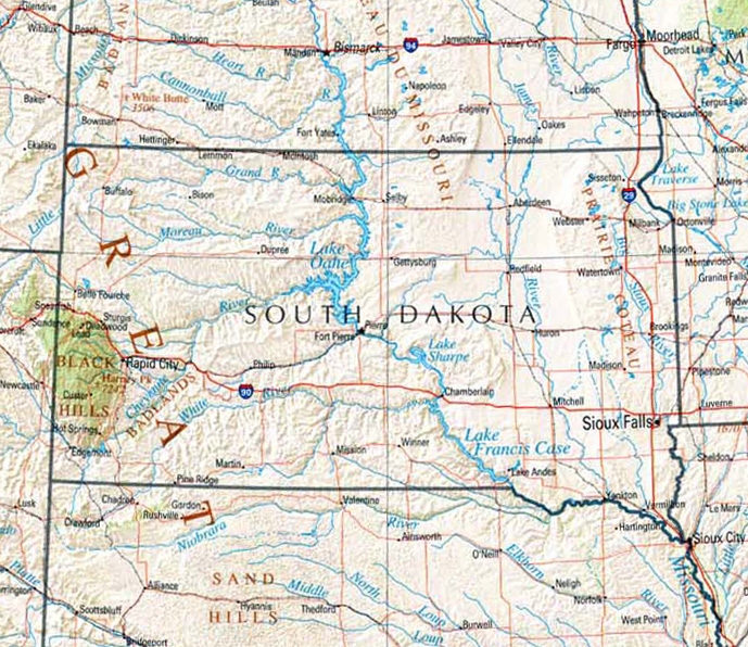
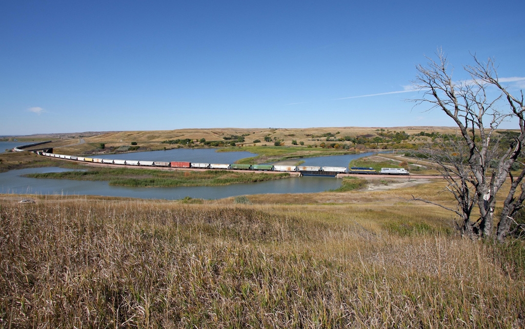
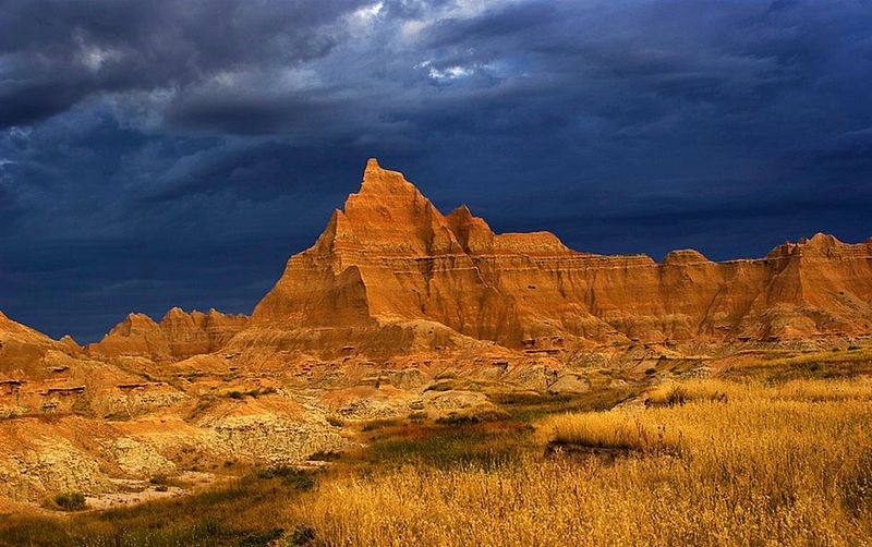
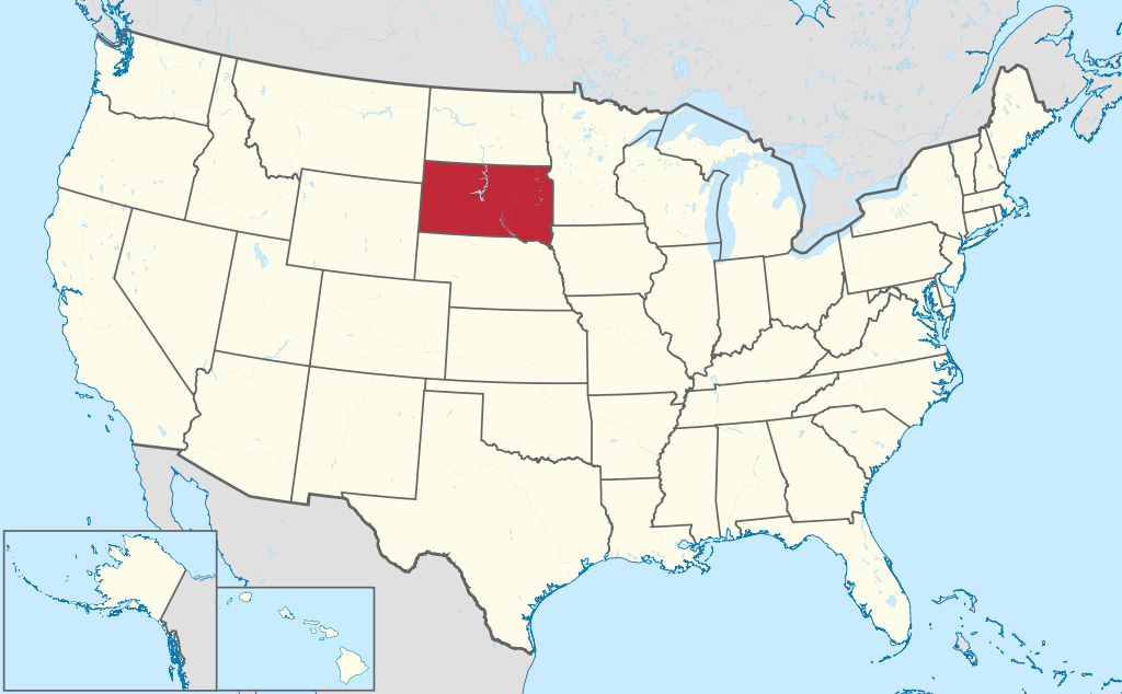
South Dakota is located in the Upper Midwest region of the United States. The Missouri River divides the state, which lies entirely in the Great Plains, into two regions, called East River and West River. The East is flatter and more fertile than the West, and much of the land here is used for both grazing and cultivation. The West is drier and more rugged, with plains, ravines and steep, flat-topped hills called buttes. Where possible the land is used for cattle and sheep ranching. Between the White River and the Cheyenne River lie the Badlands, a landscape featuring deeply eroded gullies. The Black Hills rise on the border with Wyoming.
Name
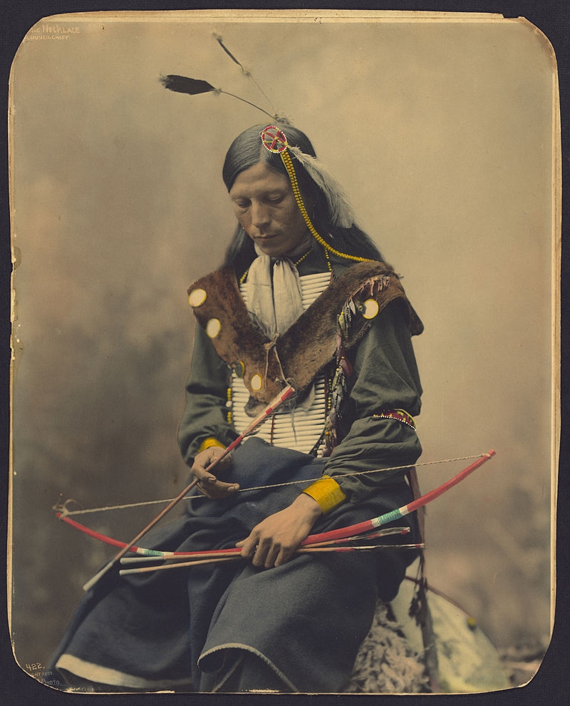
Among the Native American peoples who settled in the South Dakota region were the Lakota and Dakota (both part of the Sioux group). The word "Dakota" is a version of a Lakota word meaning "friends". Today’s states of North and South Dakota were once joined together as Dakota Territory. North Dakota and South Dakota were admitted to the union as separate states on 2nd November 1889.
Climate
South Dakota has a continental climate, with hot summers and bitterly cold winters. Summer daytime temperatures climbing above 100°F (38°C) are not uncommon, while temperatures in the depths of winter average below 10°F (-12°C). Sometimes severe blizzards blanket the state with snow. The average annual rainfall is low, and becomes lower across South Dakota going from east to west, where it is semi-arid. In years of drought, summer winds remove large amounts of topsoil in what are known as "black blizzards”.
Summers bring frequent, sometimes severe, thunderstorms to South Dakota. The eastern part of the state is part of Tornado Alley, and South Dakota experiences an average of 30 tornadoes each year.

Economy
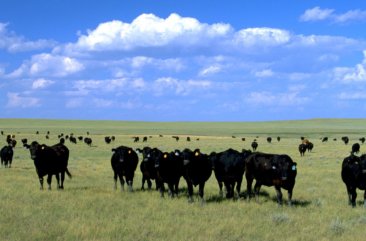
South Dakota is a leading producer of sunflowers (for their seeds and oil). Other crops include soya beans, wheat, oats, maize, barley, flaxseed, sorghum and alfalfa. Cattle, sheep and pigs are widely raised. Meat-packing, food processing and ethanol production are the state’s major industries. Ellsworth Air Force Base, near Rapid City, is the one of the largest employers in the state. Tourism is a booming industry: the Mount Rushmore sculpture of US presidents in the Black Hills is major draw, as is the Badlands region.

Facts about South Dakota
Area 78,116 sq miles (199,729 sq km)
Highest point Black Elk Peak 7244 ft (2208 m)
Population 919,318
Capital Pierre (pop. 13,880)
Largest cities Sioux Falls, 206,410; Rapid City, 79,404; Aberdeen, 28,110
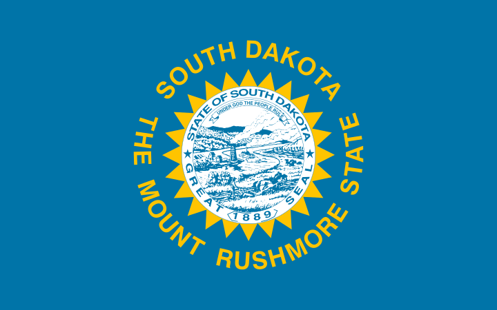
Nicknames Mount Rushmore State, Coyote State
State bird Western meadowlark
State flower Ring-necked pheasant
State tree Black hills spruce
Consultant: Nicholas Harris
History of South Dakota
18th century
South Dakota is inhabited by Native American Arikara (Ree) and Sioux (Dakota and Lakota) peoples at the time the first European explorers arrive
1743
French explorers, brothers Louis-Joseph and François Vérendrye, visit the South Dakota area; they claim the region for France as part of greater Louisiana
1762
Today’s South Dakota is part of the vast region granted by the French to Spain and becomes Spanish Louisiana
early 19th century
Sioux become dominant, driving out the Arikara
1803
The United States acquires the region from the French (who re-acquired it from Spain in 1802) as part of the Louisiana Purchase
1804–06
South Dakota is visited by Lewis and Clark as part of their Missouri River expedition
1817
Fort Pierre is founded by Pierre Chouteau and the American Fur Company as a fur trading post
1850s
Farmers start to move westward from Minnesota and Iowa to establish settlements such as Sioux Falls, Yankton, Bon Homme and Vermillion in today’s South Dakota
1858
Treaty agreed by the Lakota, in which most of present-day eastern South Dakota is ceded to the United States, opening the land between the Big Sioux and the Missouri River for settlement
1861
Dakota Territory, including today’s North and South Dakota, as well as eastern Wyoming and eastern Montana, is established with Yankton as its capital
1868
Treaty of Laramie: US grants the entire western half of present-day South Dakota (West River) to the Lakota, including the Black Hills region
1870s-80s
Great Dakota land boom: after the railway connects Yankton with the rest of the country (1873), immigrants, including those from Germany, Scandinavia and Russia, arrive in great numbers
1874
Gold is discovered in the Black Hills during a military expedition led by George Custer; miners and explorers began illegally entering land promised to the Lakota, leading to war
1876–77
Great Sioux War (Black Hills War) between US and Lakota Sioux. Despite Lakota victory at Battle of the Little Bighorn, US defeat them. By the Agreement of 1877, the US officially annexe Lakota lands and permanently establish five Native American reservations
1889
Dakotas are separated; South Dakota becomes a state with Pierre as its capital
1890
Wounded Knee Massacre on the Pine Ridge Indian Reservation, the last major armed conflict between the US and the Lakota Sioux. At least 146 Sioux, many of them women and children, are killed
1890s
Near-extinction of the buffalo herds, defeat in the Indian wars and the death of key Sioux leaders lead to the end of Native American resistance to white settlement in South Dakota
1927–41
Mount Rushmore National Memorial is created in the Black Hills near Keystone, South Dakota. Sculptor Gutzon Borglum oversees the carving in granite of the 60-ft (18-m) heads of presidents George Washington, Thomas Jefferson, Theodore Roosevelt and Abraham Lincoln
1930s
Dust Bowl, a period of severe dust storms caused by drought and damaging over-ploughing of the land, leads to the failure of several harvests and thousands of families abandoning their farms in South Dakota and elsewhere on the Great Plains
1944
Pick–Sloan Plan is passed, resulting in the construction of six large dams on the Missouri River, four of which are at least partially in South Dakota
1972
The Black Hills Flood, also known as the Rapid City Flood, the worst flood in South Dakota's history, and one of the deadliest floods in US history, takes place. Severe flooding of Rapid City occurs when Canyon Lake Dam becomes clogged with debris, resulting in 238 deaths and 3057 injuries
1978
Badlands National Park is established
2007
The Homestake gold mine near Lead, closed in 2002, is chosen as the location of a new underground research facility, the Sanford Underground Research Facility (SURF), or Sanford Lab. It houses experiments in areas such as dark matter and neutrino physics research, biology, geology and engineering
2018
South Dakota is named the happiest and healthiest state in the United States by Gallup's well-being index
pics
Without in any way limiting Q-files Ltd’s exclusive rights under copyright, any use of this publication to “train” generative artificial intelligence (AI) technologies to generate text is expressly prohibited. Q-files Ltd reserves all rights to license use of this work for generative AI training and development of machine learning language models.