
Polar regions
Antarctica
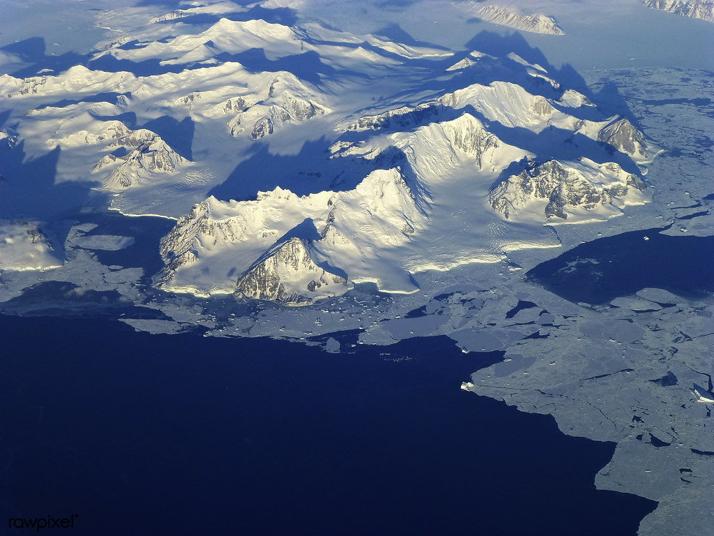
The South Pole lies on the continent of Antarctica, a mountainous landmass separated from the rest of the world by the Southern Ocean. About twice the size of Australia, Antarctica is the fifth largest continent. Nearly the whole landmass—about 98%—is covered by an ice sheet which, in places, is more than 3500 metres (11,500 feet) deep. Antarctica is the coldest, driest (it rarely rains or snows) and windiest continent. But it has not always been an empty, freezing desert: millions of years ago it was covered by rainforest and inhabited by hundreds of different kinds of animals. Today, the only large animals that live there—whales, penguins and seals—live mostly in the surrounding waters or in coastal areas.
Climate
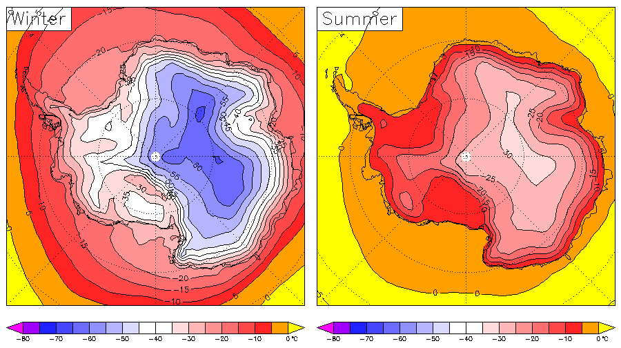
Antarctica has an extremely cold, dry, polar climate. Winter temperatures along Antarctica’s coast range from between -10° to -30°C (14° to -22°F). During the summer, they rise to around 0°C (32°F), but may sometimes reach 10°C (50°F). In the high interior, temperatures are much colder, falling to below -60°C (-76°F) in winter and climbing to only around -20°C (-4°F) in summer.
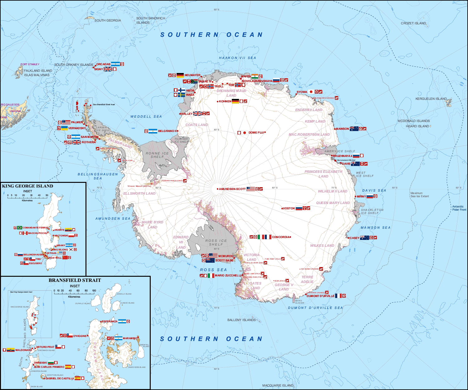
Vostok, a Russian scientific research station in Princess Elizabeth Land, East Antarctica, is the coldest place in the world, having recorded a temperature of -89.2°C (-128.6°F). Even its average temperature in summer is -32°C (-25.6°F), dropping to -68°C (-90.2°F) in winter.
The small amount of precipitation Antarctica, one of the driest deserts in the world, receives is usually in the form of snow. The interior has less than 5 centimetres (2 inches) per year, while the coastal regions typically see around than 20 cm (8 inches)—although snowfalls of up to 1.22 metres (48 inches) in 48 hours have been recorded.

Geography
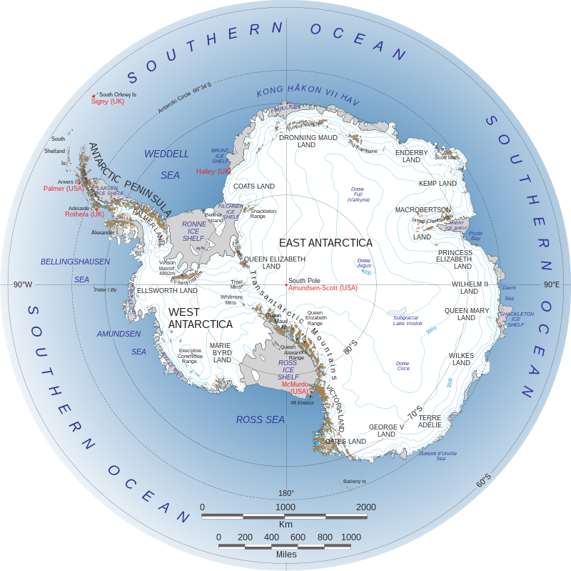
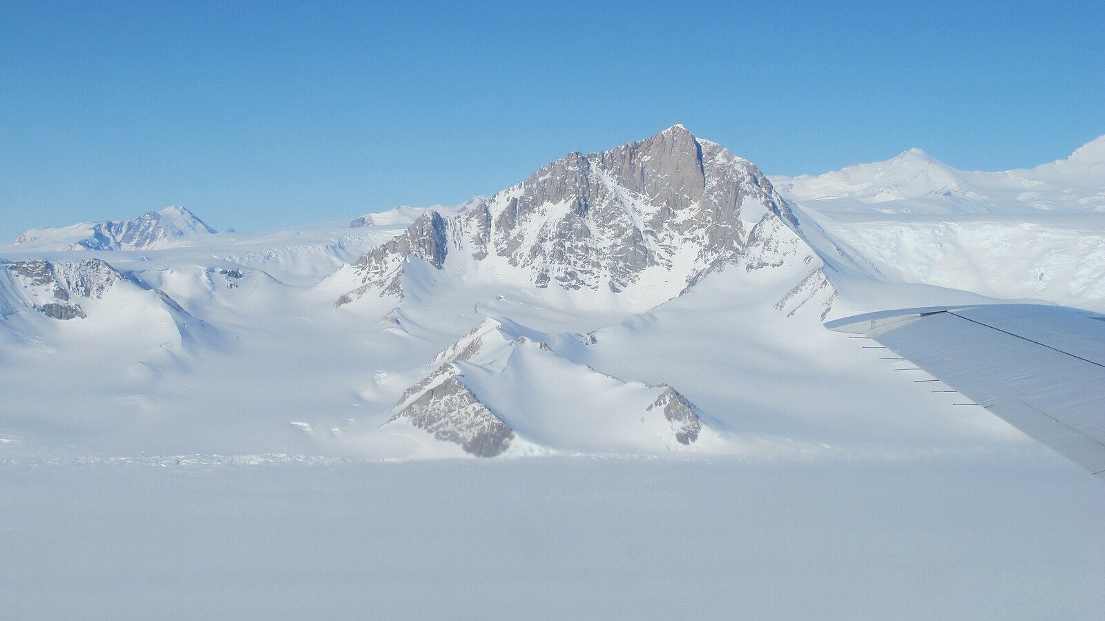
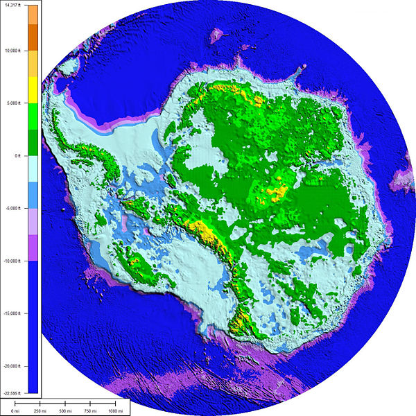
The Transantarctic Mountains, a range that stretches from Victoria Land to the Ross Sea, divides the continent into eastern and western regions: East and West Antarctica. Some of the mountain summits are higher than 4500 metres (around 15,000 feet). Vinson Massif, in the Ellsworth Mountains, is the highest peak in Antarctica at 4892 metres (16,050 ft).

Beneath the ice sheet, Antarctica is made up of an archipelago of mountainous islands in the west, called Lesser Antarctica, and a single large landmass about the size of Australia in the east, known as Greater Antarctica. Lesser Antarctica is a southerly extension of the “Ring of Fire”, an area of earthquakes and volcanoes that runs around the rim of the Pacific Ocean. Mount Erebus, on Ross Island, is the southernmost active volcano on Earth and erupts around 10 times each day.

Ice sheet
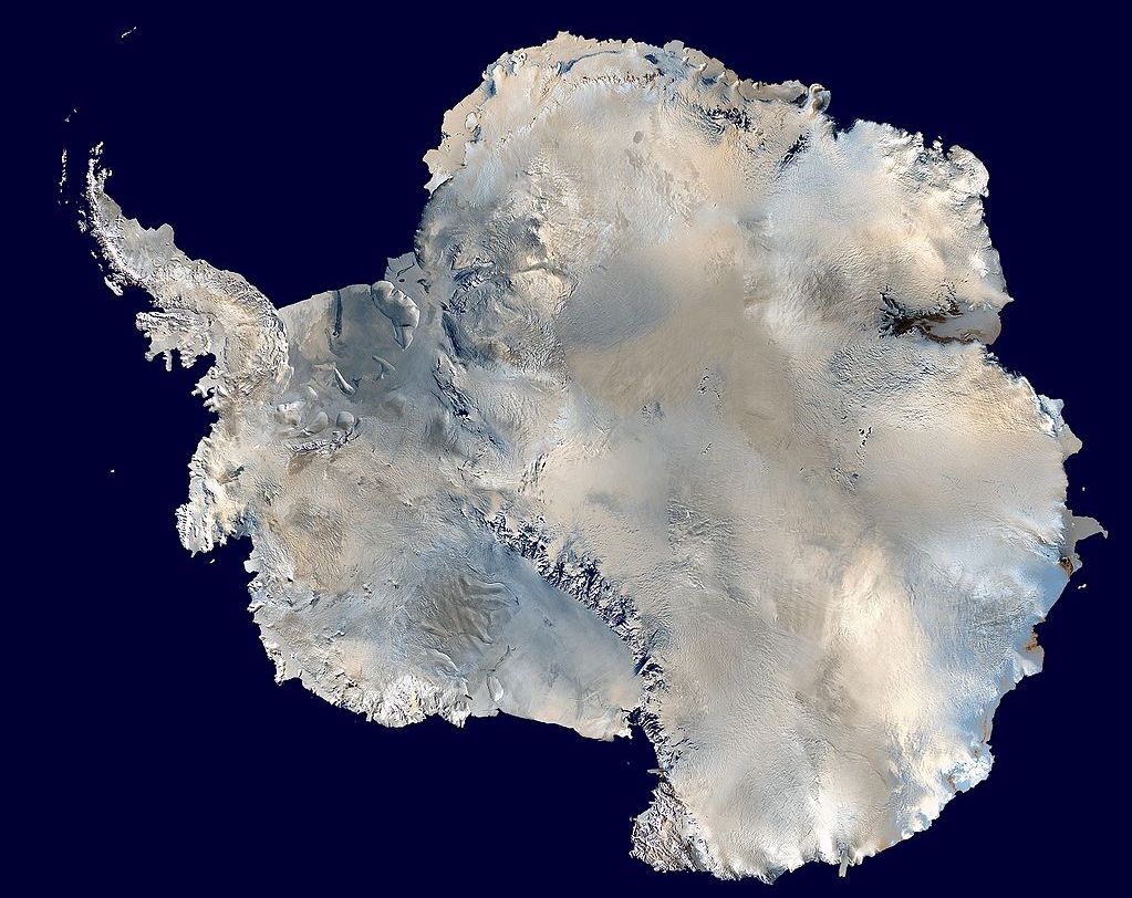
The Antarctic ice sheet is the largest mass of ice on Earth. It forms from snow which compacts to form ice. The elevation of the ice sheet averages around 1900 metres (6200 feet) above sea level, rising to 4000 metres (13,00 feet) in the centre of Antarctica. In East Antarctica, the ice sheet lies on a major land mass, while in West Antarctica, some parts of the ice sheet base lie at more than 2500 metres below sea level.
In East Antarctica, the ice sheet lies atop a continental plateau known as the Antarctic Plateau or Polar Plateau. This includes the region of the geographic South Pole. The constant freezing winds that blow across it, especially in winter, make the icy environment almost completely inhospitable to life. No penguins live here, although some sea birds—Antarctic petrels, snow petrels and south polar skuas—fly across it.
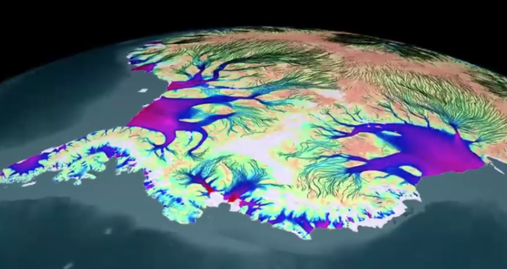
The ice moves under its own weight from Antarctica's interior towards the edges of the continent and into the surrounding ocean along ice streams. Types of glacier, these are broad corridors of fast flowing ice lying within the ice sheet. Typically more than 20 kilometres (12 miles) wide, they move at speeds of more than 1 kilometre (3300 feet) a year.
McMurdo Dry Valleys
The McMurdo Dry Valleys are a series of valleys in Victoria Land near the coast of McMurdo Sound, part of the Ross Sea. Together they form the largest permanently ice-free region in Antarctica. The surrounding mountains prevent ice streams from the East Antarctic ice sheet flowing through them to the Ross Sea. Experiencing constant cold, dry winds and extremely low humidity, the valleys are some of the driest places on Earth. They have not seen precipitation for nearly two million years.
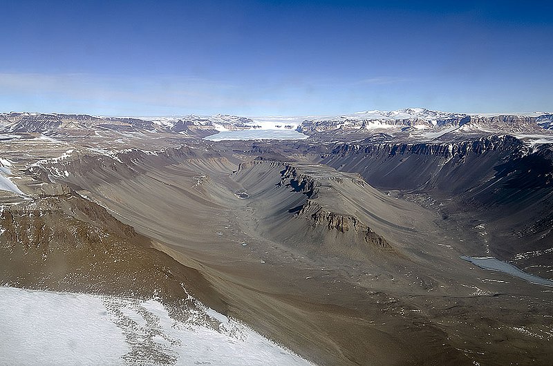
A barren desert, the McMurdo Dry Valleys contain no vegetation; the barren rock surface is covered with gravel. The region does, however, include Lake Vida, a saline lake, and the Onyx River, a meltwater stream and Antarctica's longest river.
Ice shelves
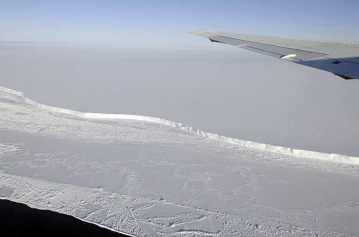
West Antarctica is fringed by huge ice shelves—great tongues of ice that jut out from the continent into the Southern Ocean (the Ross Ice Shelf, for example, is the size of France). The shelves form where ice streams from the Antarctic ice sheet run over the edge of the continent into the sea. The ice floats, but as the shelves push farther and farther out, their fronts split into smaller chunks, called icebergs. This process, called calving, is a entirely natural—it is part of the water cycle. Roughly the same amount of water "lost" from the sea by evaporation falls on Antarctica as snow, is then compacted into ice and eventually returned to the ocean from the melting icebergs. While this balance exists, global sea levels remain constant.
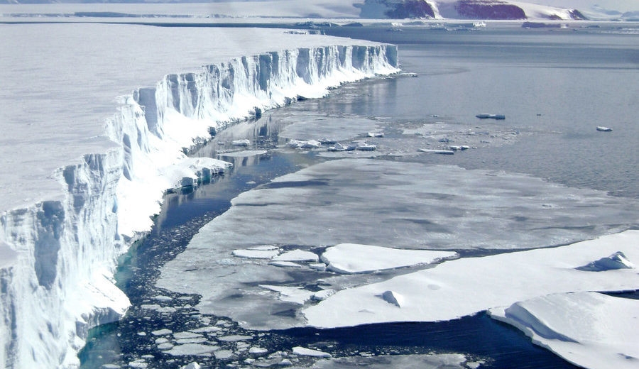
The ice shelves hold back, or "buttress", ice that flows seawards from Antarctica's ice sheet via the ice stream glaciers. Their presence thus ensures the rate at which the ice melts in the sea is balanced by the snow falling on the ice sheet. The ice shelves are, however, vulnerable to warming water melting them from below, causing them to become thinner and eventually break up. If the thinning weakens the shelves so that land ice flows faster towards the sea, an imbalance is created. Ice melts in the sea at a faster rate than water is evaporated, causing sea levels to rise.
Subglacial lakes
A subglacial lake is a lake that is found under an ice cap or ice sheet. It forms at the boundary between the ice and the underlying bedrock, where the pressure from the thick ice above lowers the melting point of ice. Over time, the ice just above the bedrock melts and collects in pools. Another way that liquid can form under the ice is from heat radiating up from the Earth's crust. This is called geothermal energy. It can be warm enough to melt the bottom of the ice sheets; the meltwater then pools and forms lakes.

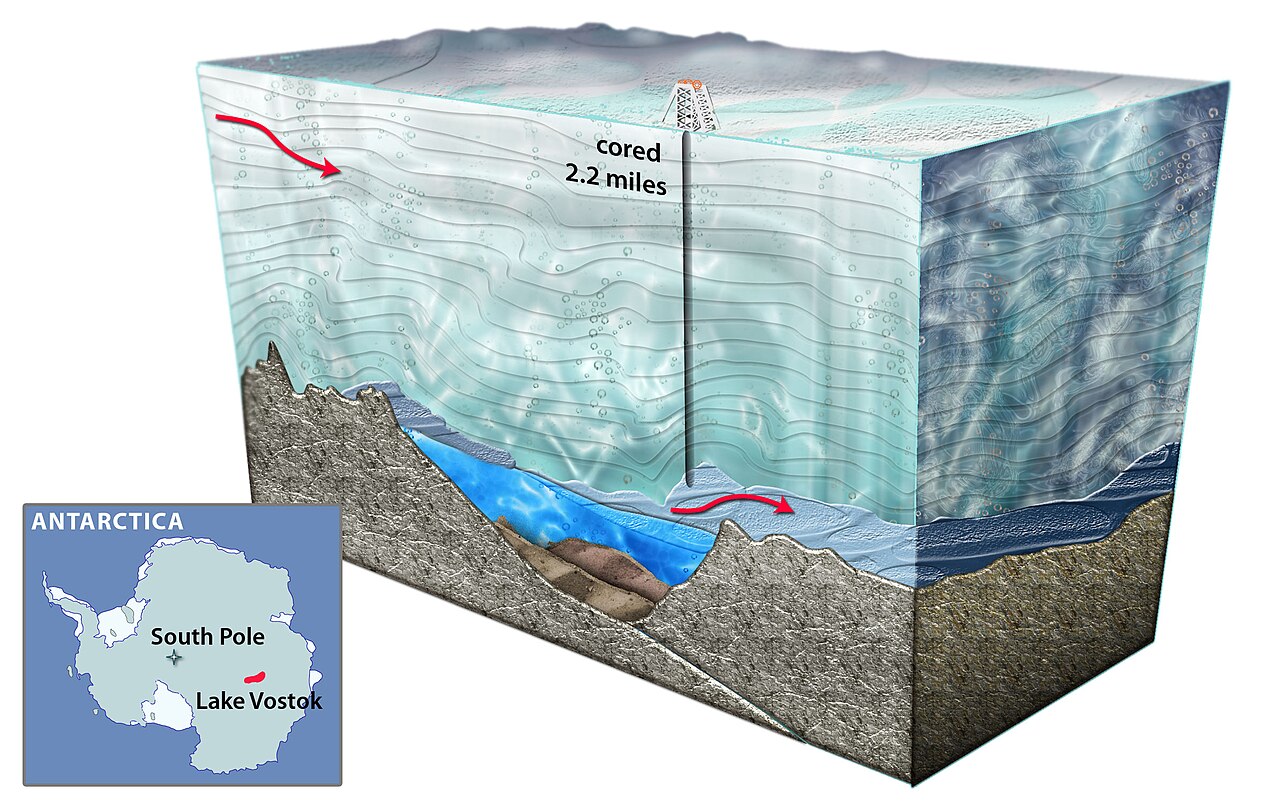
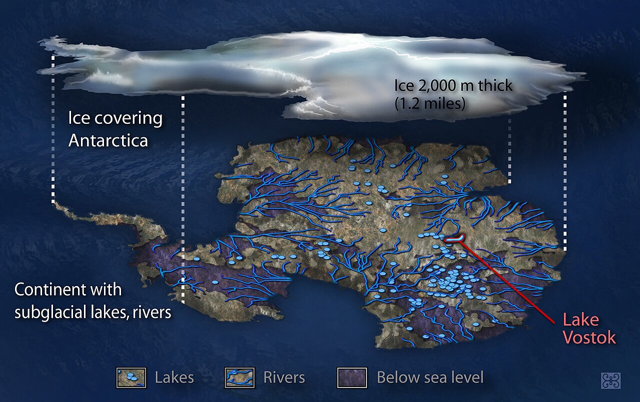
Over 400 subglacial lakes have so far been discovered in Antarctica, more recently by using satellite radar or laser altimetry (measuring altitude above the terrain). Lake Vostok, discovered beneath Russia's Vostok Station, is the world's largest subglacial lake—as well as being one of the largest lakes of any kind. Satellite data has revealed that many subglacial lakes are fed by the meltwater from a network of subglacial streams.

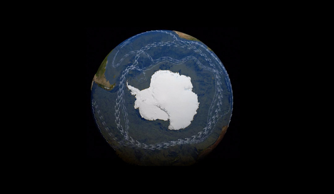
The East Wind Drift flows anticlockwise around Antarctica’s shores. Further north, the vast Antarctic Circumpolar Current, driven by strong westerly (eastwards-moving) winds, forms a powerful flow in the opposite direction. This current keeps warming ocean waters away from Antarctica, preventing its huge ice sheet from melting.
The cold waters surrounding Antarctica are so salty and dense they sink to the the ocean floor forming what is known as Antarctic Bottom Water. This water then moves northwards, slowly spreading across the floors of the world's oceans. It is a key driver of the “ocean conveyor belt,” a global system of currents in which water circulates around the globe, called thermohaline circulation.
Upwelling
Deep currents in the Pacific, Atlantic and Indian oceans flow southwards into the Southern Ocean. Here, the relatively warm water, called Circumpolar Deep Water, spirals upwards and southeastwards around Antarctica, before being drawn to the surface by the strong westerly winds.
The upward movement of seawater is known as upwelling. Replacing the surface waters, the upwelled water is able to absorb huge amounts of excess heat and carbon dioxide from the atmosphere. It also contains decomposed organic matter it has brought up to the surface from the ocean floor. This organic matter provides a rich source of nutrients which supports plankton and makes the waters of the Southern Ocean one of the richest marine ecosystems on Earth.

Vegetation
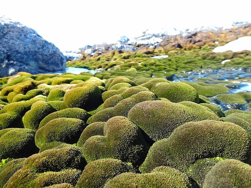
Antarctica's extremely cold, dry climate and poor soil quality does not allow much vegetation to grow. Plant species are mostly limited to mosses and liverworts, and these are confined to ice-free coastal regions. Some mosses and lichens can be found in the dry interior. There are just three species of flowering plants, all of which are found only on the Antarctic Peninsula: Antarctic hair grass, Antarctic pearlwort and annual bluegrass.
Wildlife
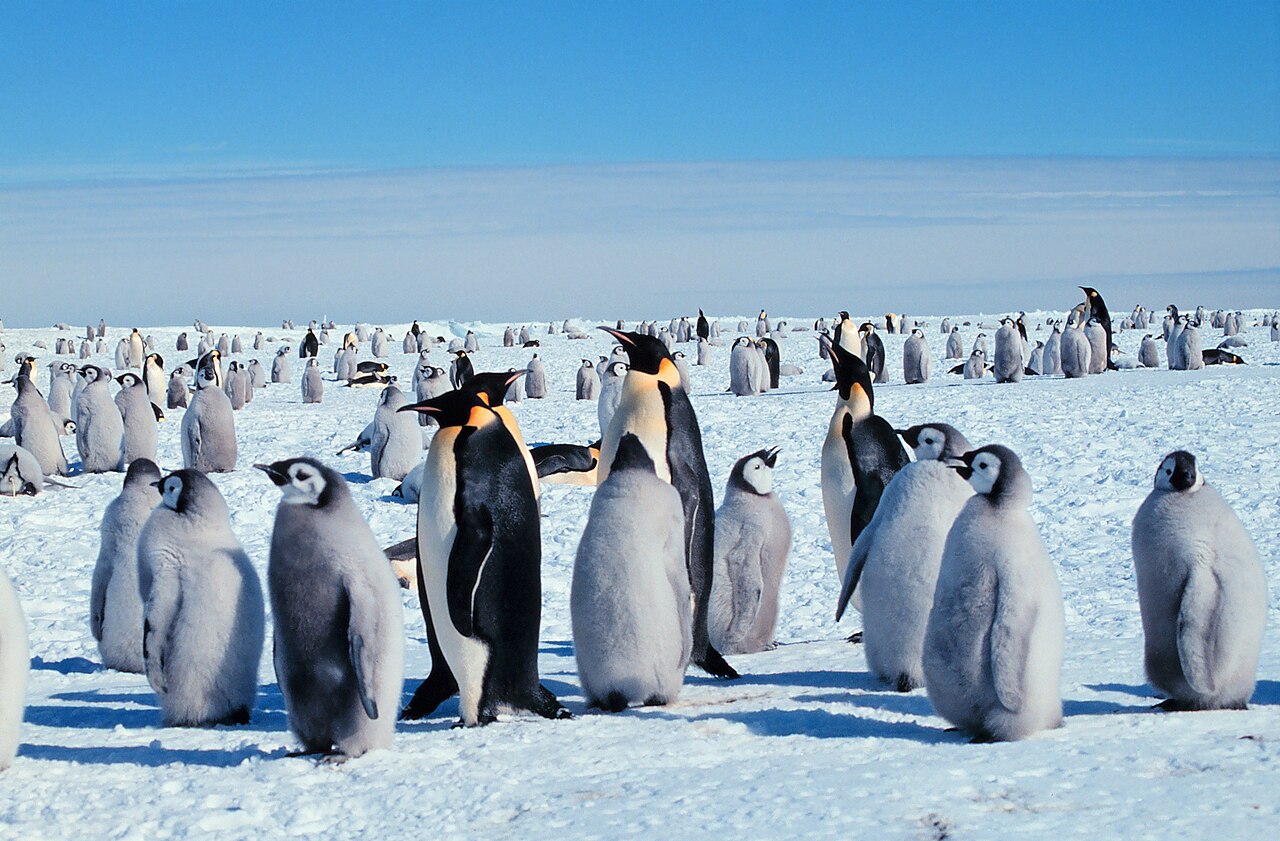
Wildlife is concentrated in areas near the Antarctic coast. Flying birds, include species of albatross, petrel, skua, gull and tern, nest on the milder shores of the Antarctic Peninsula. Five species of penguin (emperor, Adélie, chinstrap, macaroni and gentoo) inhabit coastal regions. The emperor penguin is the only Antarctic animal to breed there during the winter. Six species of seal (Antarctic fur, leopard, Ross, southern elephant, crabeater and Weddell) spend much time on the ice or beaches. Belgica antarctica, a wingless midge, is the only true insect found on the Antarctic mainland.
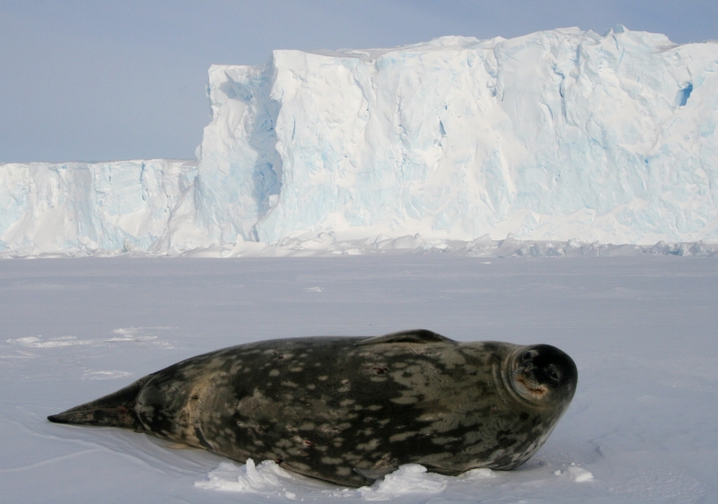
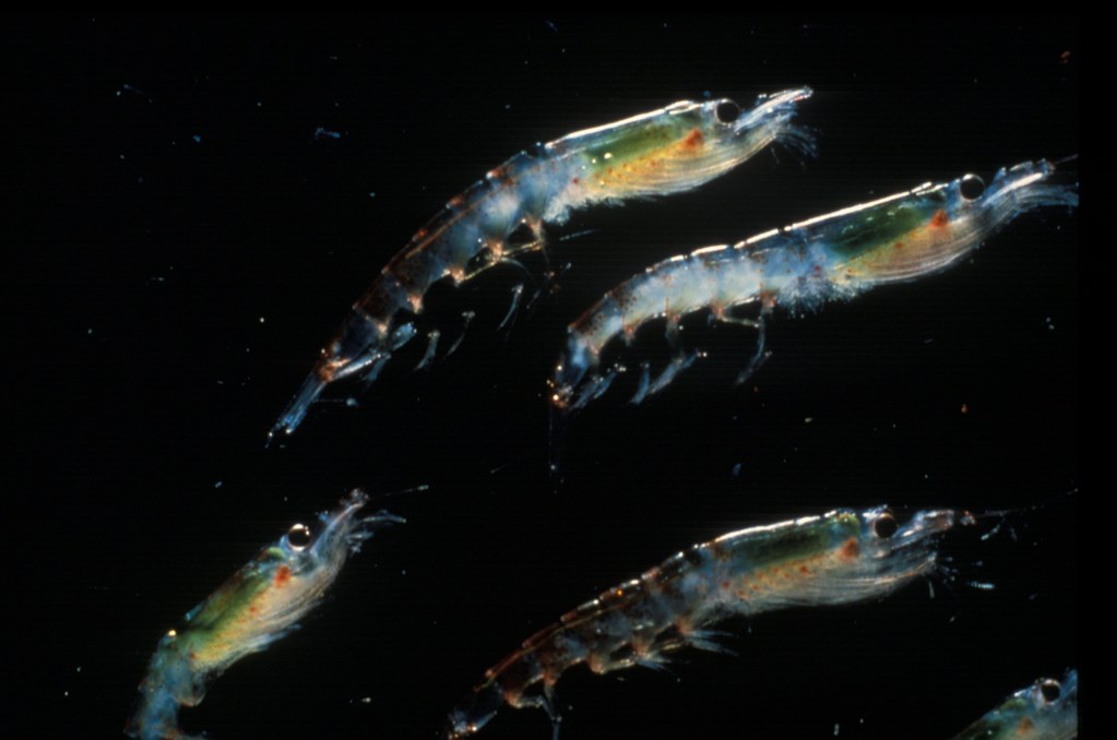
The waters surrounding Antarctica teem with life: they are among the most diverse on the planet. Upwelling allows phytoplankton to flourish, providing food for many tiny animals, such as krill, which in turn are food for fish and a wide variety of marine mammals, including orcas and blue, fin, humpback, right, minke, sei and sperm whales. Penguins dive for fish and squid in Antarctica's coastal waters, but are themselves preyed upon by fearsome leopard seals.
Scientific work

Antarctica is the only one of the world's continents without a native human population. All human activity on Antarctica is governed by the international 1959 Antarctic Treaty. Although many countries have scientific research stations on the continent, no new territorial claims have been allowed since 1959 and the continent is considered politically neutral.
Antarctica is inhabited only by people who work at scientific research stations. The scientists who work there come from dozens of different countries. The number of scientists varies throughout the year, from about 1000 in winter to around 5000 in summer.
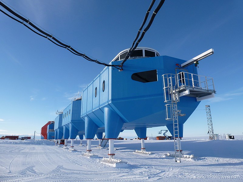
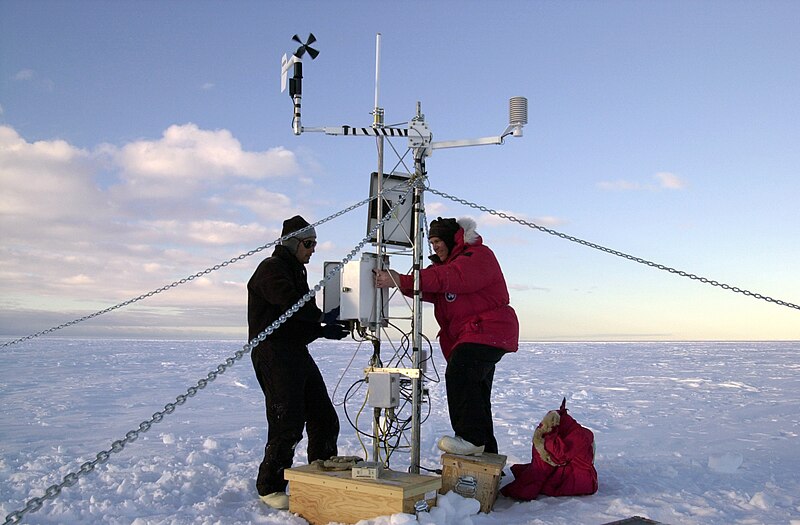
Glaciologists study all aspects of Antarctica's ice. Climatologists investigate the history of Earth’s climate using ice cores drilled from Antarctica’s ice and monitor the hole in the ozone layer that opens over the continent each spring. Biologists are interested in how Antarctica's animals and plants adapt to low temperatures and the changing climate. Astrophysicists at the Amundsen–Scott South Pole Station study Cosmic Microwave Background Radiation and neutrinos—the most abundant subatomic particles in the Universe, but almost impossible to detect.
Antarctica provides the perfect environment for the study of meteorites, chunks of rock or metal from space that have fallen through the atmosphere and crashed to the Earth's surface. The dry, polar desert preserves them well and they are quite easy to find, with the dark stone standing out in the white landscape. Most meteorites are fragments of asteroids, but some have travelled from the Moon or Mars. Meteorites are of great interest to scientists as their composition offers clues about how the Solar System was formed.

Consultant: Nicholas Harris