
Europe

CITE
We have made every effort to follow citation style rules, but there may be some minor differences. If in doubt, please refer to the appropriate citation style manual.
Channel Islands. (2026). In Q-files Encyclopedia, Geography, Europe. Retrieved from
https://www.q-files.com/geography/europe/channel-islands
"Channel Islands." Geography, Europe, Q-files Encyclopedia, 31 Mar. 2026.
https://www.q-files.com/geography/europe/channel-islands.
Accessed 13 Sep. 2026.
Channel Islands 2026. Geography, Europe. Retrieved 13 September 2026, from
https://www.q-files.com/geography/europe/channel-islands
Geography, Europe, s.v. "Channel Islands," accessed September 13, 2026.
https://www.q-files.com/geography/europe/channel-islands


Channel Islands
The Channel Islands, also known by their French name Îles Anglo-Normandes, are an archipelago in the English Channel, lying off the coast of Normandy. The total area of the islands is 198 square kilometres. They are not part of the United Kingdom, nor are they members of the European Union, but possessions of the British Crown. They are made up of a pair of Crown Dependencies: the Bailiwick of Jersey (Jersey is the largest island) and the Bailiwick of Guernsey (which includes the islands of Guernsey, Alderney, Sark and some smaller islands). The two bailiwicks each have their own independent laws and governments. The inhabitants of the Channel Islands are British citizens.


History
The islands were inhabited by Britons fleeing from invading Anglo-Saxons in the 5th century. From the beginning of the 9th century, Viking raiders appeared on the coasts. In 933, the islands became part of the Duchy of Normandy, which passed to the English monarchy after William the Conqueror became king of England in 1066. While England lost mainland Normandy in 1204, the islands remained possessions of the Crown and were divided into the two bailiwicks later that century. In a Charter of 1394, King Richard II, in appreciation of the great loyalty shown to the Crown, granted to Jersey, Guernsey, Sark and Alderney permanent exemption from English taxes.

Occupation during
World War II
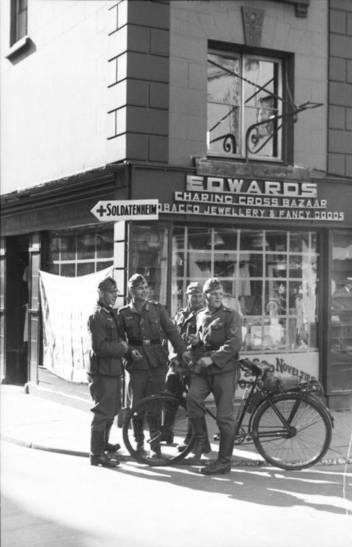
The islands were the only British territory to be occupied by Nazi Germany during World War II. Before German troops landed on 30th June 1940, many people had already been evacuated. In Alderney, almost the entire population left before the Germans arrived. The Germans built four concentration camps on Alderney. The German occupation was harsh: more than 2000 Islanders were deported as slave labourers, while Jews were sent to concentration camps. The population was close to starvation in the final months. Jersey and Guernsey were eventually liberated on 9th May 1945, the day after VE Day.

People and economy
The total population of the Channel Islands is about 171,000 (Jersey 106,080, Guernsey 63,026, Alderney 2039, Sark 600, Herm 60), the vast majority of whom is made up of native islanders of Norman French and British ancestry. The bailiwicks' capitals, Saint Helier (Jersey) and Saint Peter Port (Guernsey), have populations of 33,500 and 16,488 respectively. Residents also include some EU citizens, with a significant community from Portugal.
Tourism is a major industry in the islands, with some agriculture and horticulture. Since the 1960s, Jersey and Guernsey have taken advantage of their relatively light tax burden to become major offshore financial centres. The finance industry now dominates both islands' economies.
Jersey
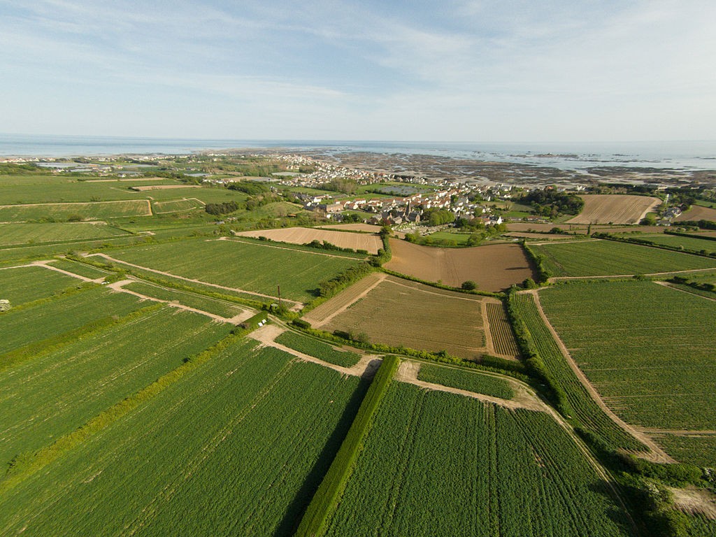
Jersey is the largest (118 square kilometres / 45 square miles) and southernmost of the Channel Islands, lying about 22 kilometres (14 miles) from Normandy, France. The terrain consists of a plateau sloping from rugged cliffs in the north to sandy bays in the south. The plateau, no more than 143 metres (469 feet) above sea level, is cut by valleys running generally north-south. The climate is temperate with mild winters and mild to warm summers. Winds from across the Atlantic Ocean ensure that Jersey is slightly cooler than southern England during the summer, but warmer in winter.
Guernsey
Guernsey is the second largest (65 square kilometres / 25 square miles) of the Channel Islands. Southern Guernsey consists of a plateau, averaging around 90 metres (300 feet) above sea level, with deeply incised valleys. The coast is lined by rugged cliffs. The north has lower lying terrain, studded with small hills, or hougues, formed from resistant rock. Guernsey’s climate is similar to that of Jersey, but with a slightly narrower annual temperature range and lower annual rainfall. Dairy farming, with the famous Guernsey cows, occupies most of the land, followed by potato and vegetable growing. Cut flowers, especially of freesias and clematis, is still a thriving industry.
Consultant: Nicholas Harris
pics
Without in any way limiting Q-files Ltd’s exclusive rights under copyright, any use of this publication to “train” generative artificial intelligence (AI) technologies to generate text is expressly prohibited. Q-files Ltd reserves all rights to license use of this work for generative AI training and development of machine learning language models.