
Africa

CITE
We have made every effort to follow citation style rules, but there may be some minor differences. If in doubt, please refer to the appropriate citation style manual.
Senegal. (2026). In Q-files Encyclopedia, Geography, Africa. Retrieved from
https://www.q-files.com/geography/africa/senegal
"Senegal." Geography, Africa, Q-files Encyclopedia, 30 Mar. 2026.
https://www.q-files.com/geography/africa/senegal.
Accessed 6 Aug. 2026.
Senegal 2026. Geography, Africa. Retrieved 6 August 2026, from
https://www.q-files.com/geography/africa/senegal
Geography, Africa, s.v. "Senegal," accessed August 6, 2026.
https://www.q-files.com/geography/africa/senegal


Senegal
Africa’s westernmost point, Cap Vert or Cabo Verde, lies within the borders of Senegal. The country is named after the River Senegal, which flows along its northern border. This horseshoe-shaped country curves around another country, The Gambia. Most of its land is made up of rolling grasslands. The foothills of the Fouta Djalon highlands—the country’s only uplands—rise in the far southeast corner. The northern part of Senegal reaches into the semi-arid Sahel, bordering the Sahara Desert. The south is greener and wetter, with a hot, tropical climate and a rainy season between June and October.


People
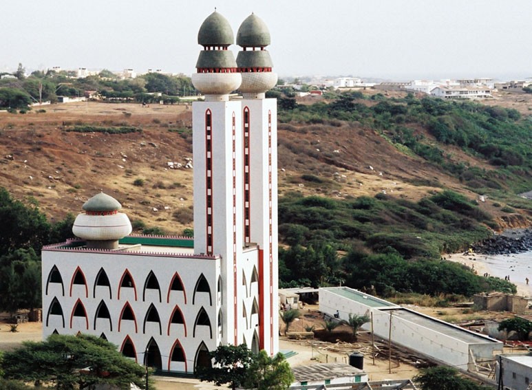
The largest ethnic group in Senegal are the Wolof, a people whose ancestors came from the western Sahara. Other large groups include the Fula in the north and the Serer, native to the Senegal valley. Senegal is largely a peaceful country. Nearly all its people are Muslims. Although French is the official language, most people speak local languages, such as Wolof or Fula. Wolof is the main language spoken in the capital, Dakar.

Schools
In Senegal, education is free and children have to go to school, but classes are often overcrowded: some have more than 50 children. Many children leave school early to go to work. Only a few stay on after the age of 14 and most are boys. Because of this, the country’s literacy rates (the percentage of people who can read and write) are low, especially among girls: just 56% of Senegalese girls aged between 15 and 24 can read and write.


Industry
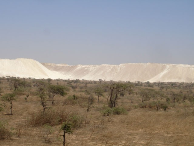
Senegal has one of the most stable economies in West Africa, partly because of its long history of peaceful government. This stability has attracted investment from Arab and French companies, who have set up international organizations and banks in the capital, Dakar. One of the country’s biggest industries is phosphate mining. Phosphates are used in the production of chemicals such as fertilizers.

Farming and fishing
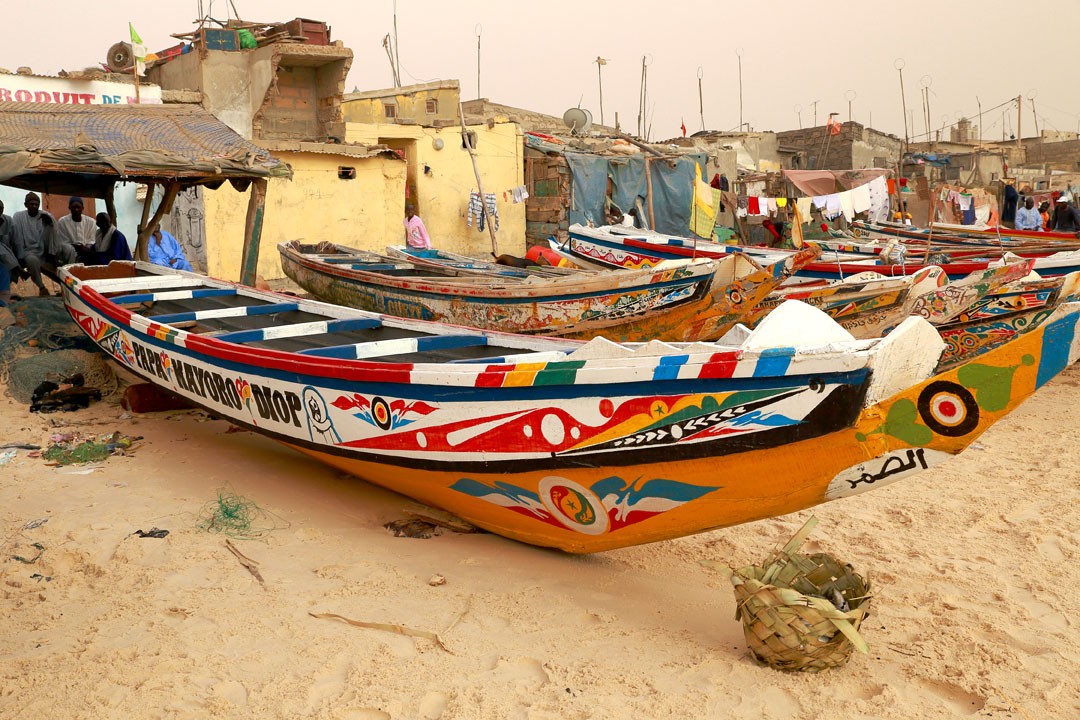
The best land for farming is in the western Senegal valley, where farmers grow peanuts and cotton for export. The wetter south is perfect for growing crops which need a lot of water, such as sugar cane and rice. The seas off the Senegalese coast are rich fishing grounds, and fish and seafood are important exports.
Consultant: Nicholas Harris
Facts about Senegal
Population 18,847,519 (2024 estimate)
Area 192,530 sq km
Highest point unnamed elevation 581 m (1906 ft)
Capital Dakar, metro area population 4,004,427
Other major cities Touba (pop. 1,120,824), Kaolack (298,904)
Languages French, Wolof, Fula, Jola, Mandinka
Religions Muslim 97%, Christian (Roman Catholic) 3%
Ethnicity Wolof 39%, Fula 27.5%, Serer 16%, Mandinka 4.9%, Jola 4.2%, Sonike 2.4%, Other 6%
Currency West African CFA franc (XOF)
Chief exports fish, groundnuts (peanuts), oil and petroleum products, phosphates (used to make fertilisers), cotton

History of Senegal
700s
Much of modern-day Senegal is ruled by the powerful Ghana Empire
800s
Trading state of Takrur grows up in the Senegal valley
11th century
Tukulor people move into the lower Senegal valley
1350s
Jolof Empire becomes powerful in the region
13th century
Mali Empire expands to include Senegal
1440s
Portuguese explorer Dinis Dias sails to the mouth of the River Senegal
1617
Dutch set up a slave-trading port on the island of Gorée, fighting off attacks by the Portuguese, French and English. From the 1620s to the 1670s, the Dutch West India Company dominates all the trade in the area
1659
French build a settlement, St Louis, at the mouth of the River Senegal: it quickly becomes a major slave-trading port
1677
French seize control of the island of Gorée from the Dutch
1756–63
War between British and French settlers: Britain takes over French trading posts and forms a new colony in the region, Senegambia
1880s
France gradually regains control over the whole region
1895
Senegal is made part of French West Africa
1914
Blaise Diagne becomes Senegal’s first representative in the French parliament
1958
Senegal becomes an autonomous (self--governing) republic within France
1960
Senegal becomes fully independent, merging with neighbouring French Sudan to form a new state, the Mali Federation. It breaks apart just 2 months later
1978
A multi-party system of government is introduced
1982–89
Senegal agrees to combine its military forces with neighbouring Gambia, forming the Senegambian Confederation
2001
Government signs a peace treaty with rebels
2002
1863 people are killed when a Senegalese ferry capsizes off the coast of Gambia
2012
Macky Sall becomes president
2024
Senegalese president Bassirou Diomaye Faye announces that France will withdraw its troops from Senegal and close its bases by the end of 2025
pics


Without in any way limiting Q-files Ltd’s exclusive rights under copyright, any use of this publication to “train” generative artificial intelligence (AI) technologies to generate text is expressly prohibited. Q-files Ltd reserves all rights to license use of this work for generative AI training and development of machine learning language models.