
Africa

CITE
We have made every effort to follow citation style rules, but there may be some minor differences. If in doubt, please refer to the appropriate citation style manual.
Mauritania. (2026). In Q-files Encyclopedia, Geography, Africa. Retrieved from
https://www.q-files.com/geography/africa/mauritania
"Mauritania." Geography, Africa, Q-files Encyclopedia, 30 Mar. 2026.
https://www.q-files.com/geography/africa/mauritania.
Accessed 22 Sep. 2026.
Mauritania 2026. Geography, Africa. Retrieved 22 September 2026, from
https://www.q-files.com/geography/africa/mauritania
Geography, Africa, s.v. "Mauritania," accessed September 22, 2026.
https://www.q-files.com/geography/africa/mauritania


Mauritania
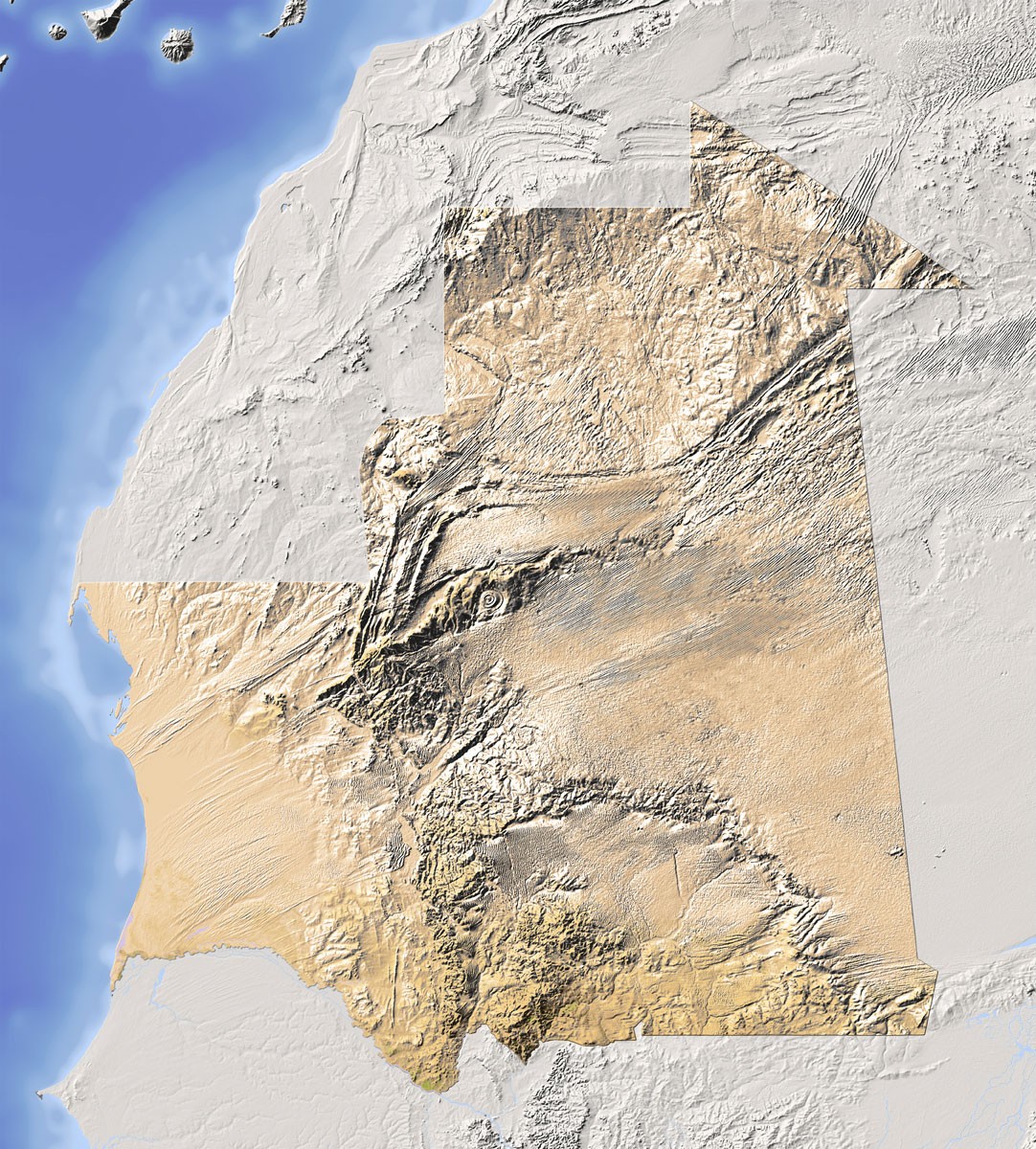
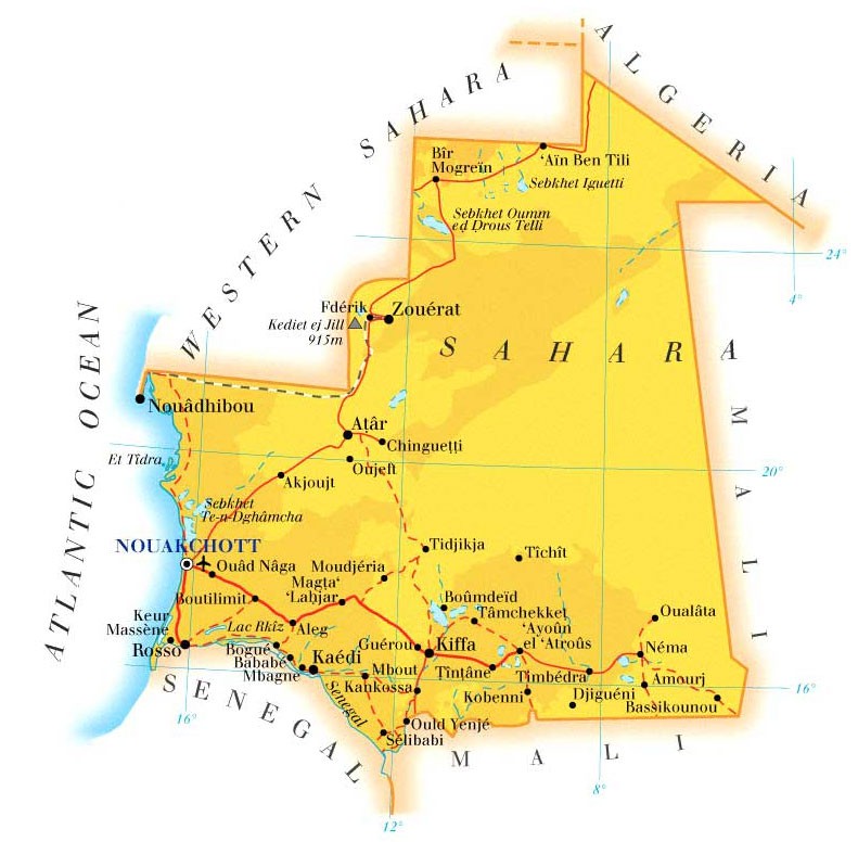
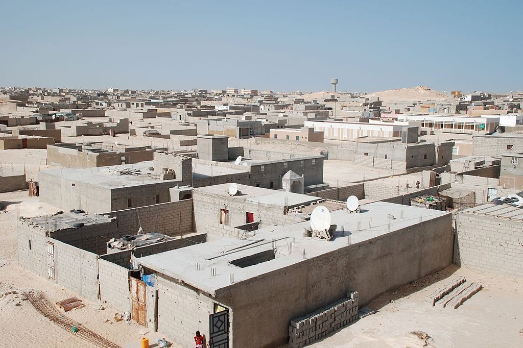
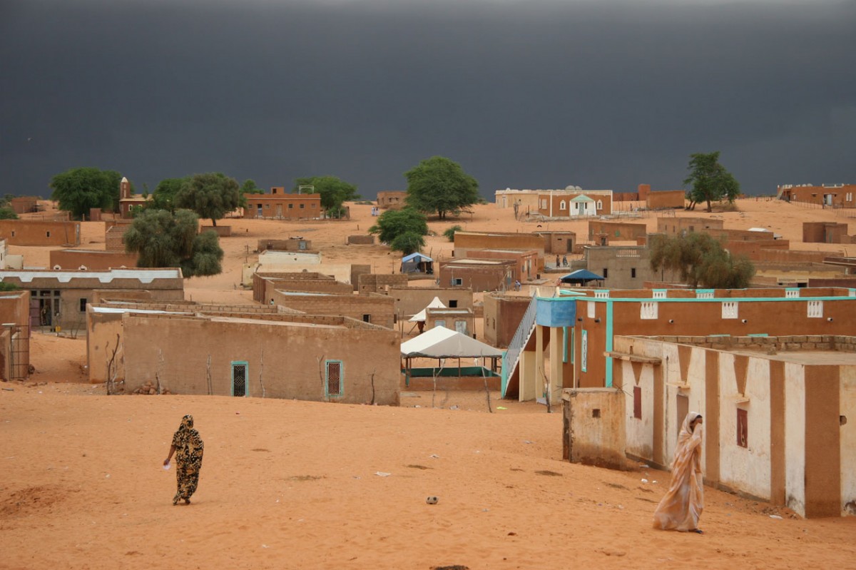
Mauritania is one of the emptiest countries in the world. Nearly all its land lies in the Sahara Desert. In the west, flat, sandy plains give way to towering dunes while in the centre of the country, rocky escarpments rise steeply from the desert. The far southern part of Mauritania dips into the semi-desert region called the Sahel. Here, the climate is not so harsh; this region is home to about two-thirds of the country’s people and nearly all of its farmland. Mauritania has an extremely hot climate and its northern regions are very dry. Although there is a short rainy season between July and September, nearly all of the rain falls in the south.
People
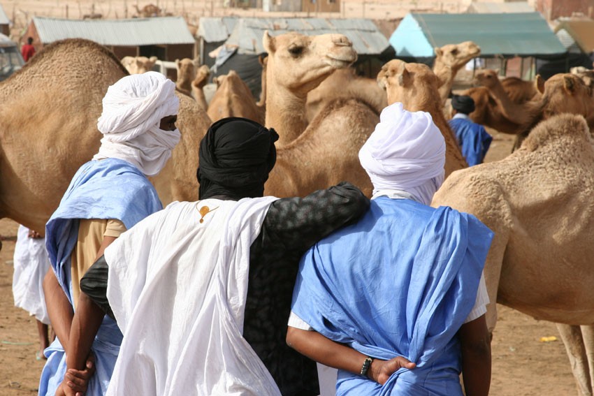
More than two-thirds of Mauritanians are a people called Maures, or Moors, descended from a mixture of Arab and Berber peoples. Black African peoples, such as the Halpulaar (Toucouleur), Fulani, Soninke and Wolof, make up the rest of the population. Many of Mauritania’s rural dwellers are nomads. The Fulani are traditionally cattle-herders who graze their cattle on the Sahel. A combination of recent droughts and overgrazing have forced them to move to the cities in search of work.
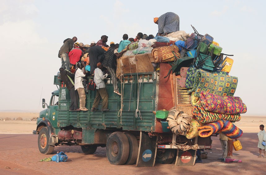
There are political tensions between the black Africans of the south and the Moors in the north. Mauritania’s official language is Arabic, but many people speak the old colonial language, French, as well.


Farming
Although most of Mauritania’s land is too hot and dry to grow crops, about half of the population somehow makes a living from farming. Farmers grow dates, millet and corn on the northern banks of the River Senegal, in the south. North of this valley, farmers herd cattle on the dry Sahel grasslands.
Fishing and minerals
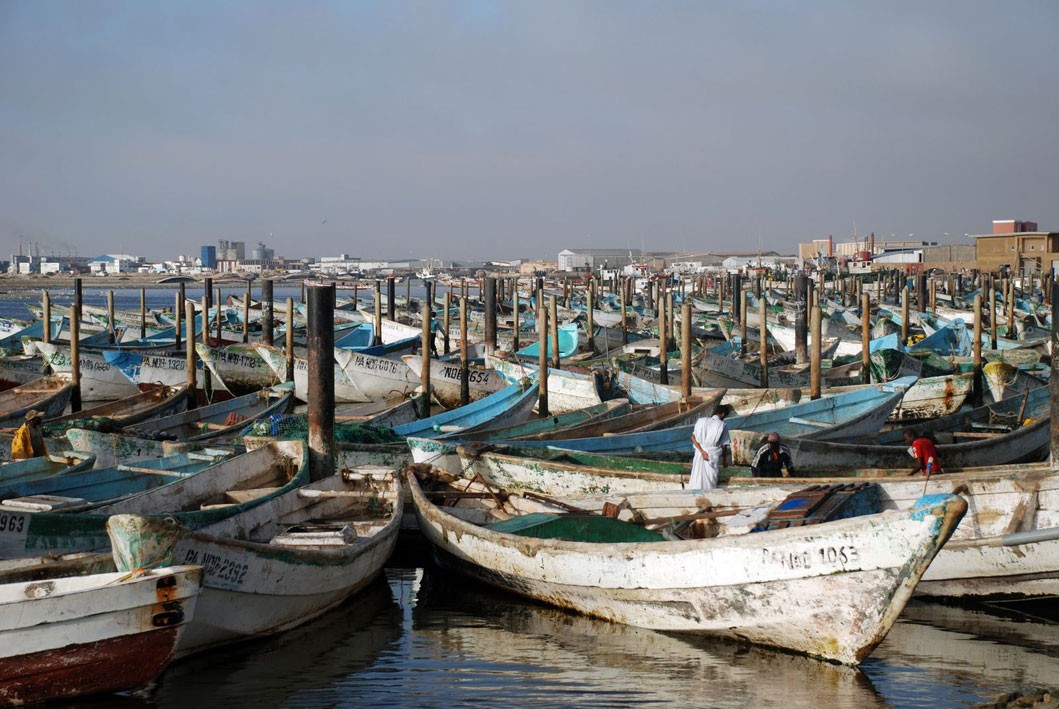
Fishing is another important industry: Mauritania’s waters are some of the richest fishing grounds in the world and fish make up 20% of the country’s exports. The rest of its foreign income comes mainly from mining: the country is rich in minerals such as iron ore, copper and gold. Offshore oil reserves were discovered in the early 2000s and could provide a boost to the economy in the future.

Consultant: Nicholas Harris
Facts about Mauritania
Population 4,328,040 (2024 estimate)
Area 1,030,700 sq km
Highest point Kediet Ijill 915 m (3002 ft)
Capital Nouakchott, population 1,446,761
Other major cities Nouadhibou (pop. 173,525), Kiffa (84,101)
Languages Arabic, Pulaar, Wolof, Soninke, French
Religion Muslim
Ethnicity African Moors 40%, Arab-Berber Moors 30%, black African (Halpulaar or Toucouleur, Fulani, Mande, Soninke, Wolof and Bamara) 30%
Currency Mauritanian ouguiya (MRO)
Chief exports iron ore, fish, gold, copper, petroleum

History of Mauritania
3rd–10th centuries
Bafour people and Arab migrants settle in the region
9th century
The Ghana Empire is powerful in the region, with its capital in south-west Mauritania
12th century
Yemeni Arabs begin to arrive in the region, introducing their religion, Islam
1076
Muslim Berber warriors attack and conquer the Ghana Empire
16th century
Mauritania begins trading gum arabic (used to make sweets and glue) with Europe
1644–74
Mauritanian Thirty Years' War: Berbers fight against invading Yemeni Arabs but are unsuccessful; the region comes under Arab control
1850s
French take control of southern Mauritania
1904
Mauritania becomes a French colony
1920
Mauritania becomes part of French West Africa and is governed from Senegal
1957
Nouakchott is made Mauritania’s capital
1958
Mauritania is granted self-government
1960
Mauritania becomes independent from France. It claims part of neighbouring Spanish Sahara (now Western Sahara) as its territory
1973
Mauritania joins the Arab League
1976
Spanish Sahara becomes independent and Mauritania and Morocco divide its land between them
1984
Military seizes control of the government; Colonel Maaouiya Ould Sid Ahmed Taya comes to power
1989
Race riots follow border tensions in southern Mauritania and Senegal. Hundreds are killed and thousands of black Mauritanians pour into Senegal
1993
United States stops aid to Mauritania over the country’s treatment of its black population
2002
$1.1 billion (£740 million) worth of Mauritania’s foreign debt is written off
2004
Locust invasion devastates Mauritania’s crops
2006
Oil production begins offshore
2008
The government is overthrown in a military coup d'état (takeover) led by General Mohamed Ould Abdel Aziz
2009
Aziz is elected president
2011
Mauritanians protest against a national census, demanding more rights for ethnic minorities. The protests erupt into violence
2024
Huge increase of refugees from 2000 to 12,000 arriving on the Canary Islands by boat from Mauritania
pics
Without in any way limiting Q-files Ltd’s exclusive rights under copyright, any use of this publication to “train” generative artificial intelligence (AI) technologies to generate text is expressly prohibited. Q-files Ltd reserves all rights to license use of this work for generative AI training and development of machine learning language models.