
Africa

CITE
We have made every effort to follow citation style rules, but there may be some minor differences. If in doubt, please refer to the appropriate citation style manual.
Zambia. (2026). In Q-files Encyclopedia, Geography, Africa. Retrieved from
https://www.q-files.com/geography/africa/zambia
"Zambia." Geography, Africa, Q-files Encyclopedia, 30 Mar. 2026.
https://www.q-files.com/geography/africa/zambia.
Accessed 6 Aug. 2026.
Zambia 2026. Geography, Africa. Retrieved 6 August 2026, from
https://www.q-files.com/geography/africa/zambia
Geography, Africa, s.v. "Zambia," accessed August 6, 2026.
https://www.q-files.com/geography/africa/zambia


Zambia
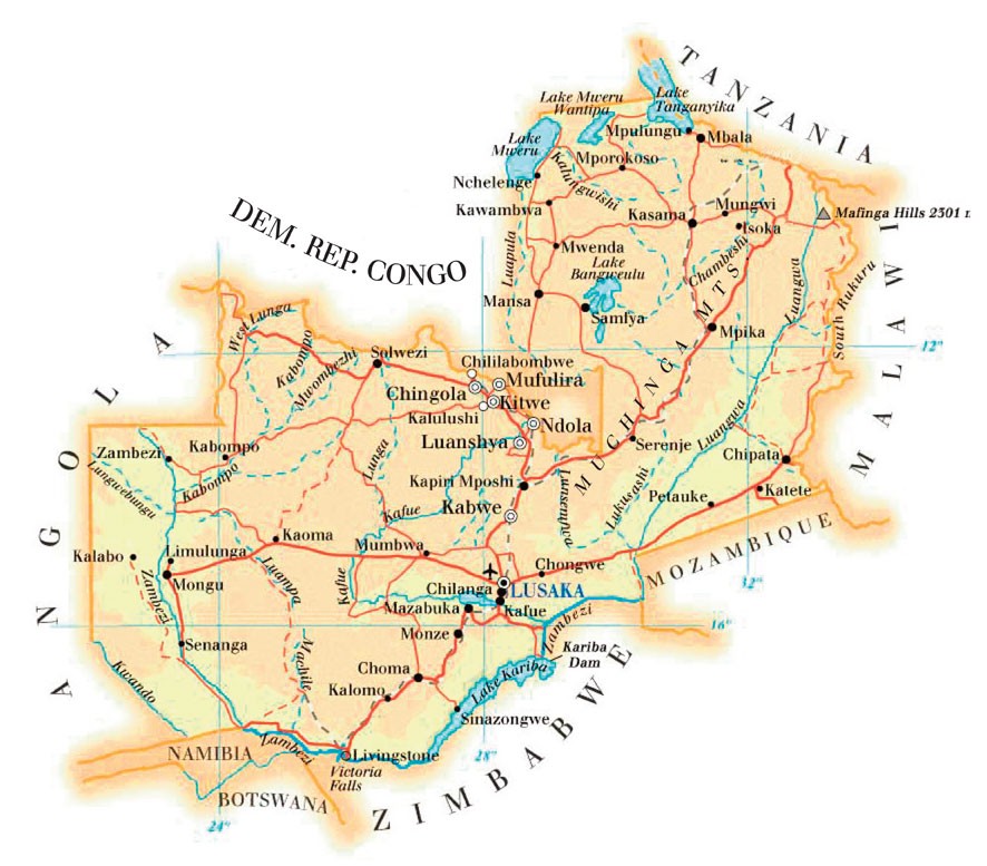
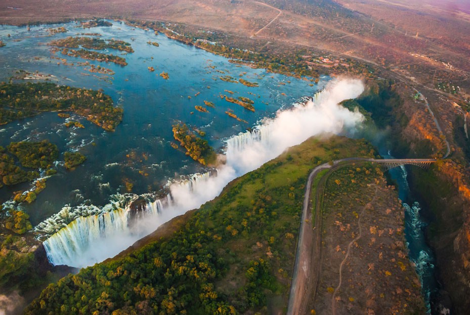
Zambia is one of Africa’s 16 landlocked countries. Much of the country lies on a high plateau, cut through by river valleys and dotted with hills and mountains. The great Kabompo and Kafue rivers flow into the River Zambezi on Zambia’s southern border. Here, the Victoria Falls (Mosi-oa-Tunya), one of the world’s largest waterfalls, plunges 108 metres (355 feet). The building of the Kariba Dam on the Zambezi has created the enormous Lake Kariba. Savanna woodland and grassland covers most of the country. Zambia has a largely tropical climate, with a dry season from May to October, and a rainy season from November to April.


People
There are over 70 ethnic groups in Zambia, nearly all descended from Bantu people who arrived in the region from around 2000 years ago. Most Zambians are Christian but many also celebrate traditional African festivals.
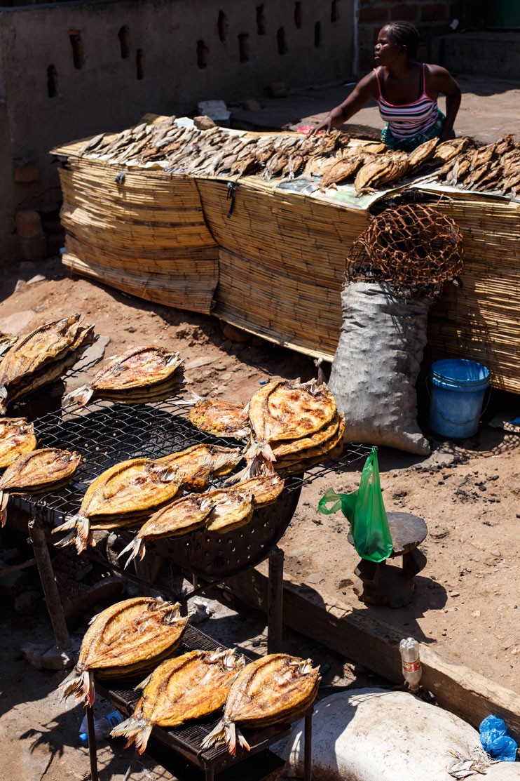
Around half of Zambia’s population lives in cities such as the capital, Lusaka, and cities in the copper mining region—known as the Copperbelt—such as Ndola and Kitwe. People in the countryside live in villages, working mostly as subsistence farmers. An estimated 48% of Zambians live in poverty.
Copper
Although 80% of its population work in agriculture, Zambia’s biggest source of income is its copper industry. Copper exports constitute about 70% of the value of all Zambian goods exported.
People have mined copper in this region for hundreds of years. Since British and American explorers discovered Zambia’s copper reserves in the late 19th century, it has become one of the biggest producers of copper in the world. Much of the copper is transported by railway to the ports of Durban in South Africa and Dar es Salaam in Tanzania. Today the Zambian government is trying to reduce the country’s dependence on copper by encouraging investment in agriculture, gemstone mining, tourism and hydro-electric power.


Facts about Zambia
Population 20,216,029 (2023 estimate)
Area 752,614 sq km (290,590 sq miles)
Highest point Mafinga Hills 2301 m (7549 ft)
Capital Lusaka (metro area population 2,238,569)
Other major cities Kitwe (661,901), Ndola (627,503)
Languages English (official language) Bemba, Chewa, Kaonde, Lozi, Lunda, Luvale, Nyanja, Tonga (recognized regional languages)
Religions Christian (Protestant) 68%, Christian (Catholic) 20%, Christian (other) 9%, other 3%
Ethnicity Bemba 22%, Tonga 11%, Lozi 5%, Nsenga 5%, Tumbuka 4%, Ngoni 4%, other 49%
Currency Zambian kwacha (ZMW)
Chief exports Copper, cobalt, tobacco, flowers, cotton, maize

Consultant: Nicholas Harris
History of Zambia
c.AD 300
Bantu people gradually push out the Khoi-San hunter-gatherers who live in the region.
1100–1300
Shona people arrive and start to establish the Mwene Mutapa Empire, which includes the modern territories of southern Zambia, Mozambique and Zimbabwe.
17th century
Lunda Empire (or Kingdom of Lunda) emerges from its parent state, the Luba Empire. It becomes a confederation of states that expand to cover what is now part of the Democratic Republic of Congo, northeastern Angola and northwestern Zambia. It is conquered by the Chokwe in the 19th century.
1790s
Portuguese explorers Manuel Caetano Pereira and Francisco de Lacerda visit the region, hoping to set up trade routes between Portuguese-ruled Mozambique and Angola.
1851
British explorer David Livingstone travels up the River Zambezi into modern Zambia.
1890s
The British South Africa Company, led by Cecil Rhodes, takes control of modern-day Zambia and Zimbabwe. Zambia becomes known as Northern Rhodesia.
1895
Copper reserves are discovered along the River Kafue.
1959
The Kariba Dam is built on the River Zambezi.
1911
The protectorate of Northern Rhodesia, the area of present-day Zambia, is formed by merging the two earlier protectorates of Barotsiland-North-Western Rhodesia and North-Eastern Rhodesia. It is administered by the British South Africa Company until 1924, when it is taken over by the British Government
1964
Northern Rhodesia becomes independent, with a new name: the Republic of Zambia. The first president is Kenneth Kaunda.
1970s
The price of copper, Zambia’s main export, decreases, and Zambia suffers an economic crisis.
1975
Tan-Zam (Tazara) railway opens, providing a link between the Copperbelt to the Tanzanian port of Dar es Salaam
1993
Eighteen Zambian national football players are killed in an aeroplane crash on their way to a World Cup qualifier in Senegal.
2001
Zambia appeals for aid to feed around 2 million people after poor harvests caused by floods and drought
2021
Kazungula Bridge, a 923-metre (3028-foot) road and rail bridge over the River Zambezi between Zambia and Botswana, is opened for traffic. The bridge is curved to avoid the nearby borders of Zimbabwe and Namibia
pics
Without in any way limiting Q-files Ltd’s exclusive rights under copyright, any use of this publication to “train” generative artificial intelligence (AI) technologies to generate text is expressly prohibited. Q-files Ltd reserves all rights to license use of this work for generative AI training and development of machine learning language models.